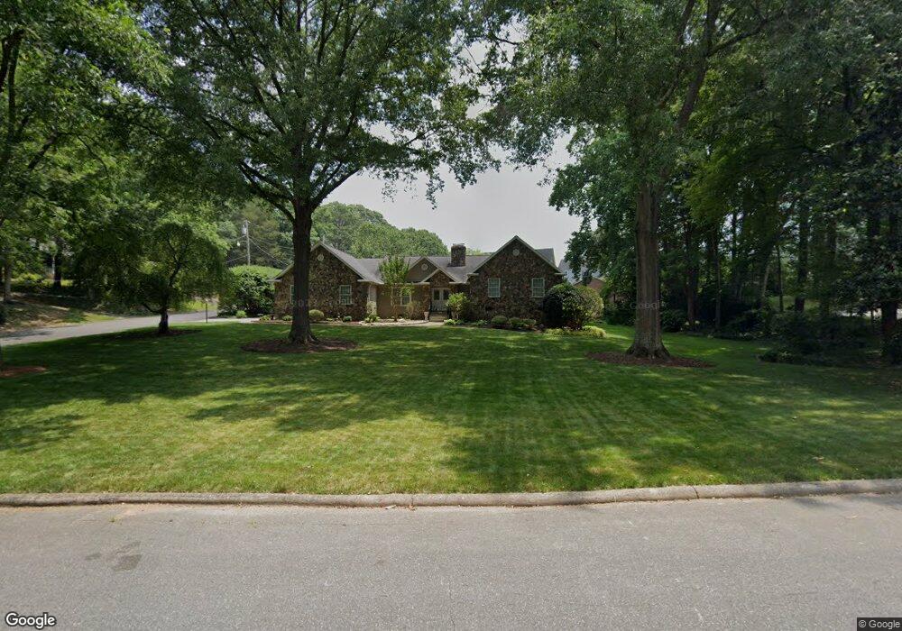
406 Garrison Dr Kings Mountain, NC 28086
Estimated Value: $309,000 - $479,000
3
Beds
3
Baths
2,256
Sq Ft
$182/Sq Ft
Est. Value
About This Home
This home is located at 406 Garrison Dr, Kings Mountain, NC 28086 and is currently estimated at $410,299, approximately $181 per square foot. 406 Garrison Dr is a home located in Cleveland County with nearby schools including North Elementary School, Kings Mountain Intermediate School, and Kings Mountain Middle.
Ownership History
Date
Name
Owned For
Owner Type
Purchase Details
Closed on
Nov 30, 2018
Sold by
Miller Sydney M
Bought by
Byerly Neddy L
Current Estimated Value
Purchase Details
Closed on
Jul 26, 2016
Sold by
Harriett T Broadwell
Bought by
Mauldin Waymon and Mauldin Pamela
Home Financials for this Owner
Home Financials are based on the most recent Mortgage that was taken out on this home.
Original Mortgage
$225,000
Interest Rate
3.45%
Create a Home Valuation Report for This Property
The Home Valuation Report is an in-depth analysis detailing your home's value as well as a comparison with similar homes in the area
Home Values in the Area
Average Home Value in this Area
Purchase History
| Date | Buyer | Sale Price | Title Company |
|---|---|---|---|
| Byerly Neddy L | $118,000 | None Available | |
| Mauldin Waymon | -- | -- |
Source: Public Records
Mortgage History
| Date | Status | Borrower | Loan Amount |
|---|---|---|---|
| Previous Owner | Mauldin Waymon | $225,000 | |
| Previous Owner | Mauldin Waymon | -- |
Source: Public Records
Tax History Compared to Growth
Tax History
| Year | Tax Paid | Tax Assessment Tax Assessment Total Assessment is a certain percentage of the fair market value that is determined by local assessors to be the total taxable value of land and additions on the property. | Land | Improvement |
|---|---|---|---|---|
| 2025 | $4,653 | $453,921 | $39,960 | $413,961 |
| 2024 | $3,375 | $286,948 | $31,968 | $254,980 |
| 2023 | $3,358 | $286,948 | $31,968 | $254,980 |
| 2022 | $3,065 | $273,370 | $31,968 | $241,402 |
| 2021 | $3,080 | $273,370 | $31,968 | $241,402 |
| 2020 | $2,249 | $193,638 | $26,341 | $167,297 |
| 2019 | $2,249 | $193,638 | $26,341 | $167,297 |
| 2018 | $2,248 | $193,638 | $26,341 | $167,297 |
| 2017 | $2,236 | $193,638 | $26,341 | $167,297 |
| 2016 | $1,795 | $199,454 | $26,341 | $173,113 |
| 2015 | $1,905 | $213,417 | $25,574 | $187,843 |
| 2014 | $1,905 | $213,417 | $25,574 | $187,843 |
Source: Public Records
Map
Nearby Homes
- 1417 Merrimont Ave
- 117 Parker Claire Ln
- 111 Parker Claire Ln
- 213 Parker Claire Ln
- 521 Coman Ln
- 208 Victoria Cir
- 1427 Merrimont Ave
- 155 Patterson Rd
- 1301 Shelby Rd
- 1500 Shelby Rd
- 442 Phifer Rd
- 104 Edison St
- 167 Patterson Rd
- 417 Phifer Rd
- 1610 Shelby Rd
- 811 W Gold St Unit 26
- 524 Waco Rd
- 522 Waco Rd
- 430 Fulton Dr
- 300 N Watterson St
- 404 Garrison Dr
- 1201 Townsend Terrace
- 1206 Townsend Terrace
- 1204 Townsend Terrace
- 407 Garrison Dr
- 405 Allison Ct
- 402 Garrison Dr
- 403 Allison Ct
- 1202 Townsend Terrace
- 501 Garrison Dr
- 405 Garrison Dr
- 401 Allison Ct
- 503 Garrison Dr
- 1221 Wales Rd
- 1305 Wales Rd
- 503 Allison Ct
- 403 Garrison Dr
- 1213 Wales Rd
- 504 Allison Ct
- 506 Allison Ct