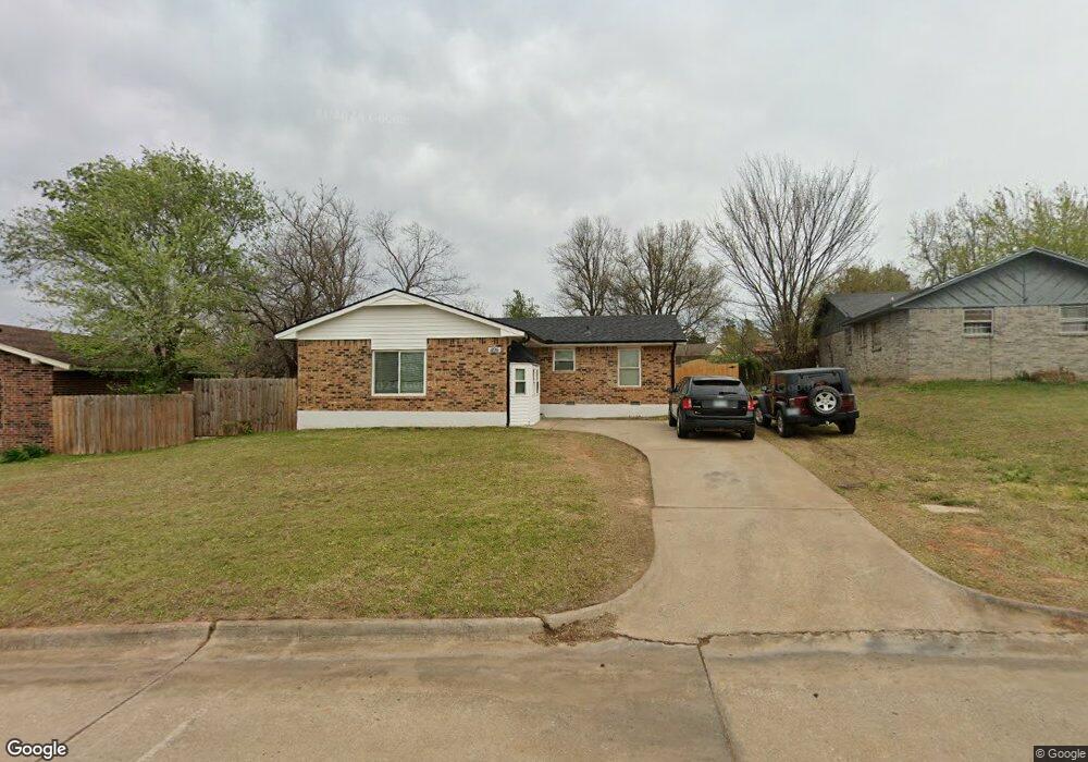
406 Jarman Dr McLoud, OK 74851
Estimated Value: $135,356 - $148,000
3
Beds
1
Bath
1,222
Sq Ft
$118/Sq Ft
Est. Value
About This Home
This home is located at 406 Jarman Dr, McLoud, OK 74851 and is currently estimated at $143,589, approximately $117 per square foot. 406 Jarman Dr is a home located in Pottawatomie County with nearby schools including McLoud Elementary School, McLoud Intermediate School, and McLoud Junior High School.
Ownership History
Date
Name
Owned For
Owner Type
Purchase Details
Closed on
Aug 17, 2010
Sold by
Tiller Amy J and Tiller David B
Bought by
Tiller David B and Tiller Amy J
Current Estimated Value
Purchase Details
Closed on
Jun 22, 2009
Sold by
White Samuel Kenneth
Bought by
White Amy Jo
Purchase Details
Closed on
Oct 3, 2007
Sold by
Citimortgage Inc
Bought by
White Amy and White Amy Jo
Home Financials for this Owner
Home Financials are based on the most recent Mortgage that was taken out on this home.
Original Mortgage
$40,000
Interest Rate
6.3%
Mortgage Type
Purchase Money Mortgage
Purchase Details
Closed on
Dec 6, 1999
Sold by
Robinson Devin
Bought by
Hood Ricky and Hood Brenda
Purchase Details
Closed on
Sep 4, 1997
Sold by
Ward Donna
Bought by
Ward Edward
Purchase Details
Closed on
May 10, 1994
Sold by
Lee Glenn and Lee Neola
Bought by
Ward Edward and Ward Donna
Create a Home Valuation Report for This Property
The Home Valuation Report is an in-depth analysis detailing your home's value as well as a comparison with similar homes in the area
Home Values in the Area
Average Home Value in this Area
Purchase History
| Date | Buyer | Sale Price | Title Company |
|---|---|---|---|
| Tiller David B | -- | None Available | |
| White Amy Jo | -- | None Available | |
| White Amy | $50,000 | Oklahoma Reo Closing & Title | |
| Hood Ricky | $33,000 | -- | |
| Ward Edward | -- | -- | |
| Ward Edward | $24,000 | -- |
Source: Public Records
Mortgage History
| Date | Status | Borrower | Loan Amount |
|---|---|---|---|
| Previous Owner | White Amy | $40,000 |
Source: Public Records
Tax History
| Year | Tax Paid | Tax Assessment Tax Assessment Total Assessment is a certain percentage of the fair market value that is determined by local assessors to be the total taxable value of land and additions on the property. | Land | Improvement |
|---|---|---|---|---|
| 2025 | $765 | $8,756 | $888 | $7,868 |
| 2024 | $661 | $8,339 | $846 | $7,493 |
| 2023 | $661 | $7,275 | $540 | $6,735 |
| 2022 | $671 | $7,275 | $540 | $6,735 |
| 2021 | $872 | $7,275 | $540 | $6,735 |
| 2020 | $671 | $7,275 | $540 | $6,735 |
| 2019 | $691 | $7,264 | $540 | $6,724 |
| 2018 | $721 | $7,143 | $540 | $6,603 |
| 2017 | $750 | $7,326 | $540 | $6,786 |
| 2016 | $648 | $7,063 | $508 | $6,555 |
| 2015 | $580 | $6,727 | $780 | $5,947 |
| 2014 | $580 | $6,533 | $780 | $5,753 |
Source: Public Records
Map
Nearby Homes
- 0 Thomas Blvd Unit 1205900
- 141 Folsom Dr
- 827 W Broadway Ave
- 211 S 6th St
- 922 W Hinchley Ave
- 400 S Main St
- 13430 Dewberry Rd
- 13421 Juneberry Dr
- 13429 Juneberry Dr
- 29805 SE 29th St
- 113 Summer Oaks Dr
- 30280 Stephens Dr
- 101 W Oak Hill Dr
- 3129 Janet Ln Unit HAR
- 22072 Melissa Ln
- 22085 Melissa Ln
- 1701 S Pottawatomie Rd
- 115 Thornbrue Dr
- 114 Timber Lake Dr
- 29049 Oilfield Trash Rd
Your Personal Tour Guide
Ask me questions while you tour the home.