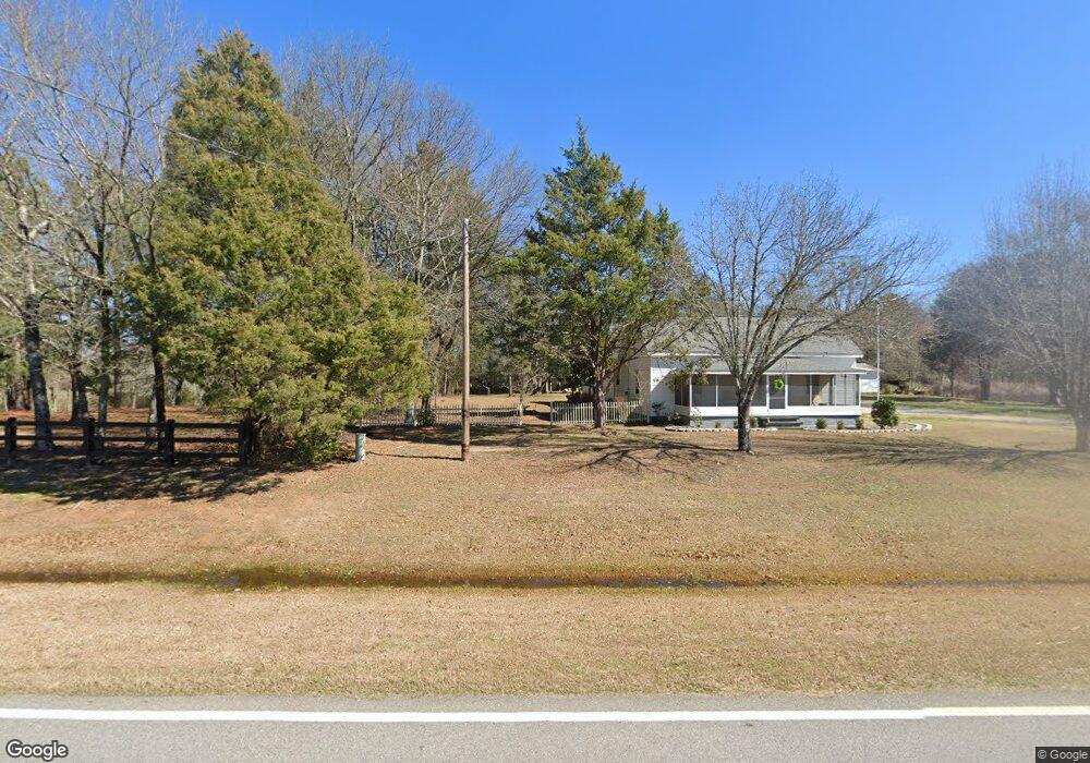
406 Louisville Rd Grovetown, GA 30813
Estimated Value: $518,000 - $991,994
3
Beds
4
Baths
3,738
Sq Ft
$197/Sq Ft
Est. Value
About This Home
This home is located at 406 Louisville Rd, Grovetown, GA 30813 and is currently estimated at $735,999, approximately $196 per square foot. 406 Louisville Rd is a home with nearby schools including Euchee Creek Elementary School, Harlem Middle School, and Harlem High School.
Ownership History
Date
Name
Owned For
Owner Type
Purchase Details
Closed on
Feb 15, 2011
Sold by
Team Excavating Co
Bought by
Coker Brian Alexander
Current Estimated Value
Purchase Details
Closed on
Sep 1, 2009
Sold by
Team Excavating Co
Bought by
Lambert Jerry A
Purchase Details
Closed on
Nov 8, 2006
Sold by
Covington Ben A
Bought by
Team Excavating Co
Purchase Details
Closed on
Oct 25, 2006
Sold by
Mora Lois D
Bought by
Harrison William E
Create a Home Valuation Report for This Property
The Home Valuation Report is an in-depth analysis detailing your home's value as well as a comparison with similar homes in the area
Home Values in the Area
Average Home Value in this Area
Purchase History
| Date | Buyer | Sale Price | Title Company |
|---|---|---|---|
| Coker Brian Alexander | $135,200 | -- | |
| Coker Brian Alexander | $135,190 | -- | |
| Lambert Jerry A | $416,500 | -- | |
| Suykerbuyk Robert A | $652,300 | -- | |
| Team Excavating Co | $822,800 | -- | |
| Harrison William E | $114,600 | -- |
Source: Public Records
Tax History Compared to Growth
Tax History
| Year | Tax Paid | Tax Assessment Tax Assessment Total Assessment is a certain percentage of the fair market value that is determined by local assessors to be the total taxable value of land and additions on the property. | Land | Improvement |
|---|---|---|---|---|
| 2025 | $8,614 | $361,400 | $95,354 | $266,046 |
| 2024 | $8,508 | $340,702 | $95,354 | $245,348 |
| 2023 | $8,508 | $339,178 | $91,814 | $247,364 |
| 2022 | $8,143 | $313,581 | $77,657 | $235,924 |
| 2021 | $5,641 | $278,427 | $75,297 | $203,130 |
| 2020 | $5,770 | $207,954 | $4,426 | $203,528 |
| 2019 | $5,687 | $204,968 | $4,362 | $200,606 |
| 2018 | $5,483 | $196,959 | $4,298 | $192,661 |
| 2017 | $5,217 | $186,725 | $4,238 | $182,487 |
| 2016 | $4,593 | $170,518 | $3,140 | $167,378 |
| 2015 | $4,439 | $164,480 | $3,082 | $161,398 |
| 2014 | $4,216 | $154,280 | $3,029 | $151,251 |
Source: Public Records
Map
Nearby Homes
- 1153 Meandering Trail
- 1147 Meandering Trail
- 1123 Meandering Trail
- 1129 Meandering Trail
- 4052 Highfield Dr
- 7115 Exley Ln
- 1171 Meandering Trail
- 243 Ronda Ct
- 1675 Swint Rd
- 1584 Swint Rd
- 1518 Swint Rd
- 1590 Swint Rd
- 1566 Swint Rd
- 1548 Swint Rd
- 1536 Swint Rd
- 1560 Swint Rd
- 1530 Swint Rd
- 1524 Swint Rd
- 1578 Swint Rd
- 1572 Swint Rd
- 416 Louisville Rd
- 426 Louisville Rd
- 410 Louisville Rd
- 378 Louisville Rd
- 430 Louisville Rd
- 440 Louisville Rd
- 376 Louisville Rd
- 825 Rolling Brook Ln
- 431 Louisville Rd
- 816 Rolling Brook Ln
- 442 Louisville Rd
- 439 Louisville Rd
- 368 Louisville Rd
- 364 Louisville Rd
- 2019 Rock Hill Ln
- 2023 Rock Hill Ln
- 409 Louisville Rd
- 375 Louisville Rd
- 6069 Anderson Rd
- 362 Louisville Rd