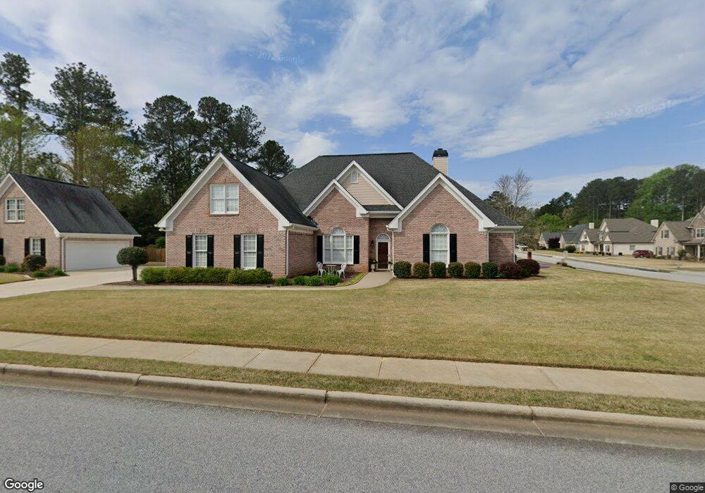
406 Mallory Cir Loganville, GA 30052
Estimated Value: $448,038 - $605,000
5
Beds
4
Baths
2,456
Sq Ft
$206/Sq Ft
Est. Value
About This Home
This home is located at 406 Mallory Cir, Loganville, GA 30052 and is currently estimated at $506,510, approximately $206 per square foot. 406 Mallory Cir is a home located in Walton County with nearby schools including Bay Creek Elementary School, Loganville Middle School, and Loganville High School.
Ownership History
Date
Name
Owned For
Owner Type
Purchase Details
Closed on
Mar 31, 2010
Sold by
Derrick Michael and Derrick Sharon
Bought by
Ferreira Joseph and Ferreira Patricia
Current Estimated Value
Home Financials for this Owner
Home Financials are based on the most recent Mortgage that was taken out on this home.
Original Mortgage
$200,000
Outstanding Balance
$133,339
Interest Rate
5.02%
Mortgage Type
New Conventional
Estimated Equity
$373,171
Purchase Details
Closed on
Jun 25, 2003
Sold by
Athens First Bk/Trust Co
Bought by
Derrick Michael and Derrick Sharon
Home Financials for this Owner
Home Financials are based on the most recent Mortgage that was taken out on this home.
Original Mortgage
$180,000
Interest Rate
5.17%
Mortgage Type
New Conventional
Purchase Details
Closed on
Feb 5, 2002
Sold by
Moose Creek Properties
Bought by
Athens First B & T
Create a Home Valuation Report for This Property
The Home Valuation Report is an in-depth analysis detailing your home's value as well as a comparison with similar homes in the area
Home Values in the Area
Average Home Value in this Area
Purchase History
| Date | Buyer | Sale Price | Title Company |
|---|---|---|---|
| Ferreira Joseph | $250,000 | -- | |
| Derrick Michael | $225,000 | -- | |
| Athens First B & T | $21,490 | -- |
Source: Public Records
Mortgage History
| Date | Status | Borrower | Loan Amount |
|---|---|---|---|
| Open | Ferreira Joseph | $200,000 | |
| Previous Owner | Derrick Michael | $180,000 |
Source: Public Records
Tax History Compared to Growth
Tax History
| Year | Tax Paid | Tax Assessment Tax Assessment Total Assessment is a certain percentage of the fair market value that is determined by local assessors to be the total taxable value of land and additions on the property. | Land | Improvement |
|---|---|---|---|---|
| 2024 | $2,418 | $146,680 | $27,200 | $119,480 |
| 2023 | $2,334 | $135,280 | $23,600 | $111,680 |
| 2022 | $993 | $128,600 | $23,600 | $105,000 |
| 2021 | $994 | $108,920 | $18,400 | $90,520 |
| 2020 | $1,019 | $107,800 | $18,000 | $89,800 |
| 2019 | $1,040 | $101,120 | $18,000 | $83,120 |
| 2018 | $1,040 | $101,120 | $18,000 | $83,120 |
| 2017 | $4,241 | $96,240 | $18,000 | $78,240 |
| 2016 | $952 | $86,000 | $16,000 | $70,000 |
| 2015 | $941 | $86,000 | $16,000 | $70,000 |
| 2014 | $914 | $79,200 | $0 | $0 |
Source: Public Records
Map
Nearby Homes
- 405 Mallory Cir
- 711 Wilhaven Ct
- 902 Edgewater Dr
- 0 Old Zion Cemetery Rd Unit 7396101
- 0 Old Zion Cemetery Rd Unit 10310202
- 638 Granite Ln
- 410 Live Oak Pass
- 412 Live Oak Pass
- 387 Lee Byrd Rd
- 6300 Highway 81
- 972 Spanish Moss Trail
- 501 Lee Byrd Rd
- 1168 Granite Ln
- 1197 Granite Ln
- 2942 Highway 81
- 1840 Pearson St
- 1920 Pearson St
- 403 Chicamauga Ct
- 0 Mallory Cir Unit 8128289
- 0 Mallory Cir Unit 8826310
- 0 Mallory Cir Unit 8836520
- 0 Mallory Cir
- 808 Mildred Ln
- 408 Mallory Cir Unit P-09
- 408 Mallory Cir
- 409 Mallory Cir
- 403 Mallory Cir
- 807 Mildred Ln
- 710 Wilhaven Ct
- 804 Mildred Ln
- 805 Mildred Ln
- 526 Mary Margaret Walk
- 0 Mildred Ln Unit 7052628
- 0 Mildred Ln Unit 8808636
- 0 Mildred Ln
- 401 Mallory Cir
- 410 Mallory Cir
- 00 Old Zion Cemetery Rd