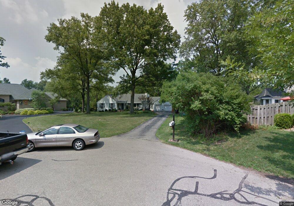
406 Meadow Ln Cincinnati, OH 45215
Estimated Value: $743,736 - $841,000
3
Beds
5
Baths
3,550
Sq Ft
$224/Sq Ft
Est. Value
About This Home
This home is located at 406 Meadow Ln, Cincinnati, OH 45215 and is currently estimated at $795,684, approximately $224 per square foot. 406 Meadow Ln is a home located in Hamilton County with nearby schools including Wyoming High School and John Paul II Catholic School.
Ownership History
Date
Name
Owned For
Owner Type
Purchase Details
Closed on
Nov 24, 1998
Sold by
Lempert Hamilton H and Lempert Deborah E
Bought by
Lempert Deborah E
Current Estimated Value
Purchase Details
Closed on
Jul 29, 1995
Sold by
Godshall Sally L
Bought by
Lempert Hamilton H and Lempert Deborah E
Home Financials for this Owner
Home Financials are based on the most recent Mortgage that was taken out on this home.
Original Mortgage
$212,800
Interest Rate
7.28%
Purchase Details
Closed on
Dec 17, 1993
Sold by
Witmeyer Richard J
Bought by
Godshall Sally L
Create a Home Valuation Report for This Property
The Home Valuation Report is an in-depth analysis detailing your home's value as well as a comparison with similar homes in the area
Home Values in the Area
Average Home Value in this Area
Purchase History
| Date | Buyer | Sale Price | Title Company |
|---|---|---|---|
| Lempert Deborah E | -- | -- | |
| Lempert Hamilton H | -- | -- | |
| Godshall Sally L | -- | -- |
Source: Public Records
Mortgage History
| Date | Status | Borrower | Loan Amount |
|---|---|---|---|
| Previous Owner | Lempert Hamilton H | $212,800 |
Source: Public Records
Tax History Compared to Growth
Tax History
| Year | Tax Paid | Tax Assessment Tax Assessment Total Assessment is a certain percentage of the fair market value that is determined by local assessors to be the total taxable value of land and additions on the property. | Land | Improvement |
|---|---|---|---|---|
| 2024 | $11,821 | $198,895 | $39,102 | $159,793 |
| 2023 | $10,897 | $198,895 | $39,102 | $159,793 |
| 2022 | $10,487 | $154,746 | $41,447 | $113,299 |
| 2021 | $10,221 | $154,746 | $41,447 | $113,299 |
| 2020 | $10,451 | $154,746 | $41,447 | $113,299 |
| 2019 | $10,668 | $145,989 | $39,102 | $106,887 |
| 2018 | $10,673 | $145,989 | $39,102 | $106,887 |
| 2017 | $10,221 | $145,989 | $39,102 | $106,887 |
| 2016 | $8,125 | $134,051 | $37,202 | $96,849 |
| 2015 | $8,218 | $134,051 | $37,202 | $96,849 |
| 2014 | $8,239 | $134,051 | $37,202 | $96,849 |
| 2013 | $7,755 | $120,768 | $33,516 | $87,252 |
Source: Public Records
Map
Nearby Homes
- 271 Poage Farm Rd
- 305 Compton Hills Dr
- 377 Compton Rd
- 513 Chisholm Trail
- 525 Chisholm Trail
- 158 Congress Run Rd
- 216 Hilltop Ln
- 204 Brocdorf Dr
- 8816 Falmouth Dr
- 239 Compton Ridge Dr
- 8608 Long Ln
- 8932 Hollyhock Dr
- 281 Compton Rd
- 9197 Long Ln
- 253 Compton Rd
- 254 Compton Rd
- 401 W Galbraith Rd
- 654 Doepke Ln
- 926 Reily Rd
- 9458 Long Ln
- 412 Meadow Ln
- 303 Poage Farm Rd
- 327 Poage Farm Rd
- 411 Meadow Ln
- 297 Poage Farm Rd
- 503 Compton Rd
- 509 Compton Rd
- 405 Meadow Ln
- 310 Poage Farm Rd
- 515 Compton Rd
- 342 Hilltop Ln
- 495 Compton Rd
- 335 Poage Farm Rd
- 346 Hilltop Ln
- 2320 Ginn Rd Unit 7110
- 2320 Ginn Rd Unit 108
- 2320 Ginn Rd Unit 18
- 2320 Ginn Rd
- 2320 Ginn Rd
- 2320 Ginn Rd Unit 11