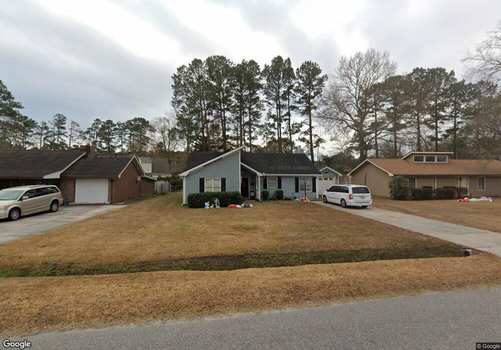
406 Meadowbrook Dr Myrtle Beach, SC 29588
Estimated Value: $248,000 - $276,000
3
Beds
2
Baths
1,700
Sq Ft
$154/Sq Ft
Est. Value
About This Home
This home is located at 406 Meadowbrook Dr, Myrtle Beach, SC 29588 and is currently estimated at $262,569, approximately $154 per square foot. 406 Meadowbrook Dr is a home located in Horry County with nearby schools including Socastee Elementary School, Forestbrook Middle School, and Socastee High School.
Ownership History
Date
Name
Owned For
Owner Type
Purchase Details
Closed on
Jul 29, 2008
Sold by
Stahley Stephanie L
Bought by
Tustin Robert J
Current Estimated Value
Purchase Details
Closed on
Aug 4, 2006
Sold by
Curry Dennis M and Curry Debra A
Bought by
Stahley Stephanie L and Florentino Enver
Home Financials for this Owner
Home Financials are based on the most recent Mortgage that was taken out on this home.
Original Mortgage
$135,000
Interest Rate
6.71%
Mortgage Type
Purchase Money Mortgage
Purchase Details
Closed on
Mar 31, 2006
Sold by
Constantino Anthony J
Bought by
Curry Dennis M and Curry Debra A
Create a Home Valuation Report for This Property
The Home Valuation Report is an in-depth analysis detailing your home's value as well as a comparison with similar homes in the area
Home Values in the Area
Average Home Value in this Area
Purchase History
| Date | Buyer | Sale Price | Title Company |
|---|---|---|---|
| Tustin Robert J | $160,000 | -- | |
| Stahley Stephanie L | $150,000 | None Available | |
| Curry Dennis M | $135,000 | None Available |
Source: Public Records
Mortgage History
| Date | Status | Borrower | Loan Amount |
|---|---|---|---|
| Previous Owner | Stahley Stephanie L | $135,000 |
Source: Public Records
Tax History Compared to Growth
Tax History
| Year | Tax Paid | Tax Assessment Tax Assessment Total Assessment is a certain percentage of the fair market value that is determined by local assessors to be the total taxable value of land and additions on the property. | Land | Improvement |
|---|---|---|---|---|
| 2024 | $693 | $9,213 | $2,801 | $6,412 |
| 2023 | $693 | $5,712 | $1,025 | $4,687 |
| 2021 | $630 | $6,453 | $1,261 | $5,192 |
| 2020 | $541 | $6,453 | $1,261 | $5,192 |
| 2019 | $541 | $6,453 | $1,261 | $5,192 |
| 2018 | $490 | $4,967 | $879 | $4,088 |
| 2017 | $475 | $4,967 | $879 | $4,088 |
| 2016 | -- | $4,967 | $879 | $4,088 |
| 2015 | $484 | $4,967 | $879 | $4,088 |
| 2014 | $448 | $4,967 | $879 | $4,088 |
Source: Public Records
Map
Nearby Homes
- TBD Bridge Creek Dr
- 303 Clear Creek Cir
- 173 Foxpath Loop
- 509 Creekwood Cir Unit MB
- 209 Foxpath Loop Unit Silver Creek Lot 322
- 282 Foxpath Loop
- 305 Foxpath Loop
- 4 Plantation Rd
- 309 Foxpath Loop
- 313 Foxpath Loop
- 4641 Socastee Blvd Unit D1
- 613 Old Fox Ct
- 5544 Rosewood Dr
- 105 Old Carriage Ct
- 5729 Rosewood Dr
- 244 Colby Ct
- 2 Sioux Trail
- 804 Geddings Dr
- 408 Highland Ridge Dr
- 220 Rice Mill Dr
- 404 Meadowbrook Dr
- 408 Meadowbrook Dr
- 207 Stonebrook Dr
- 205 Stonebrook Dr
- 209 Stonebrook Dr
- 402 Meadowbrook Dr
- 407 Meadowbrook Dr
- 405 Meadowbrook Dr
- 203 Stonebrook Dr
- 403 Meadowbrook Dr
- 400 Meadowbrook Dr
- 400 Meadowbrook Dr
- 400 Meadowbrook Dr Unit Bridge Creek
- 220 Stonebrook Dr
- 218 Stonebrook Dr
- 201 Stonebrook Dr
- 222 Stonebrook Dr
- 216 Stonebrook Dr
- 401 Meadowbrook Dr
- 606 Goosecreek Dr