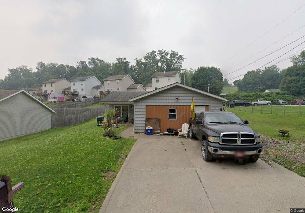
406 Mulberry St Barnesville, OH 43713
Estimated Value: $176,165 - $225,000
3
Beds
2
Baths
1,004
Sq Ft
$193/Sq Ft
Est. Value
About This Home
This home is located at 406 Mulberry St, Barnesville, OH 43713 and is currently estimated at $194,041, approximately $193 per square foot. 406 Mulberry St is a home with nearby schools including Barnesville Elementary School, Barnesville Middle School, and Barnesville High School.
Ownership History
Date
Name
Owned For
Owner Type
Purchase Details
Closed on
Nov 11, 2010
Sold by
Muffet Builders Inc
Bought by
Doll Michael A and Doll Diana L
Current Estimated Value
Home Financials for this Owner
Home Financials are based on the most recent Mortgage that was taken out on this home.
Original Mortgage
$110,748
Interest Rate
4.27%
Mortgage Type
Purchase Money Mortgage
Create a Home Valuation Report for This Property
The Home Valuation Report is an in-depth analysis detailing your home's value as well as a comparison with similar homes in the area
Home Values in the Area
Average Home Value in this Area
Purchase History
| Date | Buyer | Sale Price | Title Company |
|---|---|---|---|
| Doll Michael A | $110,500 | Attorney |
Source: Public Records
Mortgage History
| Date | Status | Borrower | Loan Amount |
|---|---|---|---|
| Previous Owner | Doll Michael A | $110,748 |
Source: Public Records
Tax History Compared to Growth
Tax History
| Year | Tax Paid | Tax Assessment Tax Assessment Total Assessment is a certain percentage of the fair market value that is determined by local assessors to be the total taxable value of land and additions on the property. | Land | Improvement |
|---|---|---|---|---|
| 2024 | $1,799 | $55,700 | $4,150 | $51,550 |
| 2023 | $1,842 | $54,680 | $3,830 | $50,850 |
| 2022 | $1,841 | $54,681 | $3,829 | $50,852 |
| 2021 | $1,845 | $54,681 | $3,829 | $50,852 |
| 2020 | $1,608 | $45,570 | $3,190 | $42,380 |
| 2019 | $1,611 | $45,570 | $3,190 | $42,380 |
| 2018 | $1,442 | $45,570 | $3,190 | $42,380 |
| 2017 | $1,284 | $35,700 | $3,970 | $31,730 |
| 2016 | $1,201 | $35,700 | $3,970 | $31,730 |
| 2015 | $1,198 | $35,700 | $3,970 | $31,730 |
| 2014 | $1,136 | $33,540 | $3,610 | $29,930 |
| 2013 | $1,144 | $33,540 | $3,610 | $29,930 |
Source: Public Records
Map
Nearby Homes
- 201 Railroad St
- 203 Railroad St
- 205 Railroad St
- 207 Railroad St
- 209 Railroad St
- 211 Railroad St
- 0 Mulberry St Unit 4503871
- 430 Watt Ave
- 213 Railroad St
- 440 Watt Ave
- 432 Watt Ave
- 343 Mulberry St
- 341 Mulberry St
- 217 Railroad St
- 217 Railroad St
- 337 Mulberry St
- 219 Railroad St
- 443 E Church St
- 335 Mulberry St
- 221 Railroad St