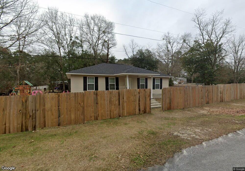
406 N Calhoun St Mount Vernon, GA 30445
Estimated Value: $116,000 - $164,000
2
Beds
1
Bath
1,302
Sq Ft
$103/Sq Ft
Est. Value
About This Home
This home is located at 406 N Calhoun St, Mount Vernon, GA 30445 and is currently estimated at $134,051, approximately $102 per square foot. 406 N Calhoun St is a home with nearby schools including Montgomery County Elementary School, Montgomery County Middle School, and Montgomery County High School.
Ownership History
Date
Name
Owned For
Owner Type
Purchase Details
Closed on
Jul 18, 2019
Sold by
Vidalia Area Habitat For Humanity Inc
Bought by
Waller Investment Llc
Current Estimated Value
Purchase Details
Closed on
Jun 16, 1993
Bought by
Mcarthur Anice
Purchase Details
Closed on
Jan 3, 1970
Bought by
Mcarthur Anice W
Create a Home Valuation Report for This Property
The Home Valuation Report is an in-depth analysis detailing your home's value as well as a comparison with similar homes in the area
Home Values in the Area
Average Home Value in this Area
Purchase History
| Date | Buyer | Sale Price | Title Company |
|---|---|---|---|
| Waller Investment Llc | $1,500 | -- | |
| Mcarthur Anice | -- | -- | |
| Mcarthur Anice W | -- | -- |
Source: Public Records
Tax History Compared to Growth
Tax History
| Year | Tax Paid | Tax Assessment Tax Assessment Total Assessment is a certain percentage of the fair market value that is determined by local assessors to be the total taxable value of land and additions on the property. | Land | Improvement |
|---|---|---|---|---|
| 2024 | $1,069 | $36,144 | $818 | $35,326 |
| 2023 | $1,183 | $36,144 | $818 | $35,326 |
| 2022 | $1,080 | $36,144 | $818 | $35,326 |
| 2021 | $1,073 | $36,144 | $818 | $35,326 |
| 2020 | $964 | $31,888 | $818 | $31,070 |
| 2019 | $25 | $838 | $818 | $20 |
| 2018 | $28 | $1,018 | $818 | $200 |
| 2017 | $28 | $1,018 | $818 | $200 |
| 2016 | $28 | $1,018 | $818 | $200 |
| 2015 | -- | $1,135 | $818 | $318 |
| 2014 | -- | $1,135 | $818 | $318 |
Source: Public Records
Map
Nearby Homes
- 0 E Spring St
- 0 S Railroad Ave
- 610 Dobbins St
- 520 S Johnson St
- 203 E Church St
- 400 W Bluff St
- 812 E Pearl St
- 118 Gum St
- 405 N Broughton St
- 928 N Mcbride St
- 0 Dead River Rd Glenwood Unit Ga.
- 111 Dead River Rd
- 0 Us Hwy 280 Unit 24320907
- 100 E 2nd Ave
- 65 SW 3rd Ave
- 00 Sam Anderson Rd
- 1188 U S 280
- 1025 Old Dairy Rd
- 2731 Saw Mill Rd
- 642 Still Rd
- 318 E Oconnor St
- 409 N Calhoun St
- 422 E Adams St
- 310 E Adams St
- 329 N Calhoun St
- 322 E Oconnor St
- 322 E Oconnor St
- 214 E Adams St
- 321 N Calhoun St
- 308 E Folsum St
- 202 Oconnor St
- 314 E Folsum St
- 234 E Folsum St
- 332 E Folsum St
- 324 E Folsum St
- N Calhoun St
- 224 E Folsum St
- 235 Folsum St
- 210 E Folsum St
- 430 College St