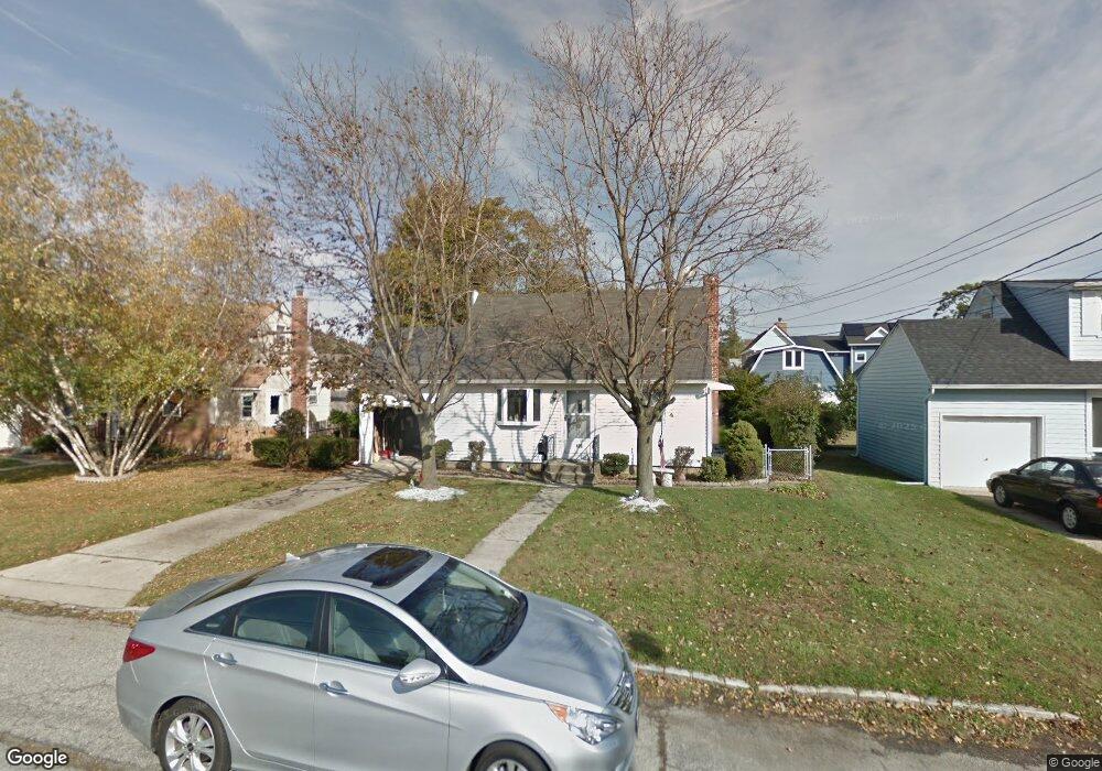
406 N Ontario Ave Lindenhurst, NY 11757
Estimated Value: $610,000 - $633,000
--
Bed
--
Bath
1,077
Sq Ft
$582/Sq Ft
Est. Value
About This Home
This home is located at 406 N Ontario Ave, Lindenhurst, NY 11757 and is currently estimated at $626,297, approximately $581 per square foot. 406 N Ontario Ave is a home located in Suffolk County with nearby schools including Daniel Street School, Lindenhurst Middle School, and Lindenhurst Senior High School.
Ownership History
Date
Name
Owned For
Owner Type
Purchase Details
Closed on
May 24, 2012
Sold by
Gatti Alfred
Bought by
Cervin Joseph L
Current Estimated Value
Home Financials for this Owner
Home Financials are based on the most recent Mortgage that was taken out on this home.
Original Mortgage
$217,800
Outstanding Balance
$150,903
Interest Rate
3.9%
Mortgage Type
Purchase Money Mortgage
Estimated Equity
$475,394
Purchase Details
Closed on
Dec 12, 1997
Sold by
Gatti Alfred and Gatti Linda
Bought by
Gatti Alfred
Create a Home Valuation Report for This Property
The Home Valuation Report is an in-depth analysis detailing your home's value as well as a comparison with similar homes in the area
Home Values in the Area
Average Home Value in this Area
Purchase History
| Date | Buyer | Sale Price | Title Company |
|---|---|---|---|
| Cervin Joseph L | $242,000 | -- | |
| Gatti Alfred | -- | Commonwealth Land Title Ins |
Source: Public Records
Mortgage History
| Date | Status | Borrower | Loan Amount |
|---|---|---|---|
| Open | Cervin Joseph L | $217,800 |
Source: Public Records
Tax History Compared to Growth
Tax History
| Year | Tax Paid | Tax Assessment Tax Assessment Total Assessment is a certain percentage of the fair market value that is determined by local assessors to be the total taxable value of land and additions on the property. | Land | Improvement |
|---|---|---|---|---|
| 2024 | $9,589 | $2,830 | $270 | $2,560 |
| 2023 | $8,520 | $2,830 | $270 | $2,560 |
| 2022 | $7,209 | $2,830 | $270 | $2,560 |
| 2021 | $7,209 | $2,830 | $270 | $2,560 |
| 2020 | $7,590 | $2,830 | $270 | $2,560 |
| 2019 | $8,537 | $0 | $0 | $0 |
| 2018 | $7,115 | $2,830 | $270 | $2,560 |
| 2017 | $7,115 | $2,830 | $270 | $2,560 |
| 2016 | $7,156 | $2,830 | $270 | $2,560 |
| 2015 | -- | $2,830 | $270 | $2,560 |
| 2014 | -- | $2,830 | $270 | $2,560 |
Source: Public Records
Map
Nearby Homes
- 436 N Ontario Ave
- 475 N Putnam Ave
- 404 N Putnam Ave
- 457 N Monroe Ave
- 417 N Monroe Ave
- 465 N Monroe Ave
- 557 N Kings Ave
- 833 Bermuda Rd
- 449 N Indiana Ave
- 805 Arlington Rd
- 1701 Alto St
- 468 N Greene Ave
- 480 N Greene Ave
- 792 Glendale Rd
- 825 Weber Ave
- 145 Centre Ave
- 34 Karen St
- 656 N Greene Ave
- 247 N Greene Ave
- 669 East Dr
- 416 N Ontario Ave
- 402 N Ontario Ave
- 405 N Putnam Ave
- 415 N Putnam Ave
- 426 N Ontario Ave
- 401 N Putnam Ave
- 409 N Ontario Ave
- 425 N Putnam Ave
- 362 Charles St
- 421 N Ontario Ave
- 371 Charles St
- 435 N Putnam Ave
- 379 Charles St
- 433 N Ontario Ave
- 406 N Putnam Ave
- 446 N Ontario Ave
- 361 Charles St
- 410 N Niagara Ave
- 352 Charles St
- 445 N Putnam Ave