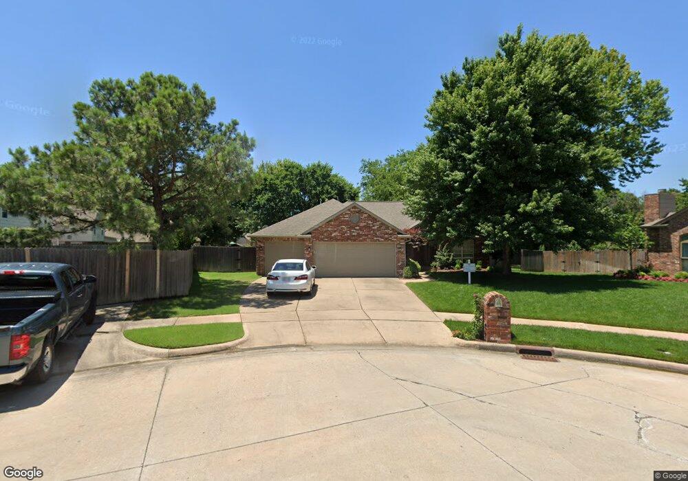
406 N Palm Ct Broken Arrow, OK 74012
Country Aire Estates NeighborhoodEstimated Value: $283,587 - $312,000
--
Bed
4
Baths
1,885
Sq Ft
$156/Sq Ft
Est. Value
About This Home
This home is located at 406 N Palm Ct, Broken Arrow, OK 74012 and is currently estimated at $294,647, approximately $156 per square foot. 406 N Palm Ct is a home located in Tulsa County with nearby schools including Marshall T. Moore Elementary School, Union 8th Grade Center, and Union 6th-7th Grade Center.
Ownership History
Date
Name
Owned For
Owner Type
Purchase Details
Closed on
Jul 21, 2022
Sold by
Hobbs William D and Hobbs Teresa C
Bought by
Beresh Stephen and Beresh Tonya
Current Estimated Value
Purchase Details
Closed on
Jun 30, 1998
Sold by
Talley Ray E and Talley Carol S
Bought by
Hobbs William D and Hobbs Teresa C
Purchase Details
Closed on
Dec 1, 1995
Purchase Details
Closed on
May 1, 1995
Create a Home Valuation Report for This Property
The Home Valuation Report is an in-depth analysis detailing your home's value as well as a comparison with similar homes in the area
Home Values in the Area
Average Home Value in this Area
Purchase History
| Date | Buyer | Sale Price | Title Company |
|---|---|---|---|
| Beresh Stephen | $248,000 | Firstitle & Abstract Services | |
| Hobbs William D | $132,000 | Tulsa Abstract & Title Co | |
| -- | $129,000 | -- | |
| -- | $24,000 | -- |
Source: Public Records
Tax History Compared to Growth
Tax History
| Year | Tax Paid | Tax Assessment Tax Assessment Total Assessment is a certain percentage of the fair market value that is determined by local assessors to be the total taxable value of land and additions on the property. | Land | Improvement |
|---|---|---|---|---|
| 2024 | $3,658 | $27,936 | $3,364 | $24,572 |
| 2023 | $3,658 | $29,347 | $3,484 | $25,863 |
| 2022 | $2,591 | $19,913 | $3,317 | $16,596 |
| 2021 | $2,548 | $19,516 | $3,250 | $16,266 |
| 2020 | $2,486 | $18,919 | $3,309 | $15,610 |
| 2019 | $2,482 | $18,919 | $3,309 | $15,610 |
| 2018 | $2,475 | $18,919 | $3,309 | $15,610 |
| 2017 | $2,493 | $19,805 | $3,464 | $16,341 |
| 2016 | $2,384 | $19,228 | $3,363 | $15,865 |
| 2015 | $2,312 | $18,668 | $3,265 | $15,403 |
| 2014 | $2,230 | $18,668 | $3,265 | $15,403 |
Source: Public Records
Map
Nearby Homes
- 409 N Palm Ave
- 208 N Nyssa Ave
- 3408 W College St
- 4201 W Detroit St
- 3309 W Freeport St
- 3812 W El Paso St
- 507 S Redwood Ave
- 708 N Aster Ave
- 4408 W Elgin St
- 4400 W Freeport Cir
- 705 N Indianwood Ave
- 701 N Indianwood Ave
- 4501 W Hartford St
- 3108 W Norman Cir
- 3843 W Galveston Place
- 2416 W Lansing Place
- 3033 W Oakland St
- 905 N Butternut Ave
- 3200 W Lansing St
- 3212 W Houston Place
- 3727 N Redwood Ave
- 410 N Palm Ct
- 3716 W Elgin St
- 3712 W Elgin St
- 3733 W Freeport St
- 3729 W Freeport St
- 3725 W Freeport St
- 3737 W Freeport St
- 3724 W Elgin St
- 3721 W Freeport St
- 411 N Palm Ct
- 3605 N Redwood Ave
- 3604 N Redwood Ave
- 3613 N Redwood Ave
- 3741 W Freeport St
- 407 N Palm Ct
- 403 N Palm Ct
- 3717 W Freeport St
- 3732 N Redwood Ave
- 3728 W Elgin St
