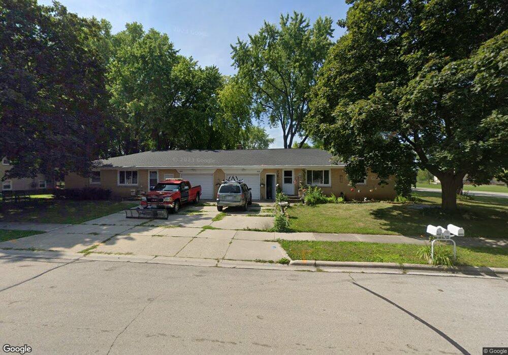
406 N Saint Bernard Dr Unit 408 de Pere, WI 54115
Estimated Value: $312,372 - $348,000
4
Beds
2
Baths
2,460
Sq Ft
$135/Sq Ft
Est. Value
About This Home
This home is located at 406 N Saint Bernard Dr Unit 408, de Pere, WI 54115 and is currently estimated at $331,593, approximately $134 per square foot. 406 N Saint Bernard Dr Unit 408 is a home located in Brown County with nearby schools including Susie C. Altmayer Elementary School, Foxview Intermediate School, and De Pere Middle School.
Ownership History
Date
Name
Owned For
Owner Type
Purchase Details
Closed on
Aug 25, 2014
Sold by
Rogers Alexandra A
Bought by
Rogers Survivors Trust
Current Estimated Value
Purchase Details
Closed on
Sep 3, 2013
Sold by
Vaness Jeanette L
Bought by
Rogers Alexandra A and Rogers Family Trust
Purchase Details
Closed on
Oct 31, 2001
Sold by
Kehoe Darrin M
Bought by
Vaness Lyle J and Vaness Jeanette L
Create a Home Valuation Report for This Property
The Home Valuation Report is an in-depth analysis detailing your home's value as well as a comparison with similar homes in the area
Home Values in the Area
Average Home Value in this Area
Purchase History
| Date | Buyer | Sale Price | Title Company |
|---|---|---|---|
| Rogers Survivors Trust | -- | -- | |
| Rogers Alexandra A | -- | -- | |
| Rogers Alexandra A | $128,000 | Area Title Llc | |
| Vaness Lyle J | $147,000 | Gb Title |
Source: Public Records
Tax History Compared to Growth
Tax History
| Year | Tax Paid | Tax Assessment Tax Assessment Total Assessment is a certain percentage of the fair market value that is determined by local assessors to be the total taxable value of land and additions on the property. | Land | Improvement |
|---|---|---|---|---|
| 2024 | $3,356 | $222,600 | $41,500 | $181,100 |
| 2023 | $2,818 | $193,500 | $41,500 | $152,000 |
| 2022 | $2,653 | $174,200 | $41,500 | $132,700 |
| 2021 | $2,478 | $153,600 | $34,600 | $119,000 |
| 2020 | $2,506 | $143,700 | $34,600 | $109,100 |
| 2019 | $2,561 | $133,800 | $34,600 | $99,200 |
| 2018 | $2,709 | $129,500 | $34,600 | $94,900 |
| 2017 | $2,525 | $118,500 | $34,600 | $83,900 |
| 2016 | $2,566 | $118,500 | $34,600 | $83,900 |
| 2015 | $2,771 | $126,800 | $36,600 | $90,200 |
| 2014 | $5,170 | $126,800 | $36,600 | $90,200 |
| 2013 | $5,170 | $179,700 | $36,600 | $143,100 |
Source: Public Records
Map
Nearby Homes
- 717 4th St
- 830 S Superior St Unit 832
- 806 4th St
- 1120 Cardinal St
- 634 Grant St
- 555 Main Ave Unit 110
- 555 Main Ave Unit 104
- 555 Main Ave Unit 111
- 555 Main Ave Unit 206
- 555 Main Ave Unit 113
- 416 Lansdowne St
- 410 Battery Ave
- 363 Battery Ave
- 1611 N Honeysuckle Cir
- 305 Battery Ave
- 385 Battery Ave
- 413 Brookline Ave
- 337 Battery Ave
- 400 Battery Ave
- 318 S Webster Ave
- 406 N St Bernard
- 1305 Fox River Dr
- 414 N Saint Bernard Dr
- 412 N Saint Bernard Dr Unit 414
- 405 N Saint Bernard Dr Unit 407
- 1217 Fox River Dr
- 405 S Saint Bernard Dr
- 407 S Saint Bernard Dr Unit 409
- 416 N Saint Bernard Dr Unit 418
- 407 S St Bernard
- 411 N Saint Bernard Dr Unit 413
- 1309 Fox River Dr
- 417 N Saint Bernard Dr Unit 419
- 411 S Saint Bernard Dr
- 417 N St Bernard St
- 417 N St Bernard
- 1250 Fox River Dr
- 420 N Saint Bernard Dr
- 1218 Fox River Dr
- 1306 Fox River Dr