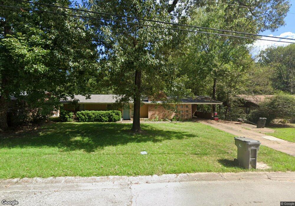
406 Randybrook Dr Lufkin, TX 75901
Estimated Value: $132,119 - $168,000
3
Beds
1
Bath
1,425
Sq Ft
$111/Sq Ft
Est. Value
About This Home
This home is located at 406 Randybrook Dr, Lufkin, TX 75901 and is currently estimated at $158,030, approximately $110 per square foot. 406 Randybrook Dr is a home located in Angelina County with nearby schools including Herty Primary School, Coston Elementary School, and Lufkin Middle School.
Ownership History
Date
Name
Owned For
Owner Type
Purchase Details
Closed on
May 11, 2022
Sold by
Nicole Swearingen Krista
Bought by
Swearingen Michael
Current Estimated Value
Home Financials for this Owner
Home Financials are based on the most recent Mortgage that was taken out on this home.
Original Mortgage
$72,907
Outstanding Balance
$68,660
Interest Rate
5.11%
Mortgage Type
New Conventional
Estimated Equity
$89,371
Purchase Details
Closed on
Sep 5, 2008
Sold by
Carr James Ray and Carr Cathie
Bought by
Swearingen Krista N and Swearingen Michael
Home Financials for this Owner
Home Financials are based on the most recent Mortgage that was taken out on this home.
Original Mortgage
$78,571
Interest Rate
6.66%
Mortgage Type
New Conventional
Create a Home Valuation Report for This Property
The Home Valuation Report is an in-depth analysis detailing your home's value as well as a comparison with similar homes in the area
Purchase History
| Date | Buyer | Sale Price | Title Company |
|---|---|---|---|
| Swearingen Michael | -- | None Listed On Document | |
| Swearingen Krista N | $78,571 | None Available |
Source: Public Records
Mortgage History
| Date | Status | Borrower | Loan Amount |
|---|---|---|---|
| Open | Swearingen Michael | $72,907 | |
| Previous Owner | Swearingen Krista N | $78,571 |
Source: Public Records
Tax History
| Year | Tax Paid | Tax Assessment Tax Assessment Total Assessment is a certain percentage of the fair market value that is determined by local assessors to be the total taxable value of land and additions on the property. | Land | Improvement |
|---|---|---|---|---|
| 2025 | $2,471 | $118,220 | $13,770 | $104,450 |
| 2024 | $2,447 | $117,100 | $13,770 | $103,330 |
| 2023 | $2,290 | $115,230 | $13,770 | $101,460 |
| 2022 | $2,426 | $114,250 | $6,990 | $107,260 |
| 2021 | $2,374 | $101,810 | $6,990 | $94,820 |
| 2020 | $2,153 | $87,610 | $6,990 | $80,620 |
| 2019 | $2,277 | $87,610 | $6,990 | $80,620 |
| 2018 | $1,609 | $84,660 | $6,990 | $77,670 |
| 2017 | $1,609 | $80,230 | $6,990 | $73,240 |
| 2016 | $1,935 | $81,180 | $6,990 | $74,190 |
| 2015 | $1,587 | $81,180 | $6,990 | $74,190 |
| 2014 | $1,587 | $82,630 | $6,990 | $75,640 |
Source: Public Records
Map
Nearby Homes
- 1914 Pineburr St
- 801 Shermell St
- 2105 Paul Ave
- 1603 Atkinson Dr
- 2122 Paul Ave
- 111 Hemlock Rd
- 2401 Paul Ave
- 0 N Highway 69
- 2549 N Highway 69
- 4344 N Highway 69
- Tract 189 N Highway 69
- 2000 Paul Ave
- 816 Circle Dr
- 2232 N Medford Dr
- 1911 Paul Ave
- 1207 Glade St
- 1618 Paul Ave
- Tract 48 Shady Pine St
- Tract 50 Shady Pine St
- Tract 49 Shady Pine St
- 408 Randybrook Dr
- 404 Randybrook Dr
- 410 Randybrook Dr
- 409 Randybrook Dr
- 2010 Atkinson Dr
- 407 Randybrook Dr
- 411 Randybrook Dr
- 502 Randybrook Dr
- 310 Randybrook Dr
- 406 Rosebrook Dr
- 404 Rosebrook Dr
- 1919 Montclair St
- 408 Rosebrook Dr
- 504 Randybrook Dr
- 402 Rosebrook Dr
- 1917 Montclair St
- 400 Rosebrook Dr
- 1920 Pine Burr St
- 506 Randybrook Dr
- 1920 Pineburr St
Your Personal Tour Guide
Ask me questions while you tour the home.