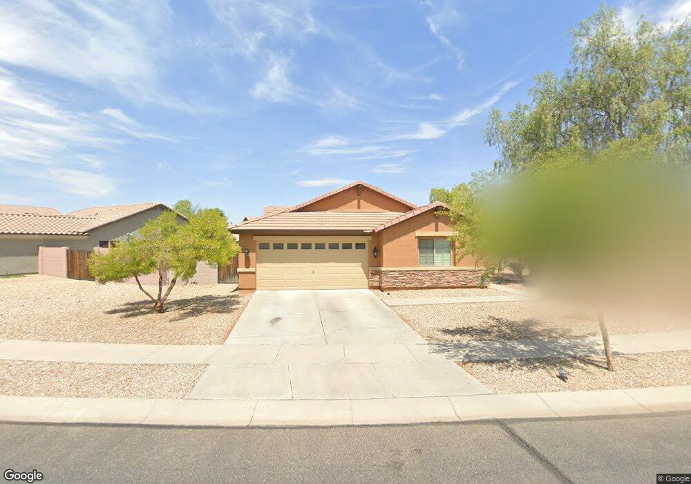
406 S 112th Dr Avondale, AZ 85323
Avondale Gateway NeighborhoodEstimated Value: $376,323 - $401,000
4
Beds
2
Baths
1,804
Sq Ft
$214/Sq Ft
Est. Value
About This Home
This home is located at 406 S 112th Dr, Avondale, AZ 85323 and is currently estimated at $386,581, approximately $214 per square foot. 406 S 112th Dr is a home located in Maricopa County with nearby schools including Littleton Elementary School, La Joya Community High School, and Academies of Math and Science Avondale.
Ownership History
Date
Name
Owned For
Owner Type
Purchase Details
Closed on
Apr 4, 2022
Sold by
Le Hong T
Bought by
Le Hong T and Le Julia Anna
Current Estimated Value
Purchase Details
Closed on
Mar 16, 2006
Sold by
Beazer Homes Sales Inc
Bought by
Le Bay Be and Le Hong Thi
Home Financials for this Owner
Home Financials are based on the most recent Mortgage that was taken out on this home.
Original Mortgage
$150,000
Interest Rate
6.19%
Mortgage Type
New Conventional
Create a Home Valuation Report for This Property
The Home Valuation Report is an in-depth analysis detailing your home's value as well as a comparison with similar homes in the area
Home Values in the Area
Average Home Value in this Area
Purchase History
| Date | Buyer | Sale Price | Title Company |
|---|---|---|---|
| Le Hong T | -- | None Listed On Document | |
| Le Bay Be | $271,705 | Lawyers Title Of Arizona Inc | |
| Beazer Homes Sales Inc | -- | Lawyers Title Of Arizona Inc |
Source: Public Records
Mortgage History
| Date | Status | Borrower | Loan Amount |
|---|---|---|---|
| Previous Owner | Le Bay Be | $150,000 |
Source: Public Records
Tax History
| Year | Tax Paid | Tax Assessment Tax Assessment Total Assessment is a certain percentage of the fair market value that is determined by local assessors to be the total taxable value of land and additions on the property. | Land | Improvement |
|---|---|---|---|---|
| 2025 | $2,308 | $15,954 | -- | -- |
| 2024 | $2,118 | $15,194 | -- | -- |
| 2023 | $2,118 | $30,150 | $6,030 | $24,120 |
| 2022 | $2,108 | $22,210 | $4,440 | $17,770 |
| 2021 | $2,029 | $21,210 | $4,240 | $16,970 |
| 2020 | $1,958 | $19,860 | $3,970 | $15,890 |
| 2019 | $1,952 | $17,410 | $3,480 | $13,930 |
| 2018 | $1,799 | $15,800 | $3,160 | $12,640 |
| 2017 | $1,681 | $14,200 | $2,840 | $11,360 |
| 2016 | $1,581 | $13,310 | $2,660 | $10,650 |
| 2015 | $1,545 | $13,410 | $2,680 | $10,730 |
Source: Public Records
Map
Nearby Homes
- 11032 W Lincoln St
- 11009 W Harrison St
- 11086 W Hadley St
- 11003 W Buchanan St
- 11081 W Hadley St
- 11049 W Hadley St
- 11014 W Jefferson St Unit 1
- 11074 W Tonto St
- 11021 W Adams St Unit I
- 11009 W Adams St
- 513 S 115th Dr
- 11555 W Lincoln St
- 913 S 115th Dr
- 11559 W Tonto St
- 141 N 110th Dr
- 814 S 109th Ave
- 11560 W Kinderman Dr
- 11575 W Tonto St
- 11552 W Hill Dr
- 133 N 109th Dr
- 402 S 112th Dr
- 410 S 112th Dr
- 11261 W Buchanan St
- 414 S 112th Dr
- 11265 W Buchanan St
- 417 S 112th Dr
- 405 S 112th Dr
- 413 S 112th Dr
- 000 W 10 Bd Ral In Avondale St
- 409 S 112th Dr
- 421 S 112th Dr
- 418 S 112th Dr
- 401 S 112th Dr
- 11256 W Buchanan St
- 11252 W Buchanan St
- 425 S 112th Dr
- 11269 W Buchanan St
- 11260 W Buchanan St
- 429 S 112th Dr
- 315 S 112th Dr
Your Personal Tour Guide
Ask me questions while you tour the home.