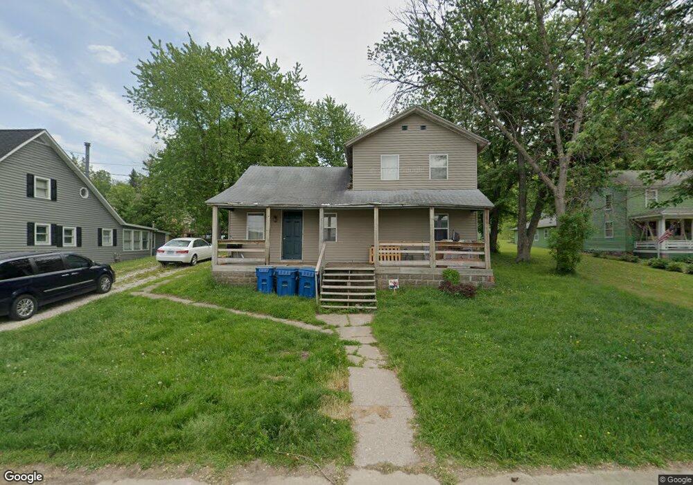
406 S Main St Port Byron, IL 61275
Estimated Value: $144,400 - $267,000
--
Bed
--
Bath
1,705
Sq Ft
$121/Sq Ft
Est. Value
About This Home
This home is located at 406 S Main St, Port Byron, IL 61275 and is currently estimated at $205,850, approximately $120 per square foot. 406 S Main St is a home located in Rock Island County with nearby schools including Riverdale Elementary School, Riverdale Middle School, and Riverdale Senior High School.
Create a Home Valuation Report for This Property
The Home Valuation Report is an in-depth analysis detailing your home's value as well as a comparison with similar homes in the area
Home Values in the Area
Average Home Value in this Area
Tax History Compared to Growth
Tax History
| Year | Tax Paid | Tax Assessment Tax Assessment Total Assessment is a certain percentage of the fair market value that is determined by local assessors to be the total taxable value of land and additions on the property. | Land | Improvement |
|---|---|---|---|---|
| 2024 | $2,998 | $39,520 | $12,237 | $27,283 |
| 2023 | $2,998 | $36,257 | $11,227 | $25,030 |
| 2022 | $2,421 | $30,754 | $10,708 | $20,046 |
| 2021 | $2,367 | $29,151 | $10,150 | $19,001 |
| 2020 | $2,332 | $28,720 | $10,000 | $18,720 |
| 2019 | $2,368 | $28,720 | $10,000 | $18,720 |
| 2018 | $2,368 | $29,592 | $13,670 | $15,922 |
| 2017 | $2,333 | $29,592 | $13,670 | $15,922 |
| 2016 | $2,312 | $29,183 | $13,481 | $15,702 |
| 2015 | $2,248 | $28,107 | $12,984 | $15,123 |
| 2014 | $477 | $27,555 | $12,729 | $14,826 |
| 2013 | $477 | $27,555 | $12,729 | $14,826 |
Source: Public Records
Map
Nearby Homes