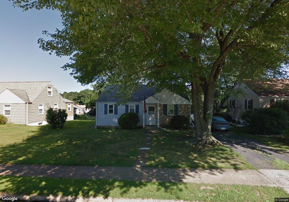
406 Walker Ave Langhorne, PA 19047
Estimated Value: $326,000 - $376,000
3
Beds
1
Bath
936
Sq Ft
$375/Sq Ft
Est. Value
About This Home
This home is located at 406 Walker Ave, Langhorne, PA 19047 and is currently estimated at $351,265, approximately $375 per square foot. 406 Walker Ave is a home located in Bucks County with nearby schools including Hoover Elementary School, Maple Point Middle School, and Neshaminy High School.
Ownership History
Date
Name
Owned For
Owner Type
Purchase Details
Closed on
Dec 30, 2021
Sold by
Lamond Ronson
Bought by
Lamond Ronson and Lamond Alicia
Current Estimated Value
Home Financials for this Owner
Home Financials are based on the most recent Mortgage that was taken out on this home.
Original Mortgage
$162,000
Outstanding Balance
$127,480
Interest Rate
2.34%
Mortgage Type
New Conventional
Estimated Equity
$223,785
Purchase Details
Closed on
Jul 11, 2011
Sold by
Kull Arlene L
Bought by
Lamond Ronson
Home Financials for this Owner
Home Financials are based on the most recent Mortgage that was taken out on this home.
Original Mortgage
$154,303
Interest Rate
4.75%
Mortgage Type
FHA
Purchase Details
Closed on
Oct 12, 1989
Bought by
Kull Arlene L
Create a Home Valuation Report for This Property
The Home Valuation Report is an in-depth analysis detailing your home's value as well as a comparison with similar homes in the area
Home Values in the Area
Average Home Value in this Area
Purchase History
| Date | Buyer | Sale Price | Title Company |
|---|---|---|---|
| Lamond Ronson | -- | National Link Originations | |
| Lamond Ronson | $159,900 | First American Title Ins Co | |
| Kull Arlene L | $33,900 | -- |
Source: Public Records
Mortgage History
| Date | Status | Borrower | Loan Amount |
|---|---|---|---|
| Open | Lamond Ronson | $162,000 | |
| Closed | Lamond Ronson | $154,303 |
Source: Public Records
Tax History
| Year | Tax Paid | Tax Assessment Tax Assessment Total Assessment is a certain percentage of the fair market value that is determined by local assessors to be the total taxable value of land and additions on the property. | Land | Improvement |
|---|---|---|---|---|
| 2025 | $3,397 | $15,200 | $3,680 | $11,520 |
| 2024 | $3,397 | $15,200 | $3,680 | $11,520 |
| 2023 | $3,367 | $15,200 | $3,680 | $11,520 |
| 2022 | $3,281 | $15,200 | $3,680 | $11,520 |
| 2021 | $3,327 | $15,200 | $3,680 | $11,520 |
| 2020 | $3,334 | $15,200 | $3,680 | $11,520 |
| 2019 | $3,264 | $15,200 | $3,680 | $11,520 |
| 2018 | $3,200 | $15,200 | $3,680 | $11,520 |
| 2017 | $3,124 | $15,200 | $3,680 | $11,520 |
| 2016 | $3,071 | $15,200 | $3,680 | $11,520 |
| 2015 | -- | $15,200 | $3,680 | $11,520 |
| 2014 | -- | $15,200 | $3,680 | $11,520 |
Source: Public Records
Map
Nearby Homes
- 786 E Parker St Unit C1
- 732 Sparrow Ln
- 409 Fairview Ave
- 56 W Lincoln Hwy
- 111 Dehaven Ave
- 866 Hulmeville Rd
- 827 Hulmeville Rd
- 428 Madison Ave
- 430 Parkview Ave
- 455 Jefferson Ave
- 858 Avenue E Unit E
- 914 Avenue D
- 565 Hulmeville Rd
- 629 S Bellevue Ave Unit B
- 0 Prospect Ave
- 3225 Ethan Allen Ct
- 3257 Ethan Allen Ct
- 711 Madison Ave
- 6301 Powder Horn Ct
- 975 Woodvale Ave
Your Personal Tour Guide
Ask me questions while you tour the home.