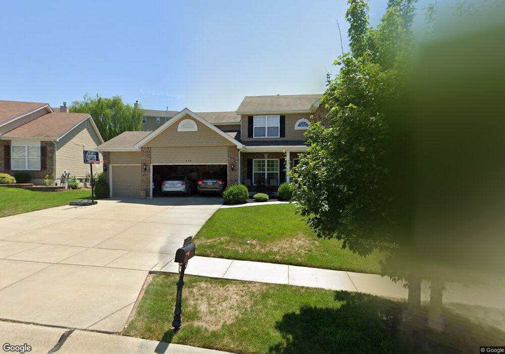
406 Wynding Gate Dr Lake Saint Louis, MO 63367
Estimated Value: $529,000 - $558,000
4
Beds
4
Baths
2,848
Sq Ft
$190/Sq Ft
Est. Value
About This Home
This home is located at 406 Wynding Gate Dr, Lake Saint Louis, MO 63367 and is currently estimated at $541,090, approximately $189 per square foot. 406 Wynding Gate Dr is a home with nearby schools including Duello Elementary School, Frontier Middle School, and Liberty High School.
Ownership History
Date
Name
Owned For
Owner Type
Purchase Details
Closed on
Dec 18, 2012
Sold by
Mcbride Wyndgate Llc
Bought by
Barklage Christopher J and Barklage Aliece N
Current Estimated Value
Home Financials for this Owner
Home Financials are based on the most recent Mortgage that was taken out on this home.
Original Mortgage
$240,601
Outstanding Balance
$167,089
Interest Rate
3.42%
Mortgage Type
New Conventional
Estimated Equity
$374,001
Purchase Details
Closed on
Oct 21, 2010
Sold by
Regions Bank
Bought by
Mcbride Wyndgate Llc
Create a Home Valuation Report for This Property
The Home Valuation Report is an in-depth analysis detailing your home's value as well as a comparison with similar homes in the area
Home Values in the Area
Average Home Value in this Area
Purchase History
| Date | Buyer | Sale Price | Title Company |
|---|---|---|---|
| Barklage Christopher J | $248,043 | Dependable Title Llc | |
| Mcbride Wyndgate Llc | -- | Benchmark Title Llc |
Source: Public Records
Mortgage History
| Date | Status | Borrower | Loan Amount |
|---|---|---|---|
| Open | Barklage Christopher J | $240,601 | |
| Closed | Mcbride Wyndgate Llc | $0 |
Source: Public Records
Tax History Compared to Growth
Tax History
| Year | Tax Paid | Tax Assessment Tax Assessment Total Assessment is a certain percentage of the fair market value that is determined by local assessors to be the total taxable value of land and additions on the property. | Land | Improvement |
|---|---|---|---|---|
| 2025 | $5,934 | $93,321 | -- | -- |
| 2023 | $5,939 | $86,913 | $0 | $0 |
| 2022 | $5,009 | $68,295 | $0 | $0 |
| 2021 | $5,020 | $68,295 | $0 | $0 |
| 2020 | $4,621 | $60,372 | $0 | $0 |
| 2019 | $4,338 | $60,372 | $0 | $0 |
| 2018 | $4,278 | $56,652 | $0 | $0 |
| 2017 | $4,251 | $56,652 | $0 | $0 |
| 2016 | $4,058 | $51,873 | $0 | $0 |
| 2015 | $3,998 | $51,873 | $0 | $0 |
| 2014 | $3,387 | $47,128 | $0 | $0 |
Source: Public Records
Map
Nearby Homes
- 522 Long Creek Dr
- 497 Parkgate Dr
- 215 Everett Creek Ct
- 125 Far Meadow Dr
- 31 Briscoe Glen Ct
- 2001 Paul Renaud Blvd
- 104 Long Pass Ct
- 113 Wyndcrest Ct
- 126 Far Meadow Dr
- 422 Parkgate Dr
- 324 Eastgate Dr
- 821 Topsfield Dr
- 0 Unknown Unit MIS25067021
- 0 Unknown Unit MIS25067020
- 0 Unknown Unit MIS25067019
- 0 Unknown Unit MIS25067014
- 0 Unknown Unit MIS25067011
- 0 Unknown Unit MIS25067015
- 0 Unknown Unit MIS25067013
- 0 Unknown Unit MIS25067012
- 408 Wynding Gate Dr
- 1063 Wyndgate Ridge Dr
- 1065 Wyndgate Ridge Dr
- 410 Wynding Gate Dr
- 1061 Wyndgate Ridge Dr
- 402 Wynding Gate Dr
- 407 Wynding Gate Dr
- 1067 Wyndgate Ridge Dr
- 401 Wynding Gate Dr
- 1059 Wyndgate Ridge Dr
- 1059 Wyndgate Ridge Dr Unit 621
- 412 Wynding Gate Dr
- 1069 Wyndgate Ridge Dr
- 411 Wynding Gate Dr
- 400 Wynding Gate Dr
- 2009 Wyndgate Ridge Dr
- 1064 Wyndgate Ridge Dr
- 2006 Wyndgate Ridge Dr
- 1062 Wyndgate Ridge Dr
- 1057 Wyndgate Ridge Dr