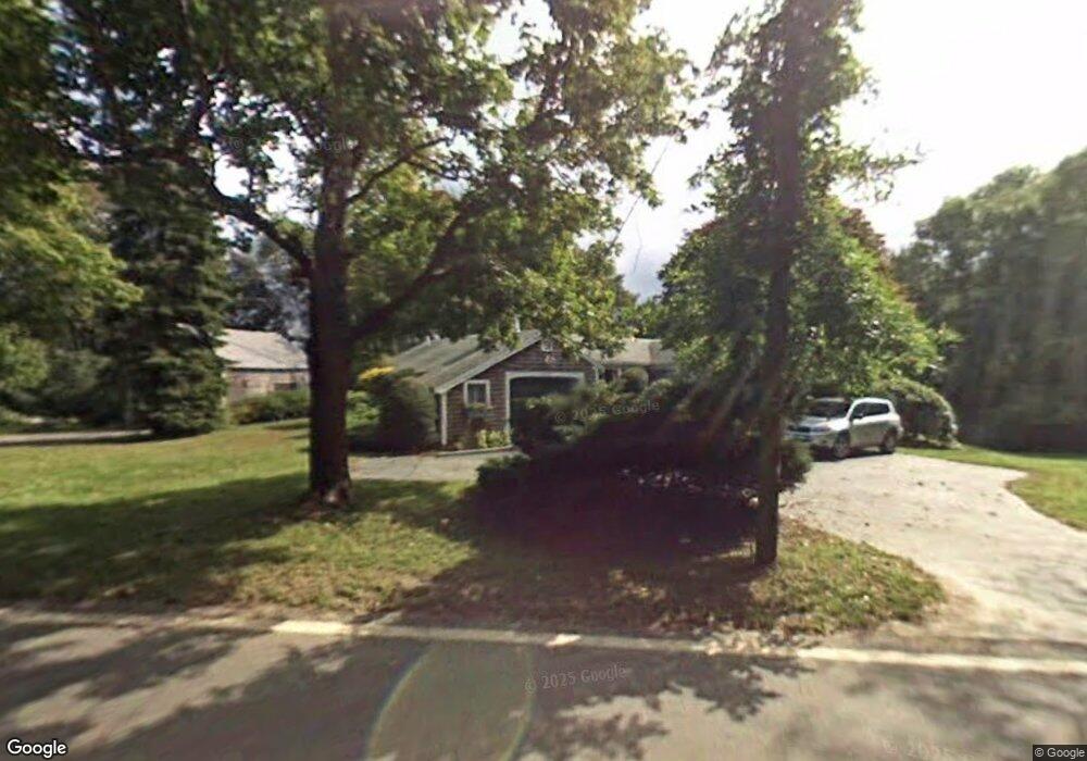
4061 Main St Barnstable, MA 02630
Barnstable Village NeighborhoodEstimated Value: $736,312 - $1,221,000
2
Beds
2
Baths
1,657
Sq Ft
$550/Sq Ft
Est. Value
About This Home
This home is located at 4061 Main St, Barnstable, MA 02630 and is currently estimated at $911,078, approximately $549 per square foot. 4061 Main St is a home located in Barnstable County with nearby schools including West Barnstable Elementary School, Barnstable United Elementary School, and Barnstable Intermediate School.
Ownership History
Date
Name
Owned For
Owner Type
Purchase Details
Closed on
Jun 24, 2013
Sold by
Kroeber Ft
Bought by
White Lincoln E
Current Estimated Value
Home Financials for this Owner
Home Financials are based on the most recent Mortgage that was taken out on this home.
Original Mortgage
$272,000
Outstanding Balance
$193,140
Interest Rate
3.45%
Mortgage Type
New Conventional
Estimated Equity
$717,938
Purchase Details
Closed on
May 4, 2004
Sold by
Kroeber Jean
Bought by
Kroeber Bernd F
Create a Home Valuation Report for This Property
The Home Valuation Report is an in-depth analysis detailing your home's value as well as a comparison with similar homes in the area
Home Values in the Area
Average Home Value in this Area
Purchase History
| Date | Buyer | Sale Price | Title Company |
|---|---|---|---|
| White Lincoln E | $340,000 | -- | |
| Kroeber Bernd F | -- | -- |
Source: Public Records
Mortgage History
| Date | Status | Borrower | Loan Amount |
|---|---|---|---|
| Open | White Lincoln E | $272,000 |
Source: Public Records
Tax History
| Year | Tax Paid | Tax Assessment Tax Assessment Total Assessment is a certain percentage of the fair market value that is determined by local assessors to be the total taxable value of land and additions on the property. | Land | Improvement |
|---|---|---|---|---|
| 2025 | $5,734 | $620,600 | $279,700 | $340,900 |
| 2024 | $5,374 | $613,500 | $279,700 | $333,800 |
| 2023 | $5,105 | $568,500 | $276,700 | $291,800 |
| 2022 | $4,795 | $429,700 | $177,300 | $252,400 |
| 2021 | $4,615 | $394,100 | $188,300 | $205,800 |
| 2020 | $4,759 | $388,200 | $199,400 | $188,800 |
| 2019 | $4,634 | $379,200 | $210,500 | $168,700 |
| 2018 | $4,413 | $350,800 | $209,900 | $140,900 |
| 2017 | $4,374 | $349,900 | $215,700 | $134,200 |
| 2016 | $4,272 | $346,500 | $212,300 | $134,200 |
| 2015 | $4,059 | $335,200 | $213,700 | $121,500 |
Source: Public Records
Map
Nearby Homes
- 79 Bayberry Ln
- 30 Indian Trail
- 4390 Main St
- 44 Iris Ln
- 41 Dromoland Ln
- 65 Oakmont Rd
- 18 Sleeping Dog Path
- 3528 Main St
- 100 Spy Glass Hill Rd
- 81 Desert Sands Ln
- 162 Route 6a
- 186 Route 6a
- 0 Indian Trail
- 371 Route 6a
- 0 Phinneys Ln
- 93 Harris Meadow Ln
- 95 Washington Ave
- 61 Coolidge Rd
- 28 Mariners Ln
- 933-935 W Yarmouth Rd
- 4061 Main Rte 6a St
- 4011 Main St
- 4170 Massachusetts 6a
- 4430 Massachusetts 6a
- 3826 Massachusetts 6a
- 4073 Massachusetts 6a
- 4022 Main St
- 4042 Main St Unit U-B
- 4044 Main St
- 4046 Main St
- 4040 Main St
- 4042 Main St
- 4054 Main Route 6a St
- 4054 Main St
- 4083 Main St
- 4070 Main St
- 4084 Main Rte 6a St
- 8 Rue Michelle
- 4039 Massachusetts 6a
- 4039 Main St
Your Personal Tour Guide
Ask me questions while you tour the home.