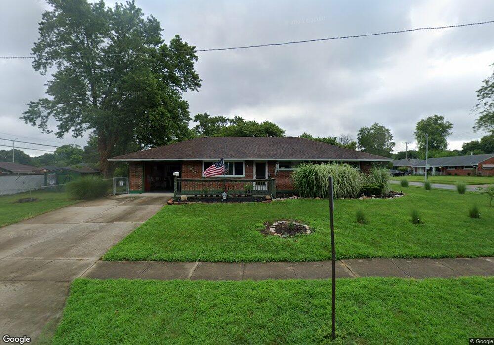
4062 Cordell Dr Dayton, OH 45439
Woodbourne-Hyde Park NeighborhoodEstimated Value: $180,225 - $189,000
3
Beds
1
Bath
1,080
Sq Ft
$171/Sq Ft
Est. Value
About This Home
This home is located at 4062 Cordell Dr, Dayton, OH 45439 and is currently estimated at $184,556, approximately $170 per square foot. 4062 Cordell Dr is a home located in Montgomery County with nearby schools including West Carrollton High School, Miami Valley Academies, and St. Albert the Great Catholic School.
Ownership History
Date
Name
Owned For
Owner Type
Purchase Details
Closed on
Aug 4, 2021
Sold by
Allison Scott K
Bought by
Allison Dana G
Current Estimated Value
Purchase Details
Closed on
Oct 21, 2020
Sold by
Estate Of Betty W Allison
Bought by
Allison Dana G and Allison Scott K
Purchase Details
Closed on
Apr 17, 2007
Sold by
Hammonds R Kenneth and Kell Judy V
Bought by
Allison Betty W
Create a Home Valuation Report for This Property
The Home Valuation Report is an in-depth analysis detailing your home's value as well as a comparison with similar homes in the area
Home Values in the Area
Average Home Value in this Area
Purchase History
| Date | Buyer | Sale Price | Title Company |
|---|---|---|---|
| Allison Dana G | -- | None Available | |
| Allison Dana G | -- | None Available | |
| Allison Betty W | $89,900 | Attorney |
Source: Public Records
Tax History Compared to Growth
Tax History
| Year | Tax Paid | Tax Assessment Tax Assessment Total Assessment is a certain percentage of the fair market value that is determined by local assessors to be the total taxable value of land and additions on the property. | Land | Improvement |
|---|---|---|---|---|
| 2024 | $2,641 | $46,660 | $7,820 | $38,840 |
| 2023 | $2,641 | $46,660 | $7,820 | $38,840 |
| 2022 | $2,855 | $31,310 | $5,250 | $26,060 |
| 2021 | $2,638 | $31,310 | $5,250 | $26,060 |
| 2020 | $1,916 | $31,310 | $5,250 | $26,060 |
| 2019 | $1,782 | $27,060 | $5,250 | $21,810 |
| 2018 | $1,668 | $27,060 | $5,250 | $21,810 |
| 2017 | $1,658 | $27,060 | $5,250 | $21,810 |
| 2016 | $1,656 | $26,440 | $5,250 | $21,190 |
| 2015 | $1,543 | $26,440 | $5,250 | $21,190 |
| 2014 | $1,543 | $26,440 | $5,250 | $21,190 |
| 2012 | -- | $27,240 | $7,000 | $20,240 |
Source: Public Records
Map
Nearby Homes
- 1673 W Stroop Rd
- 2090 Mattis Dr
- 4301 Tait Rd
- 1905 Tait Circle Rd
- 1952 Tait Circle Rd
- 3519 Waterbury Dr
- 4207 S Dixie Dr
- 3720 Ridgeleigh Rd Unit D
- 4519 Harbison St
- 2050 William Ln
- 4629 Richwood Dr
- 4661 Richwood Dr
- 1349 Tamerlane Rd
- 2639 Blanchard Ave
- 4792 Loxley Dr
- 2571 Cluster Ave
- 1955 Kresswood Cir
- 4400 Royal Ridge Way
- 1314 Ridgeview Ave
- 3225 Southdale Dr Unit 1
- 2001 Mattis Dr
- 4040 Cordell Dr
- 2041 Mattis Dr
- 4057 Cordell Dr
- 1987 Mattis Dr
- 4047 Cordell Dr
- 4022 Cordell Dr
- 1994 Mattis Dr
- 1994 W Stroop Rd
- 1980 W Stroop Rd
- 1973 Mattis Dr
- 4035 Cordell Dr
- 4097 Cordell Dr
- 4102 Cordell Dr
- 2053 Norway Dr
- 2061 Mattis Dr
- 1980 Mattis Dr
- 2065 Norway Dr
- 2050 Mattis Dr
- 1968 W Stroop Rd