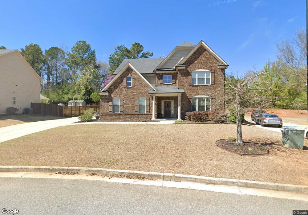
4064 Bunker Dr SW Austell, GA 30106
Estimated Value: $506,394 - $548,000
5
Beds
4
Baths
3,814
Sq Ft
$138/Sq Ft
Est. Value
About This Home
This home is located at 4064 Bunker Dr SW, Austell, GA 30106 and is currently estimated at $527,849, approximately $138 per square foot. 4064 Bunker Dr SW is a home with nearby schools including Deerwood Elementary School, Clarkdale Elementary School, and Cooper Middle School.
Ownership History
Date
Name
Owned For
Owner Type
Purchase Details
Closed on
Apr 25, 2019
Sold by
Mcafee Charlie N
Bought by
Mcafee Katrina D
Current Estimated Value
Purchase Details
Closed on
Mar 24, 2016
Sold by
Venture Homes Inc
Bought by
Mcafee Charlie N and Mcafee Katrina D
Home Financials for this Owner
Home Financials are based on the most recent Mortgage that was taken out on this home.
Original Mortgage
$256,101
Interest Rate
3.62%
Mortgage Type
New Conventional
Create a Home Valuation Report for This Property
The Home Valuation Report is an in-depth analysis detailing your home's value as well as a comparison with similar homes in the area
Home Values in the Area
Average Home Value in this Area
Purchase History
| Date | Buyer | Sale Price | Title Company |
|---|---|---|---|
| Mcafee Katrina D | -- | -- | |
| Mcafee Charlie N | $269,580 | -- |
Source: Public Records
Mortgage History
| Date | Status | Borrower | Loan Amount |
|---|---|---|---|
| Previous Owner | Mcafee Charlie N | $256,101 |
Source: Public Records
Tax History Compared to Growth
Tax History
| Year | Tax Paid | Tax Assessment Tax Assessment Total Assessment is a certain percentage of the fair market value that is determined by local assessors to be the total taxable value of land and additions on the property. | Land | Improvement |
|---|---|---|---|---|
| 2025 | $5,878 | $238,416 | $34,000 | $204,416 |
| 2024 | $5,882 | $238,416 | $34,000 | $204,416 |
| 2023 | $4,419 | $195,960 | $20,000 | $175,960 |
| 2022 | $3,999 | $150,280 | $20,000 | $130,280 |
| 2021 | $3,594 | $131,792 | $20,000 | $111,792 |
| 2020 | $3,594 | $131,792 | $20,000 | $111,792 |
| 2019 | $3,454 | $125,368 | $20,000 | $105,368 |
| 2018 | $3,526 | $116,176 | $22,000 | $94,176 |
| 2017 | $3,099 | $107,800 | $23,040 | $84,760 |
| 2016 | $460 | $16,000 | $16,000 | $0 |
Source: Public Records
Map
Nearby Homes
- 4099 Bunker Dr SW
- 4079 Broadmoor Ct SW
- 2867 Ash St SW
- 3989 Flint Hill Rd
- 2774 Eloquent Ln
- 2855 Brass Ct
- 2473 Greenside Ct
- 2402 Greenside Ct
- 3832 Abbott Ln Unit 1
- 3916 Abbott Way Unit 2
- 2539 Dogwood Hills Ct
- 4598 Flint Hill Rd
- 2300 Anderson Mill Rd
- 3807 Abbott Ln SW Unit 15
- 4287 Keats Ct
- 3227 Abbott Dr Unit 6
- 3237 Abbott Dr SW Unit 7
- 4068 Bunker Dr SW
- 4068 Bunker Dr SW
- 4060 Bunker Dr SW
- 4072 Bunker
- 4072 Bunker Dr SW
- 4143 Ewing Rd
- 4065 Bunker Dr SW
- 4175 Ewing Rd
- 4056 Bunker Dr SW
- 4080 Bunker
- 4080 Bunker Dr SW
- 4080 Bunker Dr SW
- 4133 Ewing Rd
- 4080R SW Bunker Dr SW
- 2274 Pikewood Ln SW
- 2274 Pikewood Ln SW
- 2267 Pikewood Ln SW
- 4075 Bunker Dr SW Unit 46
- 4075 Bunker Dr SW
- 4075 Bunker Dr SW