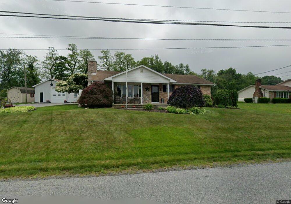
4067 Cedar Dr Walnutport, PA 18088
Estimated Value: $355,001 - $542,000
2
Beds
2
Baths
1,457
Sq Ft
$288/Sq Ft
Est. Value
About This Home
This home is located at 4067 Cedar Dr, Walnutport, PA 18088 and is currently estimated at $419,750, approximately $288 per square foot. 4067 Cedar Dr is a home located in Northampton County with nearby schools including Lehigh Elementary School, Northampton Area Middle School, and Northampton Area High School.
Ownership History
Date
Name
Owned For
Owner Type
Purchase Details
Closed on
Aug 1, 2014
Sold by
Fox Guy D and Fox Leeza F
Bought by
Fox David L
Current Estimated Value
Home Financials for this Owner
Home Financials are based on the most recent Mortgage that was taken out on this home.
Original Mortgage
$195,000
Outstanding Balance
$149,075
Interest Rate
4.18%
Mortgage Type
New Conventional
Estimated Equity
$270,675
Purchase Details
Closed on
May 1, 1992
Bought by
Fox Leeza F and Fox Guy D
Create a Home Valuation Report for This Property
The Home Valuation Report is an in-depth analysis detailing your home's value as well as a comparison with similar homes in the area
Home Values in the Area
Average Home Value in this Area
Purchase History
| Date | Buyer | Sale Price | Title Company |
|---|---|---|---|
| Fox David L | $235,000 | None Available | |
| Fox Leeza F | -- | -- |
Source: Public Records
Mortgage History
| Date | Status | Borrower | Loan Amount |
|---|---|---|---|
| Open | Fox David L | $195,000 |
Source: Public Records
Tax History Compared to Growth
Tax History
| Year | Tax Paid | Tax Assessment Tax Assessment Total Assessment is a certain percentage of the fair market value that is determined by local assessors to be the total taxable value of land and additions on the property. | Land | Improvement |
|---|---|---|---|---|
| 2025 | $773 | $71,600 | $16,200 | $55,400 |
| 2024 | $5,263 | $71,600 | $16,200 | $55,400 |
| 2023 | $5,170 | $71,600 | $16,200 | $55,400 |
| 2022 | $5,170 | $71,600 | $16,200 | $55,400 |
| 2021 | $5,183 | $71,600 | $16,200 | $55,400 |
| 2020 | $5,183 | $71,600 | $16,200 | $55,400 |
| 2019 | $5,107 | $71,600 | $16,200 | $55,400 |
| 2018 | $5,031 | $71,600 | $16,200 | $55,400 |
| 2017 | $4,922 | $71,600 | $16,200 | $55,400 |
| 2016 | -- | $71,600 | $16,200 | $55,400 |
| 2015 | -- | $71,600 | $16,200 | $55,400 |
| 2014 | -- | $71,600 | $16,200 | $55,400 |
Source: Public Records
Map
Nearby Homes
- 1015 Honeysuckle Rd
- 723 Fir Dr
- 904 Municipal Rd
- 0 Walnut Dr
- 4015 Sycamore Dr
- 861 Municipal Rd
- 4390 Woodland Cir
- 4405 Lehigh Dr
- 4237 Independence Ln
- 4196 Independence Ln
- 137 E Zimmer Dr
- 1150 E Stateside Dr
- 1225 Meyer Dr
- 4083 W Mountain View Dr
- 0 Olive Rd
- 3829 Dogwood Rd
- 95 Nashua St
- 93 Nashua St
- 0 Mountain View Dr Unit 747924
- 79 De Rose St
- 4073 Cedar Dr
- 4049 Cedar Dr
- 4060 Cedar Dr
- 886 Blue Mountain Dr
- 4085 Cedar Dr
- 850 Blue Mountain Dr
- 4086 Cedar Dr
- 848 Blue Mountain Dr
- 844 Blue Mountain Dr
- 4093 Cedar Dr
- 4038 Cedar Dr
- 842 Blue Mountain Dr
- 4026 Cedar Dr
- 834 Blue Mountain Dr
- 4101 Cedar Dr
- 846 Blue Mountain Dr
- 832 Blue Mountain Dr
- 4096 Cedar Dr
- 4109 Cedar Dr
- 918 Blue Mountain Dr