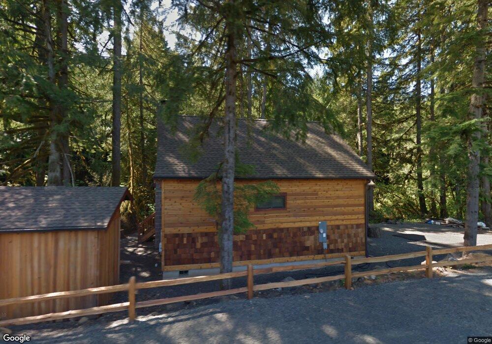
40684 Mohawk River Rd Marcola, OR 97454
Estimated Value: $385,000 - $511,000
2
Beds
1
Bath
788
Sq Ft
$565/Sq Ft
Est. Value
About This Home
This home is located at 40684 Mohawk River Rd, Marcola, OR 97454 and is currently estimated at $445,314, approximately $565 per square foot. 40684 Mohawk River Rd is a home located in Lane County with nearby schools including Marcola Elementary School and Mohawk High School.
Ownership History
Date
Name
Owned For
Owner Type
Purchase Details
Closed on
Nov 16, 2020
Sold by
Jackson Robert and Jackson Jennifer Jill
Bought by
Barnes Benjamin J and Barnes Trisha M
Current Estimated Value
Home Financials for this Owner
Home Financials are based on the most recent Mortgage that was taken out on this home.
Original Mortgage
$280,800
Outstanding Balance
$225,576
Interest Rate
2.8%
Mortgage Type
New Conventional
Estimated Equity
$219,738
Purchase Details
Closed on
Apr 16, 2020
Sold by
Jackson Robert
Bought by
Jackson Robert and Jackson Jennifer Jill
Home Financials for this Owner
Home Financials are based on the most recent Mortgage that was taken out on this home.
Original Mortgage
$225,000
Interest Rate
3.3%
Mortgage Type
New Conventional
Purchase Details
Closed on
Jul 7, 2010
Sold by
Weyerhaeuser Real Estate Development Com
Bought by
Jackson Robert
Create a Home Valuation Report for This Property
The Home Valuation Report is an in-depth analysis detailing your home's value as well as a comparison with similar homes in the area
Purchase History
| Date | Buyer | Sale Price | Title Company |
|---|---|---|---|
| Barnes Benjamin J | $351,000 | First American | |
| Jackson Robert | -- | Silk Abstract Company | |
| Jackson Robert | $22,500 | Cascade Title Co |
Source: Public Records
Mortgage History
| Date | Status | Borrower | Loan Amount |
|---|---|---|---|
| Open | Barnes Benjamin J | $280,800 | |
| Previous Owner | Jackson Robert | $225,000 |
Source: Public Records
Tax History
| Year | Tax Paid | Tax Assessment Tax Assessment Total Assessment is a certain percentage of the fair market value that is determined by local assessors to be the total taxable value of land and additions on the property. | Land | Improvement |
|---|---|---|---|---|
| 2025 | $2,155 | $171,428 | -- | -- |
| 2024 | $2,095 | $166,435 | -- | -- |
| 2023 | $2,095 | $161,588 | $0 | $0 |
| 2022 | $1,939 | $156,882 | $0 | $0 |
| 2021 | $1,896 | $152,313 | $0 | $0 |
| 2020 | $1,843 | $147,877 | $0 | $0 |
| 2019 | $1,783 | $143,570 | $0 | $0 |
| 2018 | $1,733 | $135,329 | $0 | $0 |
| 2017 | $1,605 | $135,329 | $0 | $0 |
| 2016 | $1,571 | $131,387 | $0 | $0 |
| 2015 | $1,543 | $127,560 | $0 | $0 |
| 2014 | $1,255 | $123,845 | $0 | $0 |
Source: Public Records
Map
Nearby Homes
- 95021 Bethany Ln
- 39449 Ann Ln
- 94703 Johnson Rd
- 94671 Johnson Rd
- 0 Shotgun Creek Rd
- 42664 Upper Calapooia (Nx2
- 42531 Upper Calapooia Dr
- 93099 Marcola Rd
- 42664 (Next to) Upper Calapooia Dr
- 25606 Rice Rd
- 0 Wendling Rd
- 40080 Highway 228
- 40352 Holley Heights Loop
- 0 Highway 228 (Lot Unit 3)
- 0 Highway 228 Unit Lot 4
- 38216 Wendling Rd
- TL 604 Highway 228
- Lot 2 228 Hwy
- 38058 Railroad Ln
- 92133 Marcola Rd
- 40684 Mohawk River Rd (Nt)
- 40684 Mohawk River (Next To) Rd
- 40684 Mohawk River Rd
- 40711 Mohawk River Rd
- 40714 Mohawk River Rd
- - S Hall Rd
- - N Hall Rd
- 40598 Mohawk River Rd
- 40586 Mohawk River Rd
- 40591 Mohawk River Rd
- 40582 Mohawk River Rd
- 0 Mohawk River Rd Unit 20324102
- 0 Mohawk River Rd Unit 8068421
- 0 Mohawk River Rd Unit 8068408
- 0 Mohawk River Rd Unit 8068416
- 0 Mohawk River Rd Unit 8068402
- 0 Mohawk River Rd Unit 8068398
- 0 Mohawk River Rd Unit 8068404
- 0 Mohawk River Rd Unit 8068394
- 0 Mohawk River Rd Unit 8068241
Your Personal Tour Guide
Ask me questions while you tour the home.