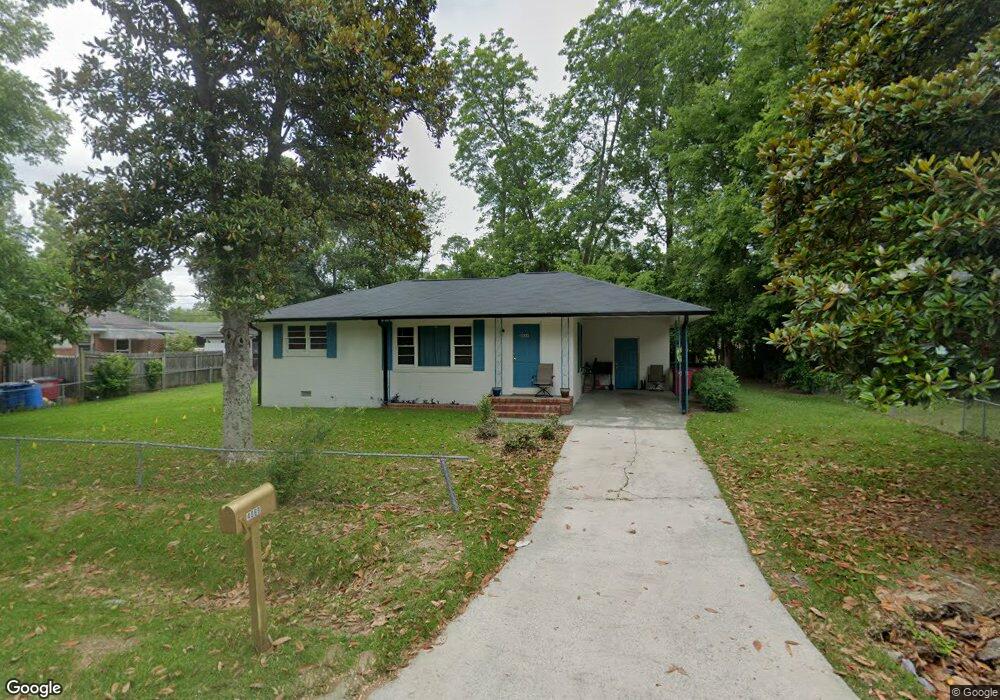
4069 Blair Ct Macon, GA 31206
Estimated Value: $66,000 - $79,000
3
Beds
1
Bath
864
Sq Ft
$86/Sq Ft
Est. Value
About This Home
This home is located at 4069 Blair Ct, Macon, GA 31206 and is currently estimated at $74,401, approximately $86 per square foot. 4069 Blair Ct is a home located in Bibb County with nearby schools including Veterans Elementary School, Southwest High School, and Gilead Christian Academy.
Ownership History
Date
Name
Owned For
Owner Type
Purchase Details
Closed on
Jul 18, 2022
Sold by
Lunsford Family Properties Llc
Bought by
Greenflower 22A Llc
Current Estimated Value
Purchase Details
Closed on
Apr 5, 2022
Sold by
Williams David
Bought by
Lunsford Family Properties Llc
Purchase Details
Closed on
Sep 8, 2006
Sold by
Micmaster Hugh
Bought by
Williams David
Home Financials for this Owner
Home Financials are based on the most recent Mortgage that was taken out on this home.
Original Mortgage
$66,500
Interest Rate
10.25%
Mortgage Type
Adjustable Rate Mortgage/ARM
Purchase Details
Closed on
Aug 25, 2004
Purchase Details
Closed on
Sep 14, 1998
Create a Home Valuation Report for This Property
The Home Valuation Report is an in-depth analysis detailing your home's value as well as a comparison with similar homes in the area
Home Values in the Area
Average Home Value in this Area
Purchase History
| Date | Buyer | Sale Price | Title Company |
|---|---|---|---|
| Greenflower 22A Llc | -- | None Listed On Document | |
| Lunsford Family Properties Llc | $47,000 | -- | |
| Williams David | $66,500 | None Avelable | |
| -- | $56,000 | -- | |
| -- | $33,300 | -- |
Source: Public Records
Mortgage History
| Date | Status | Borrower | Loan Amount |
|---|---|---|---|
| Previous Owner | Williams David | $66,500 |
Source: Public Records
Tax History Compared to Growth
Tax History
| Year | Tax Paid | Tax Assessment Tax Assessment Total Assessment is a certain percentage of the fair market value that is determined by local assessors to be the total taxable value of land and additions on the property. | Land | Improvement |
|---|---|---|---|---|
| 2025 | $522 | $21,242 | $2,280 | $18,962 |
| 2024 | $539 | $21,242 | $2,280 | $18,962 |
| 2023 | $539 | $21,242 | $2,280 | $18,962 |
| 2022 | $664 | $19,181 | $4,183 | $14,998 |
| 2021 | $729 | $19,181 | $4,183 | $14,998 |
| 2020 | $745 | $19,181 | $4,183 | $14,998 |
| 2019 | $751 | $19,181 | $4,183 | $14,998 |
| 2018 | $1,330 | $19,181 | $4,183 | $14,998 |
| 2017 | $719 | $19,181 | $4,183 | $14,998 |
| 2016 | $664 | $19,180 | $4,183 | $14,998 |
| 2015 | $939 | $19,180 | $4,183 | $14,998 |
| 2014 | $1,080 | $19,180 | $4,183 | $14,998 |
Source: Public Records
Map
Nearby Homes
- 5060 Pinefield Dr
- 3913 Blair Ct
- 2868 Barrett Ave
- 2765 Alden St
- 3842 Wynnwood Dr
- 4940 Pinefield Dr
- 2995 Virginia Dr
- 3716 Wynnwood Dr
- 4500 Chambers Rd
- 2769 Nancy Dr
- 2768 Nancy Dr
- 2972 Richard Dr
- 140 Spencer Hill Ct
- 3078 Alfred Dr
- 2801 Deeb Dr
- 4742 Bloomfield Rd
- 5711 Sterling Place
- 2443 Lambert Dr
- 5746 Sterling Place
- 2521 Rocky Creek Rd