Estimated Value: $418,000 - $459,000
3
Beds
2
Baths
2,116
Sq Ft
$204/Sq Ft
Est. Value
About This Home
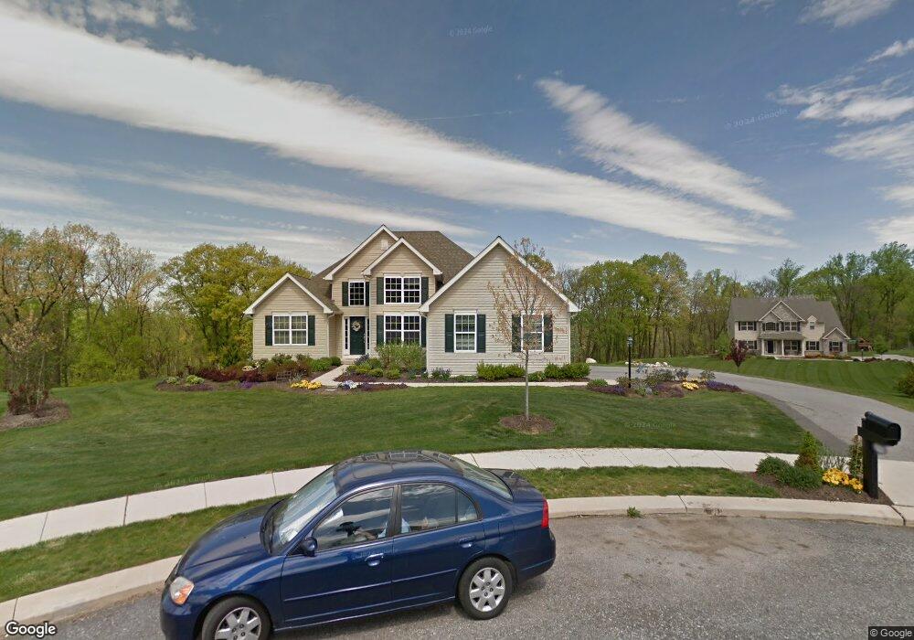
This home is located at 4069 Elmhurst Ct, York, PA 17408 and is currently estimated at $432,193, approximately $204 per square foot. 4069 Elmhurst Ct is a home located in York County with nearby schools including Spring Grove Area Middle School and Spring Grove Area High School.
Ownership History
Date
Name
Owned For
Owner Type
Purchase Details
Closed on
Sep 1, 2009
Sold by
Glenpoint Llc
Bought by
Armstrong Basil M and Armstrong Linda T
Current Estimated Value
Home Financials for this Owner
Home Financials are based on the most recent Mortgage that was taken out on this home.
Original Mortgage
$269,100
Outstanding Balance
$182,476
Interest Rate
5.31%
Mortgage Type
Future Advance Clause Open End Mortgage
Estimated Equity
$249,717
Create a Home Valuation Report for This Property
The Home Valuation Report is an in-depth analysis detailing your home's value as well as a comparison with similar homes in the area
Home Values in the Area
Average Home Value in this Area
Purchase History
| Date | Buyer | Sale Price | Title Company |
|---|---|---|---|
| Armstrong Basil M | $75,000 | Conestoga Title Insurance Co |
Source: Public Records
Mortgage History
| Date | Status | Borrower | Loan Amount |
|---|---|---|---|
| Open | Armstrong Basil M | $269,100 |
Source: Public Records
Tax History Compared to Growth
Tax History
| Year | Tax Paid | Tax Assessment Tax Assessment Total Assessment is a certain percentage of the fair market value that is determined by local assessors to be the total taxable value of land and additions on the property. | Land | Improvement |
|---|---|---|---|---|
| 2025 | $8,912 | $267,210 | $100,440 | $166,770 |
| 2024 | $8,816 | $267,210 | $100,440 | $166,770 |
| 2023 | $8,816 | $267,210 | $100,440 | $166,770 |
| 2022 | $8,816 | $267,210 | $100,440 | $166,770 |
| 2021 | $8,435 | $267,210 | $100,440 | $166,770 |
| 2020 | $8,435 | $267,210 | $100,440 | $166,770 |
| 2019 | $8,374 | $267,210 | $100,440 | $166,770 |
| 2018 | $8,264 | $267,210 | $100,440 | $166,770 |
| 2017 | $8,076 | $267,210 | $100,440 | $166,770 |
| 2016 | $0 | $267,210 | $100,440 | $166,770 |
| 2015 | -- | $267,210 | $100,440 | $166,770 |
| 2014 | -- | $267,210 | $100,440 | $166,770 |
Source: Public Records
Map
Nearby Homes
- 1675 Hampden Dr
- 4074 Robinhood Dr
- 4061 Robinhood Dr
- 40 S Main St
- 87 N Main St
- 27 N Main St
- 1709 Country Manor Dr
- 1776 Country Manor Dr
- 3971 Little John Dr
- 3984 Little John Dr
- 3987 Little John Dr
- 2015 Paperback Way
- 1036 Smith Hill Rd
- Penwell Plan at Strawberry Field Estates
- Henley Plan at Strawberry Field Estates
- Galen Plan at Strawberry Field Estates
- Neuville Plan at Strawberry Field Estates
- 1832 Buck Hill Dr
- 1844 Buck Hill Dr
- 2060 Paperback Way
- 4072 Elmhurst Ct
- 4066 Elmhurst Ct
- 4063 Elmhurst Ct
- 4057 Elmhurst Ct
- 4060 Elmhurst Ct
- 4051 Elmhurst Ct
- 4048 Elmhurst Ct
- 4141 Robinhood Dr
- 4143 Robinhood Dr
- 4045 Elmhurst Ct
- 1663 Hampden Dr
- 4137 Robinhood Dr
- 4147 Robinhood Dr
- 0 Hampden Dr Unit 1004772125
- 0 Hampden Dr Unit 1004612405
- 0 Hampden Dr Unit 1004630855
- 0 Hampden Dr Unit 20807381
- 0 Hampden Dr Unit 20904689
- 0 Hampden Dr Unit 21000778
- 1681 Hampden Dr