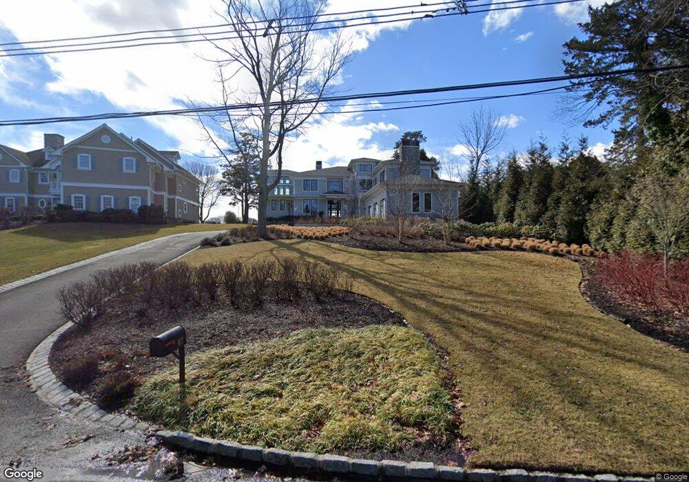
407 Osprey Point Dr Brielle, NJ 08730
Estimated Value: $3,467,000 - $5,059,491
3
Beds
5
Baths
4,831
Sq Ft
$853/Sq Ft
Est. Value
About This Home
This home is located at 407 Osprey Point Dr, Brielle, NJ 08730 and is currently estimated at $4,122,873, approximately $853 per square foot. 407 Osprey Point Dr is a home located in Monmouth County with nearby schools including Brielle Elementary School, St Dominic School, and St. Peter School.
Ownership History
Date
Name
Owned For
Owner Type
Purchase Details
Closed on
Mar 14, 2007
Sold by
Forrester Douglas
Bought by
Pilling Scott T and Pilling Laurie Z
Current Estimated Value
Home Financials for this Owner
Home Financials are based on the most recent Mortgage that was taken out on this home.
Original Mortgage
$1,750,000
Outstanding Balance
$1,063,303
Interest Rate
6.33%
Mortgage Type
Future Advance Clause Open End Mortgage
Estimated Equity
$3,059,570
Purchase Details
Closed on
Nov 14, 2005
Sold by
Young George
Bought by
Forrester Douglas and Forrester Andrea
Create a Home Valuation Report for This Property
The Home Valuation Report is an in-depth analysis detailing your home's value as well as a comparison with similar homes in the area
Home Values in the Area
Average Home Value in this Area
Purchase History
| Date | Buyer | Sale Price | Title Company |
|---|---|---|---|
| Pilling Scott T | $2,500,000 | -- | |
| Forrester Douglas | $2,190,000 | -- |
Source: Public Records
Mortgage History
| Date | Status | Borrower | Loan Amount |
|---|---|---|---|
| Open | Pilling Scott T | $1,750,000 |
Source: Public Records
Tax History Compared to Growth
Tax History
| Year | Tax Paid | Tax Assessment Tax Assessment Total Assessment is a certain percentage of the fair market value that is determined by local assessors to be the total taxable value of land and additions on the property. | Land | Improvement |
|---|---|---|---|---|
| 2025 | $47,754 | $3,857,600 | $2,330,000 | $1,527,600 |
| 2024 | $51,378 | $3,848,000 | $2,298,500 | $1,549,500 |
Source: Public Records
Map
Nearby Homes
- 922 Woodview Rd
- 1015 Riverview Dr
- 924 Birch Dr
- 931 Birch Dr
- 1015 Forrest Rd
- 907 Riverview Dr
- 21 N Tamarack Dr
- 1004 Cedar Ln
- 1105 Shore Dr
- 103 River Ave
- 2201 River Rd Unit 4303
- 3000 River Rd Unit 3000 & 3000A
- 207 River Ave
- 804 Clark St
- 909 Arnold Ave
- 2821 Herbertsville Rd
- 842 Arnold Ave Unit 2
- 842 Arnold Ave Unit 3
- 811 Rue Ave
- 3006 Herbertsville Rd
- 409 Osprey Ln
- 405 Osprey Point Dr
- 411 Osprey Ln
- 413 Osprey Ln
- 404 Osprey Point Dr
- 412 Osprey Ln
- 403 1/2 Osprey Point Dr
- 403 Osprey Point Dr
- 402 Osprey Point Dr
- 406 Osprey Point Dr
- 415 Osprey Ln
- 408 Osprey Point Dr
- 400 Osprey Point Dr
- 927 Cole Dr
- 1000 Riverview Dr
- 926 Riverview Dr
- 401 Osprey Point Dr
- 934 Cole Dr
- 931 Riverview Dr
- 924 Riverview Dr
