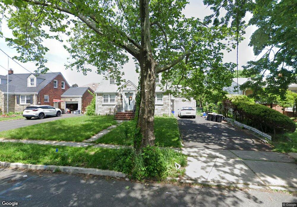
407 Robins St Roselle, NJ 07203
Estimated Value: $441,000 - $546,579
--
Bed
--
Bath
2,242
Sq Ft
$229/Sq Ft
Est. Value
About This Home
This home is located at 407 Robins St, Roselle, NJ 07203 and is currently estimated at $513,395, approximately $228 per square foot. 407 Robins St is a home located in Union County with nearby schools including Washington Elementary School, Leonard V. Moore Middle School, and Grace Wilday Junior High School.
Ownership History
Date
Name
Owned For
Owner Type
Purchase Details
Closed on
Nov 30, 2007
Sold by
Gooding Andrew K and Gooding Donna M
Bought by
Nunez Ramon and Matos Nunez Rosemarie
Current Estimated Value
Home Financials for this Owner
Home Financials are based on the most recent Mortgage that was taken out on this home.
Original Mortgage
$270,000
Outstanding Balance
$172,483
Interest Rate
6.48%
Mortgage Type
Purchase Money Mortgage
Estimated Equity
$340,912
Purchase Details
Closed on
Sep 12, 2003
Sold by
Depaola Michael
Bought by
Carnathan Donna
Create a Home Valuation Report for This Property
The Home Valuation Report is an in-depth analysis detailing your home's value as well as a comparison with similar homes in the area
Home Values in the Area
Average Home Value in this Area
Purchase History
| Date | Buyer | Sale Price | Title Company |
|---|---|---|---|
| Nunez Ramon | $270,000 | Fidelity Natl Title Ins Co | |
| Carnathan Donna | $195,000 | -- |
Source: Public Records
Mortgage History
| Date | Status | Borrower | Loan Amount |
|---|---|---|---|
| Open | Nunez Ramon | $270,000 |
Source: Public Records
Tax History Compared to Growth
Tax History
| Year | Tax Paid | Tax Assessment Tax Assessment Total Assessment is a certain percentage of the fair market value that is determined by local assessors to be the total taxable value of land and additions on the property. | Land | Improvement |
|---|---|---|---|---|
| 2025 | $12,173 | $140,000 | $63,400 | $76,600 |
| 2024 | $11,868 | $140,000 | $63,400 | $76,600 |
| 2023 | $11,868 | $140,000 | $63,400 | $76,600 |
| 2022 | $11,950 | $140,000 | $63,400 | $76,600 |
| 2021 | $11,879 | $140,000 | $63,400 | $76,600 |
| 2020 | $11,841 | $140,000 | $63,400 | $76,600 |
| 2019 | $11,690 | $140,000 | $63,400 | $76,600 |
| 2018 | $11,626 | $140,000 | $63,400 | $76,600 |
| 2017 | $11,564 | $140,000 | $63,400 | $76,600 |
| 2016 | $11,309 | $140,000 | $63,400 | $76,600 |
| 2015 | $11,308 | $140,000 | $63,400 | $76,600 |
| 2014 | $10,993 | $140,000 | $63,400 | $76,600 |
Source: Public Records
Map
Nearby Homes
- 457 W 4th Ave
- 219 Gordon St
- 624 Jackson Ave
- 323 Dermody St
- 443 Wheatsheaf Rd
- 446 W 6th Ave
- 569 Berlant Ave
- 339 W 3rd Ave
- 463 W 6th Ave
- 569 W 5th Ave
- 107 Myrtle St
- 511 Westfield Ave W
- 37 Independence Dr
- 13 Independence Dr
- 38 Independence Dr
- 211 Sterling Place
- 65 Independence Dr
- 54 Pallant Ave
- 57 Berlant Ave
- 350 Birch Dr
- 411 Robins St
- 403 Robins St
- 390 Aldene Rd
- 394 Aldene Rd
- 415 Robins St
- 398 Aldene Rd
- 406 Robins St
- 406 Robins St Unit 2
- 410 Robins St
- 414 Robins St
- 423 Robins St
- 402 Aldene Rd
- 416 Robins St
- 412 Amsterdam Ave
- 425 Robins St
- 401 Aldene Rd Unit 1
- 401 Aldene Rd
- 404 Amsterdam Ave
- 416 Amsterdam Ave
- 420 Robins St