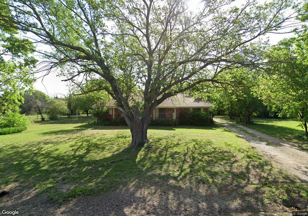
407 Simpson Dr Sherman, TX 75092
Estimated Value: $233,000 - $328,000
Studio
--
Bath
1,200
Sq Ft
$237/Sq Ft
Est. Value
About This Home
This home is located at 407 Simpson Dr, Sherman, TX 75092 and is currently estimated at $284,701, approximately $237 per square foot. 407 Simpson Dr is a home located in Grayson County with nearby schools including S&S Consolidated Elementary School, S&S Consolidated Middle School, and S. & S. Cons H.S..
Ownership History
Date
Name
Owned For
Owner Type
Purchase Details
Closed on
Oct 13, 2023
Sold by
Maestas Jim and Maestas Maria Rose
Bought by
Maestas Ryan James and Maestas Kelli Deann
Current Estimated Value
Home Financials for this Owner
Home Financials are based on the most recent Mortgage that was taken out on this home.
Original Mortgage
$160,000
Outstanding Balance
$156,889
Interest Rate
7.18%
Mortgage Type
New Conventional
Estimated Equity
$127,812
Purchase Details
Closed on
Sep 14, 2007
Sold by
Coleman Larry
Bought by
Maestas Jim and Maestas Maria Rose
Home Financials for this Owner
Home Financials are based on the most recent Mortgage that was taken out on this home.
Original Mortgage
$109,137
Interest Rate
6.7%
Mortgage Type
Purchase Money Mortgage
Create a Home Valuation Report for This Property
The Home Valuation Report is an in-depth analysis detailing your home's value as well as a comparison with similar homes in the area
Home Values in the Area
Average Home Value in this Area
Purchase History
| Date | Buyer | Sale Price | Title Company |
|---|---|---|---|
| Maestas Ryan James | -- | Grayson County Title | |
| Maestas Jim | -- | Sherman Title |
Source: Public Records
Mortgage History
| Date | Status | Borrower | Loan Amount |
|---|---|---|---|
| Open | Maestas Ryan James | $160,000 | |
| Previous Owner | Maestas Jim | $109,137 |
Source: Public Records
Tax History
| Year | Tax Paid | Tax Assessment Tax Assessment Total Assessment is a certain percentage of the fair market value that is determined by local assessors to be the total taxable value of land and additions on the property. | Land | Improvement |
|---|---|---|---|---|
| 2025 | $1,971 | $229,797 | $91,711 | $138,086 |
| 2024 | $3,359 | $160,677 | $83,832 | $76,845 |
| 2023 | $3,221 | $267,321 | $0 | $0 |
| 2022 | $5,539 | $243,019 | $0 | $0 |
| 2021 | $5,520 | $233,227 | $64,679 | $168,548 |
| 2020 | $4,155 | $210,982 | $29,820 | $181,162 |
| 2019 | $4,060 | $208,066 | $26,880 | $181,186 |
| 2018 | $3,477 | $154,196 | $25,348 | $128,848 |
| 2017 | $3,177 | $130,868 | $18,045 | $112,823 |
| 2016 | $2,889 | $125,734 | $14,463 | $111,271 |
Source: Public Records
Map
Nearby Homes
- 410 Simpson Dr
- 400 Simpson Dr
- 511 Beavers Dr
- 1301 Elliott Rd
- 151 Acres Texas 289
- 000 Hwy82/289 Texas 289
- 000 Texas 289
- 1695 Elliott Rd
- 128 Willow Ridge Cir
- 112 Pine Ridge Cir
- 1601 Heritage Creek Dr
- 10.96 Acres Wible Rd
- 595 Pleasant Home Rd
- 7431 W Washington St
- 99 Acres W Washington St
- 865 Higgins Rd
- 0000 Pleasant Home Rd
- 19783 Texas 56
- 000 Texas 56
- 1639 Logston Rd
- 408 Simpson Dr
- 310 Simpson Dr
- 309 Simpson Dr
- 308 Simpson Dr
- 507 Simpson Dr
- 504 Simpson Dr
- 310 John Fielder Dr
- 501 John Fielder Dr
- 307 Simpson Dr
- 311 John Fielder Dr
- 508 Simpson Dr
- 505 John Fielder Dr
- 304 John Fielder Dr
- 303 Simpson Dr
- 511 Simpson Dr
- 305 John Fielder Dr
- 302 John Fielder Dr
- 301 Simpson Dr
- 301 John Fielder Dr
- 403 Beavers Dr
Your Personal Tour Guide
Ask me questions while you tour the home.