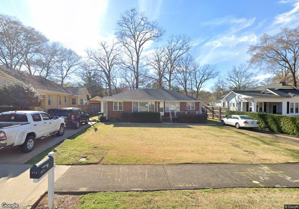
407 Springdale Dr Unit A Lagrange, GA 30240
Estimated Value: $195,000 - $257,284
2
Beds
1
Bath
850
Sq Ft
$258/Sq Ft
Est. Value
About This Home
This home is located at 407 Springdale Dr Unit A, Lagrange, GA 30240 and is currently estimated at $219,571, approximately $258 per square foot. 407 Springdale Dr Unit A is a home located in Troup County with nearby schools including Hollis Hand Elementary School, Ethel W. Kight Elementary School, and Franklin Forest Elementary School.
Ownership History
Date
Name
Owned For
Owner Type
Purchase Details
Closed on
Feb 13, 2006
Sold by
Bowen Betty B
Bought by
Whitson Sheila B and Bowen Cherrie L
Current Estimated Value
Purchase Details
Closed on
Jan 29, 2002
Sold by
Martha Lovvorn
Bought by
Betty James K and Betty Bowen
Purchase Details
Closed on
Jun 1, 2001
Bought by
Martha Lovvorn
Purchase Details
Closed on
May 1, 2001
Sold by
Martha K Murphy
Purchase Details
Closed on
Jan 1, 1973
Sold by
Thomas W Godfrey
Bought by
Martha K Murphy
Purchase Details
Closed on
Jan 1, 1950
Sold by
Carl W Edmondson
Bought by
Thomas W Godfrey
Create a Home Valuation Report for This Property
The Home Valuation Report is an in-depth analysis detailing your home's value as well as a comparison with similar homes in the area
Home Values in the Area
Average Home Value in this Area
Purchase History
| Date | Buyer | Sale Price | Title Company |
|---|---|---|---|
| Whitson Sheila B | -- | -- | |
| Betty James K | $64,500 | -- | |
| Martha Lovvorn | -- | -- | |
| -- | -- | -- | |
| Martha K Murphy | -- | -- | |
| Thomas W Godfrey | -- | -- |
Source: Public Records
Tax History Compared to Growth
Tax History
| Year | Tax Paid | Tax Assessment Tax Assessment Total Assessment is a certain percentage of the fair market value that is determined by local assessors to be the total taxable value of land and additions on the property. | Land | Improvement |
|---|---|---|---|---|
| 2024 | $1,419 | $78,920 | $18,000 | $60,920 |
| 2023 | $1,948 | $71,440 | $18,000 | $53,440 |
| 2022 | $1,795 | $64,320 | $14,000 | $50,320 |
| 2021 | $908 | $30,120 | $7,360 | $22,760 |
| 2020 | $908 | $30,120 | $7,360 | $22,760 |
| 2019 | $889 | $29,480 | $7,360 | $22,120 |
| 2018 | $857 | $28,400 | $7,360 | $21,040 |
| 2017 | $773 | $25,624 | $6,624 | $19,000 |
| 2016 | $779 | $25,845 | $6,624 | $19,221 |
| 2015 | $804 | $26,618 | $7,397 | $19,221 |
| 2014 | $793 | $26,222 | $7,397 | $18,825 |
| 2013 | -- | $29,127 | $7,397 | $21,730 |
Source: Public Records
Map
Nearby Homes
- 105 Saynor Cir
- 203 Waverly Way
- 110 Waverly Way
- 109 Waverly Way
- 408 Gordon St
- 705 Piney Woods Dr
- 609 Cherokee Rd
- 206 Broad St
- 209 Boulevard
- 208 Boulevard
- 609 Ridley Ave
- 707 Ridley Ave
- 611 Ridley Ave
- 615 Ridley Ave
- 709 Ridley Ave
- 0 Ridley Ave Unit 10550104
- 219 Banks St
- 109 Thomas St
- 748 Lakewood Dr
- 500 Boulevard
- 407 Springdale Dr
- 405 Springdale Dr
- 409 Springdale Dr
- 601 Winzor Ave
- 403 Springdale Dr
- 602 Virginia Ave
- 501 Springdale Dr
- 603 Winzor Ave
- 600 Virginia Ave
- 401 Springdale Dr
- 406 Springdale Dr
- 502 Springdale Dr
- 604 Virginia Ave
- 402 Springdale Dr
- 404 Springdale Dr
- 504 Springdale Dr
- 605 Winzor Ave
- 600 Winzor Ave
- 604 Winzor Ave
- 0 Winzor Ave Unit 8500139