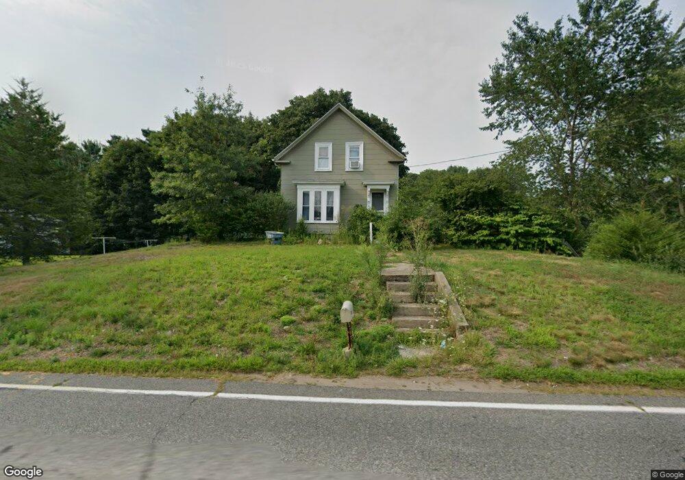
407 West St Mansfield, MA 02048
Estimated Value: $475,936 - $583,000
2
Beds
1
Bath
1,146
Sq Ft
$463/Sq Ft
Est. Value
About This Home
This home is located at 407 West St, Mansfield, MA 02048 and is currently estimated at $530,984, approximately $463 per square foot. 407 West St is a home located in Bristol County with nearby schools including Everett W. Robinson Elementary School, Jordan/Jackson Elementary School, and Harold L. Qualters Middle School.
Ownership History
Date
Name
Owned For
Owner Type
Purchase Details
Closed on
May 13, 2016
Sold by
Gordon Richard A and Gordon Carol B
Bought by
Quirk T Llc
Current Estimated Value
Purchase Details
Closed on
May 31, 1974
Bought by
Gordon Richard A and Gordon Carol
Create a Home Valuation Report for This Property
The Home Valuation Report is an in-depth analysis detailing your home's value as well as a comparison with similar homes in the area
Home Values in the Area
Average Home Value in this Area
Purchase History
| Date | Buyer | Sale Price | Title Company |
|---|---|---|---|
| Quirk T Llc | $225,000 | -- | |
| Gordon Richard A | -- | -- |
Source: Public Records
Mortgage History
| Date | Status | Borrower | Loan Amount |
|---|---|---|---|
| Previous Owner | Gordon Richard A | $70,000 | |
| Previous Owner | Gordon Richard A | $53,000 |
Source: Public Records
Tax History
| Year | Tax Paid | Tax Assessment Tax Assessment Total Assessment is a certain percentage of the fair market value that is determined by local assessors to be the total taxable value of land and additions on the property. | Land | Improvement |
|---|---|---|---|---|
| 2025 | $4,565 | $346,600 | $208,300 | $138,300 |
| 2024 | $4,618 | $342,100 | $208,300 | $133,800 |
| 2023 | $4,552 | $323,100 | $208,300 | $114,800 |
| 2022 | $4,515 | $297,600 | $192,800 | $104,800 |
| 2021 | $2,995 | $279,800 | $178,600 | $101,200 |
| 2020 | $4,090 | $266,300 | $178,600 | $87,700 |
| 2019 | $3,778 | $248,200 | $148,800 | $99,400 |
| 2018 | $4,384 | $229,600 | $134,700 | $94,900 |
| 2017 | $3,723 | $247,900 | $130,700 | $117,200 |
| 2016 | $3,631 | $235,600 | $131,000 | $104,600 |
| 2015 | $3,408 | $219,900 | $124,400 | $95,500 |
Source: Public Records
Map
Nearby Homes
Your Personal Tour Guide
Ask me questions while you tour the home.