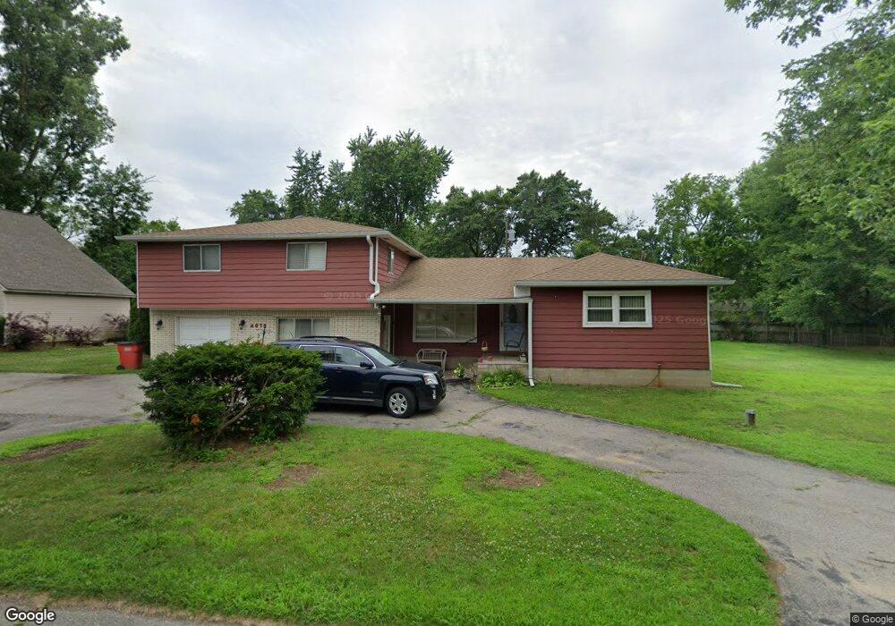
4070 Crooks St West Bloomfield, MI 48323
Estimated Value: $345,717 - $431,000
4
Beds
2
Baths
2,386
Sq Ft
$158/Sq Ft
Est. Value
About This Home
This home is located at 4070 Crooks St, West Bloomfield, MI 48323 and is currently estimated at $376,179, approximately $157 per square foot. 4070 Crooks St is a home located in Oakland County with nearby schools including Walled Lake Central High School, St. Matthew Lutheran School, and St. William School.
Ownership History
Date
Name
Owned For
Owner Type
Purchase Details
Closed on
Feb 23, 2025
Sold by
Sundria Frank W and Otto Nylene A
Bought by
Otto Nylene A and Stirzinger Tina H
Current Estimated Value
Purchase Details
Closed on
Oct 3, 2024
Sold by
Sundrla Frank W and Otto Nylene A
Bought by
Sundrla Frank W and Otto Nylene A
Purchase Details
Closed on
Nov 1, 2022
Sold by
Sundrla Frank W
Bought by
Sundrla Frank W and Otto Nylene A
Purchase Details
Closed on
May 1, 2019
Sold by
Sundrla Frank W
Bought by
Sundrla Frank W and Sundrla Norma L
Purchase Details
Closed on
Apr 15, 2019
Sold by
Sundrla Frank
Bought by
Sundrla Frank
Create a Home Valuation Report for This Property
The Home Valuation Report is an in-depth analysis detailing your home's value as well as a comparison with similar homes in the area
Home Values in the Area
Average Home Value in this Area
Purchase History
| Date | Buyer | Sale Price | Title Company |
|---|---|---|---|
| Otto Nylene A | -- | None Listed On Document | |
| Otto Nylene A | -- | None Listed On Document | |
| Sundrla Frank W | -- | None Listed On Document | |
| Sundrla Frank W | -- | -- | |
| Sundrla Frank W | -- | None Available | |
| Sundrla Frank | -- | None Available |
Source: Public Records
Tax History Compared to Growth
Tax History
| Year | Tax Paid | Tax Assessment Tax Assessment Total Assessment is a certain percentage of the fair market value that is determined by local assessors to be the total taxable value of land and additions on the property. | Land | Improvement |
|---|---|---|---|---|
| 2024 | $2,832 | $164,130 | $0 | $0 |
| 2022 | $2,823 | $147,630 | $52,030 | $95,600 |
| 2021 | $3,230 | $142,450 | $0 | $0 |
| 2020 | $1,941 | $141,180 | $57,130 | $84,050 |
| 2018 | $3,144 | $124,300 | $49,530 | $74,770 |
| 2015 | -- | $101,630 | $0 | $0 |
| 2014 | -- | $93,190 | $0 | $0 |
| 2011 | -- | $83,000 | $0 | $0 |
Source: Public Records
Map
Nearby Homes
- 7969 Richardson Rd
- 7381 Crestmore St
- 7337 Richardson Rd
- 4212 Greendale Ave
- 4245 Bunker Ave
- 7359 Woodlore Dr
- 4335 Crestdale Ave
- 7369 Sweetbriar
- 6978 Colony Dr
- 6903 Dandison Blvd
- 7146 Arrowood Dr
- 0000 Dickert St
- 7555 Windgate Cir
- 3991 Fieldview Ave
- 1047 Addison Cir
- 1778 Addison Cir
- 1777 Addison Cir
- 103 Addison Cir
- 6980 Hambro St
- 3965 Carrick Ave
- 4055 Crystal St
- 4076 Crooks St
- 4075 Crystal St
- 4041 Crystal St
- 4054 Crooks St
- 4080 Crooks St
- 4083 Crooks St
- 4095 Crooks St
- 4095 Crystal St
- 4061 Crooks St
- 4025 Crystal St
- 4090 Crooks St
- 4097 Crooks St
- 4070 Crystal St
- 4020 Crystal St
- 4040 Crystal St
- 4107 Crystal St
- 7681 Richardson Rd
- 7723 Richardson Rd
- 4080 Echo Dr