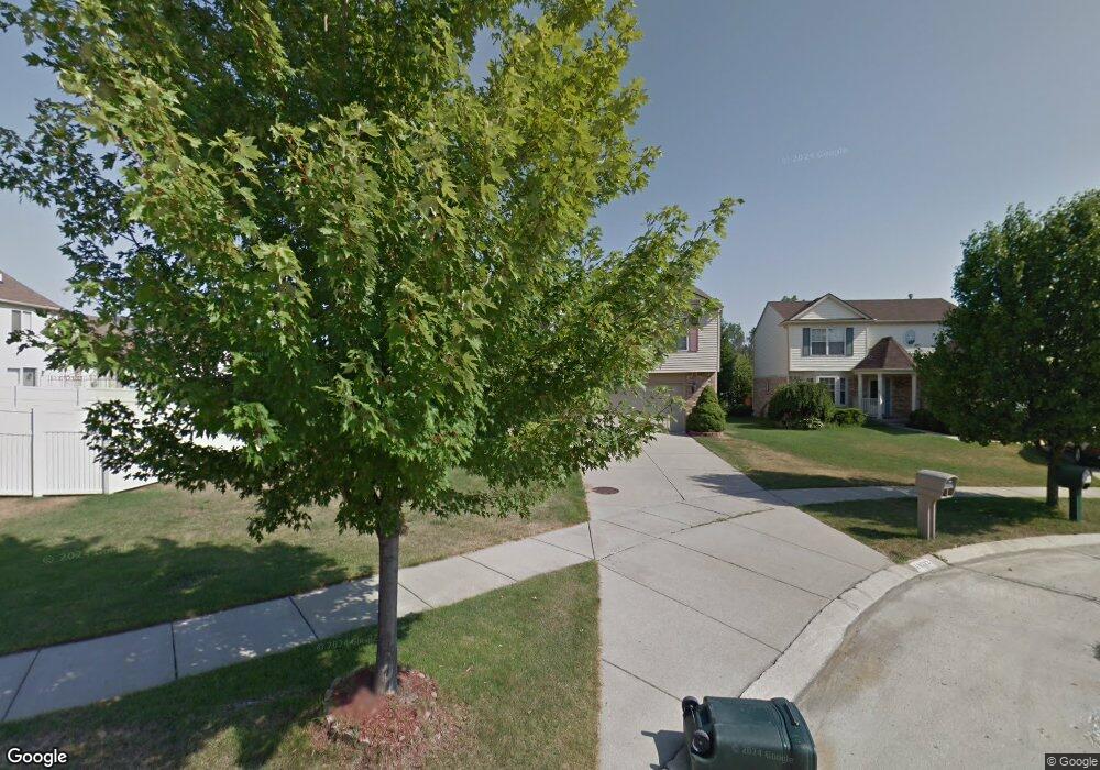
40712 Clearsprings Ct Unit 45 Canton, MI 48188
Estimated Value: $378,000 - $448,000
--
Bed
3
Baths
2,165
Sq Ft
$194/Sq Ft
Est. Value
About This Home
This home is located at 40712 Clearsprings Ct Unit 45, Canton, MI 48188 and is currently estimated at $420,554, approximately $194 per square foot. 40712 Clearsprings Ct Unit 45 is a home located in Wayne County with nearby schools including Canton High School, Salem High School, and Plymouth High School.
Ownership History
Date
Name
Owned For
Owner Type
Purchase Details
Closed on
Aug 17, 2013
Sold by
Syed Fazal U and Syed Sadia
Bought by
Syed Altaf Ahmad and Syed Nada A
Current Estimated Value
Purchase Details
Closed on
Apr 20, 2004
Sold by
Yancey Robert D and Cieslak Angela
Bought by
Syed Altaf Ahmad
Home Financials for this Owner
Home Financials are based on the most recent Mortgage that was taken out on this home.
Original Mortgage
$198,400
Interest Rate
5.63%
Mortgage Type
Purchase Money Mortgage
Create a Home Valuation Report for This Property
The Home Valuation Report is an in-depth analysis detailing your home's value as well as a comparison with similar homes in the area
Home Values in the Area
Average Home Value in this Area
Purchase History
| Date | Buyer | Sale Price | Title Company |
|---|---|---|---|
| Syed Altaf Ahmad | -- | None Available | |
| Syed Altaf Ahmad | $248,000 | First American Title | |
| Syed Altaf Ahmad | -- | Liberty Title |
Source: Public Records
Mortgage History
| Date | Status | Borrower | Loan Amount |
|---|---|---|---|
| Previous Owner | Syed Altaf Ahmad | $198,400 |
Source: Public Records
Tax History Compared to Growth
Tax History
| Year | Tax Paid | Tax Assessment Tax Assessment Total Assessment is a certain percentage of the fair market value that is determined by local assessors to be the total taxable value of land and additions on the property. | Land | Improvement |
|---|---|---|---|---|
| 2025 | $3,790 | $189,600 | $0 | $0 |
| 2024 | $3,790 | $178,700 | $0 | $0 |
| 2023 | $3,611 | $155,500 | $0 | $0 |
| 2022 | $5,692 | $137,900 | $0 | $0 |
| 2021 | $5,520 | $137,600 | $0 | $0 |
| 2020 | $5,447 | $135,000 | $0 | $0 |
| 2019 | $5,347 | $123,870 | $0 | $0 |
| 2018 | $3,108 | $122,920 | $0 | $0 |
| 2017 | $3,828 | $115,300 | $0 | $0 |
| 2016 | $4,932 | $116,200 | $0 | $0 |
| 2015 | $8,404 | $94,220 | $0 | $0 |
| 2013 | $8,141 | $84,680 | $0 | $0 |
| 2010 | -- | $93,250 | $48,282 | $44,968 |
Source: Public Records
Map
Nearby Homes
- 631 Tyler Ln
- 41109 Southwind Dr
- 41140 Northwind Dr
- 632 Georgetown St
- 170 Cherry Hill Pointe Dr
- 41567 SiMcOe Dr
- 0 Cherry Hill Unit 16924
- 39605 Dorchester Cir
- 41441 Cumberland Dr
- 41481 Cumberland Dr
- 1803 Pinecroft Dr Unit 171
- 39615 Kirkland Dr
- 40488 Glen Eagle Ln Unit 75
- 2322 Arcadia Dr Unit 254
- 2065 Pinecroft Dr Unit 201
- 39400 Cherry Hill Rd
- 2448 Arcadia Dr
- 870 N Lotz Rd
- 39214 Dillingham St
- 1913 Pebble Creek Dr
- 40674 Clearsprings Ct Unit 46
- 919 Wildwood Ln
- 941 Wildwood Ln Unit Bldg-Unit
- 941 Wildwood Ln
- 40636 Clearsprings Ct
- 815 Wildwood Ln Unit Bldg-Unit
- 815 Wildwood Ln
- 907 Wildwood Ln Unit 42
- 813 Wildwood Ln
- 40598 Clearsprings Ct Unit 48
- 821 Wildwood Ln Unit 41
- 811 Wildwood Ln
- 920 Wildwood Ln
- 956 Wildwood Ln Unit 24
- 932 Wildwood Ln
- 944 Wildwood Ln
- 908 Wildwood Ln Unit 28
- 968 Wildwood Ln Unit 23
- 884 Wildwood Ln Unit 30
- 800 Wildwood Ln