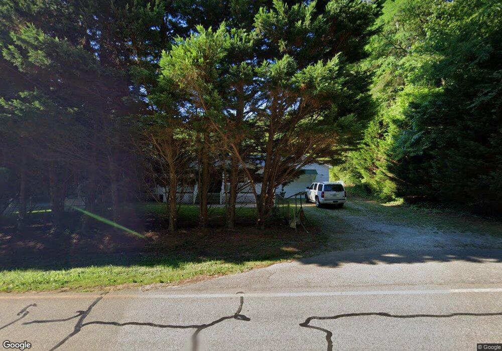
4073 Highway 52 W Dahlonega, GA 30533
Estimated Value: $268,860 - $410,000
--
Bed
2
Baths
1,792
Sq Ft
$185/Sq Ft
Est. Value
About This Home
This home is located at 4073 Highway 52 W, Dahlonega, GA 30533 and is currently estimated at $330,965, approximately $184 per square foot. 4073 Highway 52 W is a home located in Lumpkin County with nearby schools including Lumpkin County High School.
Ownership History
Date
Name
Owned For
Owner Type
Purchase Details
Closed on
Apr 21, 2025
Sold by
Rider Joann O
Bought by
Reece Carlton Corkey
Current Estimated Value
Purchase Details
Closed on
Jan 23, 1992
Sold by
Gibson Hoyt Wayne
Bought by
Rider B Richard
Purchase Details
Closed on
Jul 3, 1989
Sold by
Lumpkin County Bank
Bought by
Gibson Hoyt Wayne
Purchase Details
Closed on
Nov 1, 1988
Sold by
Roach Larry
Bought by
Lumpkin County Bank
Purchase Details
Closed on
May 1, 1985
Sold by
Jo Ann
Bought by
Roach Larry
Create a Home Valuation Report for This Property
The Home Valuation Report is an in-depth analysis detailing your home's value as well as a comparison with similar homes in the area
Home Values in the Area
Average Home Value in this Area
Purchase History
| Date | Buyer | Sale Price | Title Company |
|---|---|---|---|
| Reece Carlton Corkey | -- | -- | |
| Rider B Richard | $10,000 | -- | |
| Gibson Hoyt Wayne | $9,200 | -- | |
| Lumpkin County Bank | -- | -- | |
| Roach Larry | -- | -- |
Source: Public Records
Tax History Compared to Growth
Tax History
| Year | Tax Paid | Tax Assessment Tax Assessment Total Assessment is a certain percentage of the fair market value that is determined by local assessors to be the total taxable value of land and additions on the property. | Land | Improvement |
|---|---|---|---|---|
| 2024 | -- | $57,731 | $12,846 | $44,885 |
| 2023 | $0 | $54,075 | $12,006 | $42,069 |
| 2022 | $1,327 | $53,597 | $10,005 | $43,592 |
| 2021 | $1,329 | $46,852 | $10,005 | $36,847 |
| 2020 | $1,291 | $45,493 | $9,588 | $35,905 |
| 2019 | $1,291 | $45,493 | $9,588 | $35,905 |
| 2018 | $1,189 | $41,899 | $9,588 | $32,311 |
| 2017 | $1,198 | $43,407 | $9,588 | $33,819 |
| 2016 | $1,120 | $39,453 | $9,588 | $29,865 |
| 2015 | $1,005 | $39,452 | $9,588 | $29,865 |
| 2014 | $1,005 | $40,137 | $9,588 | $30,549 |
| 2013 | -- | $40,284 | $9,587 | $30,696 |
Source: Public Records
Map
Nearby Homes
- 0 Nimblewill Creek Rd Unit 7592435
- 0 Nimblewill Creek Rd Unit 10537541
- 0 Nimblewill Creek Rd Unit 10537492
- 0 Nimblewill Creek Rd Unit 7592523
- 3A Patriot View Dr
- 687 Nimblewill Creek Rd
- 604 Sheep Wallow Rd
- 155 Braeburn Ln
- 9 W Woods Ct
- 235 W Woods Dr
- 245 W Woods Dr
- 10 Strada Del Vino
- 0 Strada Del Vino Unit 10
- 115 W Woods Dr
- 436 Applewood Ln
- 543 Rider Mill Rd
- 78 Etowah West Dr
- 20 Angels Way
- 5.31 Tom Bell Odom Rd
- 61 Station Gap
- 4121 Highway 52 W
- 4008 Highway 52 W
- 3600 Highway 52 W
- 4008 Highway 52 W
- 71 Lawton Bluff Rd
- 4097 Georgia 52
- 4097 Highway 52 W
- 0000 Lawton Bluff Rd
- 4352 Highway 52 W
- 4329 Highway 52 W
- 140 Pine Bark Path
- 116 Twisted Pines Crossing
- 22 Twisted Pines Crossing
- 4287 Highway 52 W
- 4207 Highway 52 W
- 4267 Highway 52 W
- 3790 Highway 52 W
- 3780 Highway 52 W
- 75 Twisted Pines Crossing
- 52 West Cir Unit 8993332