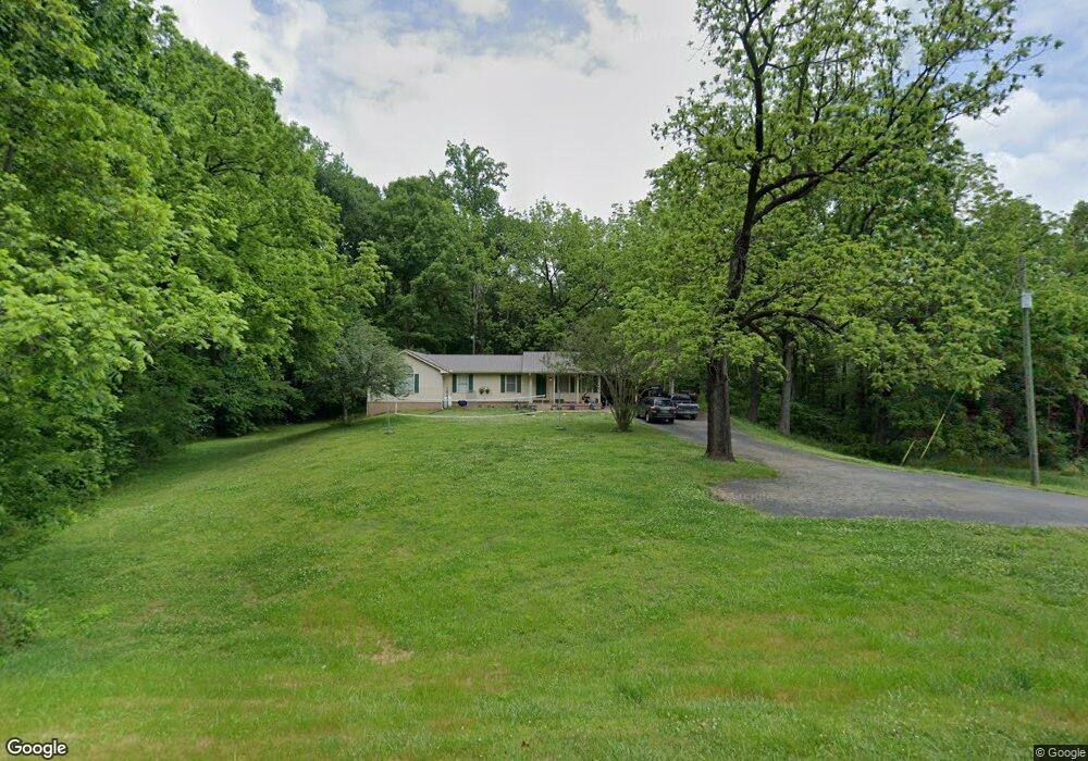
4073 Rock Creek Rd Toccoa, GA 30577
Estimated Value: $303,712 - $324,000
3
Beds
3
Baths
2,176
Sq Ft
$146/Sq Ft
Est. Value
About This Home
This home is located at 4073 Rock Creek Rd, Toccoa, GA 30577 and is currently estimated at $318,178, approximately $146 per square foot. 4073 Rock Creek Rd is a home located in Stephens County with nearby schools including Stephens County High School.
Ownership History
Date
Name
Owned For
Owner Type
Purchase Details
Closed on
Apr 7, 2009
Sold by
Hoffman Ruth E
Bought by
Hoffman Ruth E
Current Estimated Value
Purchase Details
Closed on
Apr 14, 2005
Sold by
Frederick Mary M
Bought by
Whisnant Jennifer and Whisnant Tim
Home Financials for this Owner
Home Financials are based on the most recent Mortgage that was taken out on this home.
Original Mortgage
$154,500
Interest Rate
5.88%
Mortgage Type
New Conventional
Purchase Details
Closed on
Mar 4, 2004
Bought by
<Buyer Info Not Present>
Create a Home Valuation Report for This Property
The Home Valuation Report is an in-depth analysis detailing your home's value as well as a comparison with similar homes in the area
Purchase History
| Date | Buyer | Sale Price | Title Company |
|---|---|---|---|
| Hoffman Ruth E | -- | -- | |
| Whisnant Jennifer | $154,500 | -- | |
| <Buyer Info Not Present> | -- | -- |
Source: Public Records
Mortgage History
| Date | Status | Borrower | Loan Amount |
|---|---|---|---|
| Previous Owner | Whisnant Jennifer | $154,500 |
Source: Public Records
Tax History
| Year | Tax Paid | Tax Assessment Tax Assessment Total Assessment is a certain percentage of the fair market value that is determined by local assessors to be the total taxable value of land and additions on the property. | Land | Improvement |
|---|---|---|---|---|
| 2025 | $2,080 | $91,979 | $4,845 | $87,134 |
| 2024 | $1,888 | $64,009 | $4,845 | $59,164 |
| 2023 | $1,730 | $60,115 | $4,845 | $55,270 |
| 2022 | $1,652 | $57,479 | $4,845 | $52,634 |
| 2021 | $1,621 | $53,833 | $4,845 | $48,988 |
| 2020 | $1,630 | $53,608 | $4,845 | $48,763 |
| 2019 | $1,629 | $53,377 | $4,614 | $48,763 |
| 2018 | $1,629 | $53,377 | $4,614 | $48,763 |
| 2017 | $1,649 | $53,182 | $4,614 | $48,568 |
| 2016 | $1,623 | $53,181 | $4,614 | $48,567 |
| 2015 | $1,674 | $52,414 | $4,614 | $47,800 |
| 2014 | $1,702 | $52,414 | $4,614 | $47,800 |
| 2013 | -- | $53,567 | $5,767 | $47,800 |
Source: Public Records
Map
Nearby Homes
- 3.35 ACRES Keener Rd
- 513 S Red Rock Rd
- 46 Cedar Ridge Dr
- 900 Defoor Rd
- 451 Defoor Rd
- Lot 21 Deer Chase
- 535 Deer Chase
- 5.10 ACRES Hwy 123
- 2986 Defoor Rd
- 0 Scott Rd Unit 10702484
- 545 Shady Ln
- 78 Wards Pond Way
- 68 Wards Pond Way
- 8 Fornoff Dr
- 12 Ward's Pond Way
- 109 Coneflower Ln
- 300 Rock Creek Trail
- 0 Davis Rd Unit 10694033
- 101 Cottage Ln
- 15 Cottage Ln
- 4096 Rock Creek Rd
- 4202 Rock Creek Rd
- 4201 Rock Creek Rd
- 100 McJunkin Rd
- 100 McJunkin Rd
- 415 Old Brookhaven Cir
- 49 Williams Cir
- 125 Old Brookhaven Cir
- 367 Old Brookhaven Cir
- 367 Old Brookhaven Cir
- 367 Old Brookhaven Cir
- 31 Mitchell Rd
- 391 Old Brookhaven Cir
- 223 Mitchell Rd
- 101 Williams Cir
- 48 Williams Cir
- 416 Old Brookhaven Cir
- 382 Old Brookhaven Cir
- 217 McJunkin Rd
- 78 Old Brookhaven Cir
Your Personal Tour Guide
Ask me questions while you tour the home.