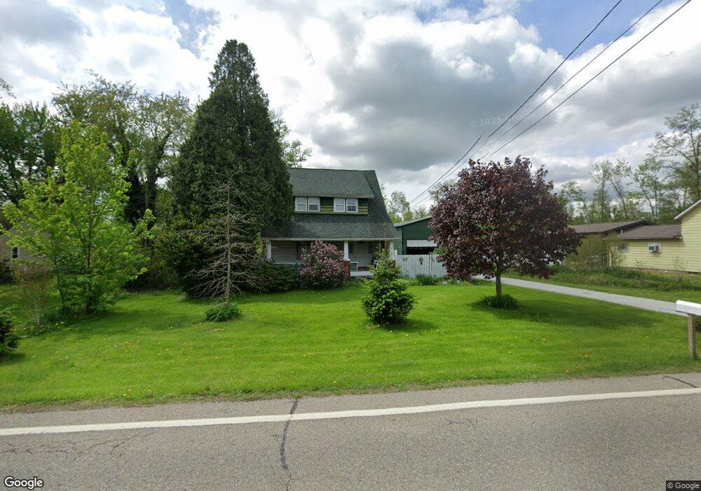
4075 State Route 82 Newton Falls, OH 44444
Estimated Value: $124,000 - $149,000
3
Beds
1
Bath
1,272
Sq Ft
$106/Sq Ft
Est. Value
About This Home
This home is located at 4075 State Route 82, Newton Falls, OH 44444 and is currently estimated at $134,505, approximately $105 per square foot. 4075 State Route 82 is a home located in Trumbull County with nearby schools including LaBrae Intermediate School, Bascom Elementary School, and LaBrae High School.
Ownership History
Date
Name
Owned For
Owner Type
Purchase Details
Closed on
May 1, 2024
Sold by
Mcwilliams Stephen S and Mcwilliams Kimberly
Bought by
Mcwilliams Family Trust and Mcwilliams
Current Estimated Value
Purchase Details
Closed on
Aug 1, 2011
Sold by
Secretary Of Housing & Urban Development
Bought by
Mcwiliams Stephen S and Mcwilliams Kimberly
Purchase Details
Closed on
Oct 26, 2010
Sold by
Howard Patricia L
Bought by
Wells Fargo Bank N A
Purchase Details
Closed on
Oct 7, 2010
Sold by
Wells Fargo Bank Na
Bought by
Secretary Of Housing & Urban Development
Purchase Details
Closed on
Dec 1, 2000
Sold by
Menz Marie M
Bought by
Howard Patricia L
Home Financials for this Owner
Home Financials are based on the most recent Mortgage that was taken out on this home.
Original Mortgage
$52,070
Interest Rate
7.86%
Mortgage Type
FHA
Purchase Details
Closed on
Jan 1, 1990
Bought by
Marie M Menz
Create a Home Valuation Report for This Property
The Home Valuation Report is an in-depth analysis detailing your home's value as well as a comparison with similar homes in the area
Home Values in the Area
Average Home Value in this Area
Purchase History
| Date | Buyer | Sale Price | Title Company |
|---|---|---|---|
| Mcwilliams Family Trust | $69,500 | None Listed On Document | |
| Mcwiliams Stephen S | $15,000 | Attorney | |
| Wells Fargo Bank N A | $26,000 | None Available | |
| Secretary Of Housing & Urban Development | -- | None Available | |
| Howard Patricia L | $52,500 | -- | |
| Marie M Menz | -- | -- |
Source: Public Records
Mortgage History
| Date | Status | Borrower | Loan Amount |
|---|---|---|---|
| Previous Owner | Howard Patricia L | $52,070 |
Source: Public Records
Tax History Compared to Growth
Tax History
| Year | Tax Paid | Tax Assessment Tax Assessment Total Assessment is a certain percentage of the fair market value that is determined by local assessors to be the total taxable value of land and additions on the property. | Land | Improvement |
|---|---|---|---|---|
| 2024 | $931 | $24,330 | $5,040 | $19,290 |
| 2023 | $887 | $24,330 | $5,040 | $19,290 |
| 2022 | $777 | $18,350 | $4,660 | $13,690 |
| 2021 | $752 | $18,350 | $4,660 | $13,690 |
| 2020 | $762 | $18,350 | $4,660 | $13,690 |
| 2019 | $737 | $16,530 | $4,310 | $12,220 |
| 2018 | $737 | $16,530 | $4,310 | $12,220 |
| 2017 | $735 | $16,530 | $4,310 | $12,220 |
| 2016 | $755 | $17,160 | $4,310 | $12,850 |
| 2015 | $765 | $17,160 | $4,310 | $12,850 |
| 2014 | $764 | $17,160 | $4,310 | $12,850 |
| 2013 | $758 | $17,160 | $4,310 | $12,850 |
Source: Public Records
Map
Nearby Homes
- 600 Braceville Robinson Rd NW
- 3994 Warren Ravenna Rd
- 1164 Kale Adams Rd
- 245 Diehl Rd S
- 1515 Braceville Robinson Rd
- 4454 Warren Ravenna Rd
- V/L McConnell East Rd
- 3366 Eagle Creek Rd
- 4448 McConnell East Rd
- 0 Kale Adams Rd SW
- 4374 Richmond Ave
- 1 Olive St
- 0 2nd St
- 0 Layer Rd
- 4409 Ophelia St
- 5177 Nelson Mosier Rd
- 4250 Herr Fieldhouse Rd
- 535 Park Ave
- 3690 Anderson Anthony Rd
- 590 Ruth Ave
- 4085 State Route 82
- 4065 State Route 82
- 4019 State Route 82
- 3933 State Route 82
- 3983 State Route 82
- 3973 State Route 82
- 576 Bailey Anderson Rd
- 4150 State Route 82
- 4076 State Route 82
- 4116 State Route 82
- 4158 State Route 82
- 4093 State Route 82
- 4246 State Route 82
- 3963 State Route 82
- 3918 State Route 82
- 3948 State Route 82
- 3953 State Route 82
- 4182 State Route 82
- 3943 State Route 82
- 3933 State Route 82