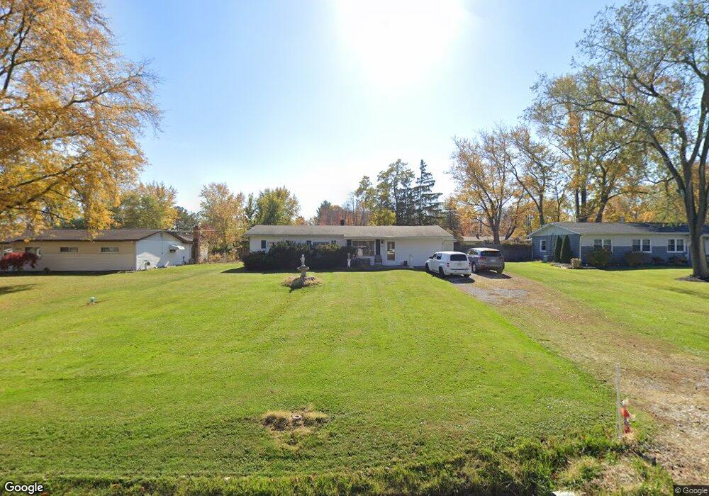
4076 Mapes Dr Brunswick, OH 44212
Estimated Value: $207,473 - $250,000
3
Beds
1
Bath
1,248
Sq Ft
$184/Sq Ft
Est. Value
About This Home
This home is located at 4076 Mapes Dr, Brunswick, OH 44212 and is currently estimated at $229,618, approximately $183 per square foot. 4076 Mapes Dr is a home located in Medina County with nearby schools including Applewood Elementary School, Willets Middle School, and Brunswick High School.
Ownership History
Date
Name
Owned For
Owner Type
Purchase Details
Closed on
Feb 25, 2004
Sold by
Richards Jeffrey M and Richards Kirschnick Katherine
Bought by
Richards William
Current Estimated Value
Purchase Details
Closed on
Jul 28, 1999
Sold by
Richards William T
Bought by
Richards Jeffrey M and Richards Katherine S
Purchase Details
Closed on
Jan 8, 1999
Sold by
Richards William T
Bought by
Richards William T and Richards Jeffrey M
Create a Home Valuation Report for This Property
The Home Valuation Report is an in-depth analysis detailing your home's value as well as a comparison with similar homes in the area
Home Values in the Area
Average Home Value in this Area
Purchase History
| Date | Buyer | Sale Price | Title Company |
|---|---|---|---|
| Richards William | -- | Cardinal Title Co Ohio Inc | |
| Richards Jeffrey M | -- | -- | |
| Richards William T | -- | Guardian Title |
Source: Public Records
Tax History
| Year | Tax Paid | Tax Assessment Tax Assessment Total Assessment is a certain percentage of the fair market value that is determined by local assessors to be the total taxable value of land and additions on the property. | Land | Improvement |
|---|---|---|---|---|
| 2024 | $2,935 | $52,880 | $23,810 | $29,070 |
| 2023 | $2,130 | $52,880 | $23,810 | $29,070 |
| 2022 | $2,064 | $52,880 | $23,810 | $29,070 |
| 2021 | $1,733 | $41,970 | $18,900 | $23,070 |
| 2020 | $1,559 | $41,970 | $18,900 | $23,070 |
| 2019 | $1,560 | $41,970 | $18,900 | $23,070 |
| 2018 | $1,283 | $34,670 | $16,400 | $18,270 |
| 2017 | $1,285 | $34,670 | $16,400 | $18,270 |
| 2016 | $1,284 | $34,670 | $16,400 | $18,270 |
| 2015 | $1,195 | $32,100 | $15,180 | $16,920 |
| 2014 | $1,191 | $32,100 | $15,180 | $16,920 |
| 2013 | $1,165 | $32,100 | $15,180 | $16,920 |
Source: Public Records
Map
Nearby Homes
- 1916 Hathaway Dr
- 1533 Diana Dr
- 1591 Pearl Rd
- 3805 Laurel Rd
- 3812 Laurel Rd
- 1441 Stanford Dr
- 1445 Andrea Dr
- 2105 Glenmont
- 2090 Glenmont
- 2088 Glenmont
- 2075 Glenmont
- 0 Center Rd Unit 4467135
- 4464 Newcastle Cove
- 4467 Newcastle Cove
- 1661 Devonshire Dr
- 1623 Devonshire Dr
- 4521 Newkirk Dr
- 1632 Scarborough Dr
- 3827 Sleepy Hollow Rd
- 3852 Sleepy Hollow Rd
- 4068 Mapes Dr
- 4086 Mapes Dr
- 4077 Laurel Rd
- 1732 Britnall Dr
- 4096 Mapes Dr
- 4067 Laurel Rd
- 4085 Laurel Rd
- 1732 Brintnall Dr
- 1733 Dannley Dr
- 4095 Laurel Rd
- 4104 Mapes Dr
- 1724 Brintnall Dr
- 1755 Brintnall Dr
- 1747 Brintnall Dr
- 4053 Laurel Rd
- 1725 Dannley Dr
- 4105 Laurel Rd
- 1737 Brintnall Dr
- 4114 Mapes Dr
- 4045 Laurel Rd
Your Personal Tour Guide
Ask me questions while you tour the home.