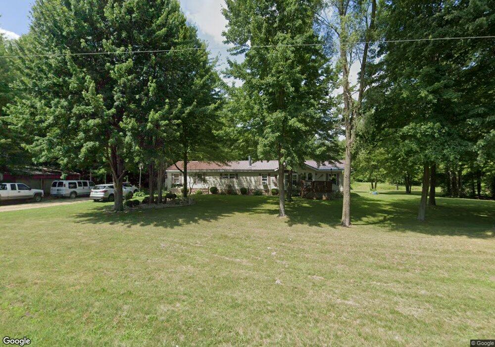
4076 W Muskrat Rd Sheridan, MI 48884
Estimated Value: $214,297 - $229,000
--
Bed
--
Bath
--
Sq Ft
20.01
Acres
About This Home
This home is located at 4076 W Muskrat Rd, Sheridan, MI 48884 and is currently estimated at $220,099. 4076 W Muskrat Rd is a home located in Montcalm County with nearby schools including Central Montcalm Elementary School, Central Montcalm Upper Elementary School, and Central Montcalm Middle School.
Ownership History
Date
Name
Owned For
Owner Type
Purchase Details
Closed on
Jun 29, 2018
Sold by
Sidney State Bank
Bought by
Hayslip Franklin J
Current Estimated Value
Purchase Details
Closed on
Jun 4, 2009
Sold by
Hayslip Franklin J and Hayslip Jeanette E
Bought by
Sidney State Bank
Purchase Details
Closed on
Mar 1, 2009
Sold by
Hayslip Franklin
Bought by
Montcalm County Treasurer
Purchase Details
Closed on
May 3, 2007
Sold by
Hayslip Jeanette E
Bought by
Hayslip Franklin J
Purchase Details
Closed on
Mar 1, 2005
Sold by
Robinson Lloyd
Bought by
Hayslip Franklin J and Hayslip Jeanette E
Home Financials for this Owner
Home Financials are based on the most recent Mortgage that was taken out on this home.
Original Mortgage
$108,000
Interest Rate
7.15%
Mortgage Type
Purchase Money Mortgage
Purchase Details
Closed on
Jun 1, 1995
Create a Home Valuation Report for This Property
The Home Valuation Report is an in-depth analysis detailing your home's value as well as a comparison with similar homes in the area
Home Values in the Area
Average Home Value in this Area
Purchase History
| Date | Buyer | Sale Price | Title Company |
|---|---|---|---|
| Hayslip Franklin J | $115,200 | -- | |
| Sidney State Bank | $121,653 | None Available | |
| Sidney State Bank | $121,700 | -- | |
| Montcalm County Treasurer | -- | -- | |
| Hayslip Franklin J | -- | -- | |
| Hayslip Franklin J | $47,000 | The Montcalm Title Company | |
| Hayslip Franklin J | $47,000 | -- | |
| -- | $10,500 | -- |
Source: Public Records
Mortgage History
| Date | Status | Borrower | Loan Amount |
|---|---|---|---|
| Previous Owner | Hayslip Franklin J | $108,000 |
Source: Public Records
Tax History Compared to Growth
Tax History
| Year | Tax Paid | Tax Assessment Tax Assessment Total Assessment is a certain percentage of the fair market value that is determined by local assessors to be the total taxable value of land and additions on the property. | Land | Improvement |
|---|---|---|---|---|
| 2025 | $1,494 | $95,300 | $0 | $0 |
| 2024 | $1,452 | $80,400 | $0 | $0 |
| 2023 | -- | $63,000 | $0 | $0 |
| 2022 | -- | $57,900 | $0 | $0 |
| 2021 | -- | $58,300 | $0 | $0 |
| 2020 | -- | -- | $0 | $0 |
| 2019 | -- | -- | $0 | $0 |
| 2018 | -- | -- | $0 | $0 |
| 2017 | -- | -- | $0 | $0 |
| 2016 | -- | -- | $0 | $0 |
| 2015 | -- | -- | $0 | $0 |
| 2014 | -- | -- | $0 | $0 |
Source: Public Records
Map
Nearby Homes
- 4829 S Derby Rd
- 4500 W Wise Rd
- 4863 W Wise Rd
- 4366 W Woods Rd
- 4691 County Farm Rd
- 3138 S Miller Rd
- VL S Grow Rd
- 5265 Huck Dr
- 4872 W Carson City Rd
- 5579 W Duckland Rd
- 1361 S Derby Rd
- 104 Bliss Ct
- 4263 S Sheridan Rd
- 601 S Main St
- 3035 Fitzner Rd
- 229 S Sherman St
- 7961 W Sidney Rd
- 9363 S Grow Rd
- 206 S Pearl St
- 1034 Thompson St SW
- 4200 W Muskrat Rd
- 3990 W Muskrat Rd
- 0 Miles Rd Unit 59022041046
- 0 Miles Rd Unit 22041046
- 4230 W Muskrat Rd
- 4318 W Muskrat Rd
- 5160 S Grow Rd
- 4300 W Muskrat Rd
- 3877 W Muskrat Rd
- 3877 W Muskrat Rd
- 0 W Muskrat Rd
- 5 W Muskrat Rd
- 4362 W Muskrat Rd
- 4686 S Grow Rd
- 4380 W Muskrat Rd
- 4895 S Miles Rd
- 4895 S Miles Rd
- 4667 S Miles Rd
- 4811 S Miles Rd
- 4425 Meadow Ln