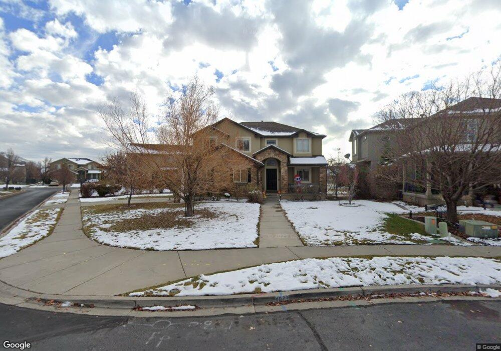
4077 Hayes Cir Pleasant Grove, UT 84062
Estimated Value: $632,452 - $664,000
4
Beds
3
Baths
2,043
Sq Ft
$318/Sq Ft
Est. Value
About This Home
This home is located at 4077 Hayes Cir, Pleasant Grove, UT 84062 and is currently estimated at $649,863, approximately $318 per square foot. 4077 Hayes Cir is a home located in Utah County with nearby schools including Cedar Ridge Elementary School, Mountain Ridge Junior High School, and Lone Peak High School.
Ownership History
Date
Name
Owned For
Owner Type
Purchase Details
Closed on
Nov 20, 2020
Sold by
Pinkston Christopher C and Pinkston Amanda
Bought by
Hernandez Lily Anne and King Logan
Current Estimated Value
Home Financials for this Owner
Home Financials are based on the most recent Mortgage that was taken out on this home.
Original Mortgage
$437,000
Outstanding Balance
$388,868
Interest Rate
2.8%
Mortgage Type
New Conventional
Estimated Equity
$260,995
Purchase Details
Closed on
Apr 30, 2019
Sold by
Pinkston Christopher C
Bought by
Pinkston Christopher C and Pinkston Amanda
Home Financials for this Owner
Home Financials are based on the most recent Mortgage that was taken out on this home.
Original Mortgage
$369,000
Interest Rate
4.2%
Mortgage Type
New Conventional
Purchase Details
Closed on
Jun 9, 2014
Sold by
Mullane Wendy S
Bought by
Pinkston Christopher C and Pinkston Amanda
Home Financials for this Owner
Home Financials are based on the most recent Mortgage that was taken out on this home.
Original Mortgage
$275,742
Interest Rate
4.4%
Mortgage Type
FHA
Purchase Details
Closed on
Jul 15, 2011
Sold by
Fannie Mae
Bought by
Mullane Wendy S
Home Financials for this Owner
Home Financials are based on the most recent Mortgage that was taken out on this home.
Original Mortgage
$257,854
Interest Rate
4.75%
Mortgage Type
FHA
Purchase Details
Closed on
Mar 3, 2011
Sold by
Densley Matthew and Densley Rebecca
Bought by
Federal National Mortgage Association
Purchase Details
Closed on
May 21, 2004
Sold by
Sundance Homes Llc
Bought by
Densley Matthew and Densley Rebecca
Home Financials for this Owner
Home Financials are based on the most recent Mortgage that was taken out on this home.
Original Mortgage
$205,637
Interest Rate
5.77%
Mortgage Type
Seller Take Back
Create a Home Valuation Report for This Property
The Home Valuation Report is an in-depth analysis detailing your home's value as well as a comparison with similar homes in the area
Home Values in the Area
Average Home Value in this Area
Purchase History
| Date | Buyer | Sale Price | Title Company |
|---|---|---|---|
| Hernandez Lily Anne | -- | Eagle Gate Title Ins Agency | |
| Pinkston Christopher C | -- | Meridian Title Company | |
| Pinkston Christopher C | -- | Meridian Title Company | |
| Pinkston Christopher C | -- | North American Title | |
| Mullane Wendy S | -- | Empire Land Title Inc | |
| Federal National Mortgage Association | $303,309 | Accommodation | |
| Densley Matthew | -- | Signature Title Insurance A |
Source: Public Records
Mortgage History
| Date | Status | Borrower | Loan Amount |
|---|---|---|---|
| Open | Hernandez Lily Anne | $437,000 | |
| Previous Owner | Pinkston Christopher C | $369,000 | |
| Previous Owner | Pinkston Christopher C | $275,742 | |
| Previous Owner | Mullane Wendy S | $257,854 | |
| Previous Owner | Densley Matthew | $205,637 |
Source: Public Records
Tax History Compared to Growth
Tax History
| Year | Tax Paid | Tax Assessment Tax Assessment Total Assessment is a certain percentage of the fair market value that is determined by local assessors to be the total taxable value of land and additions on the property. | Land | Improvement |
|---|---|---|---|---|
| 2025 | $2,526 | $314,050 | $210,800 | $360,200 |
| 2024 | $2,526 | $299,090 | $0 | $0 |
| 2023 | $2,434 | $309,760 | $0 | $0 |
| 2022 | $2,452 | $304,700 | $0 | $0 |
| 2021 | $2,207 | $408,600 | $127,900 | $280,700 |
| 2020 | $2,055 | $371,300 | $118,400 | $252,900 |
| 2019 | $1,947 | $365,300 | $118,400 | $246,900 |
| 2018 | $1,845 | $326,100 | $111,400 | $214,700 |
| 2017 | $1,801 | $170,170 | $0 | $0 |
| 2016 | $1,718 | $151,030 | $0 | $0 |
| 2015 | $1,666 | $138,600 | $0 | $0 |
| 2014 | $1,499 | $123,860 | $0 | $0 |
Source: Public Records
Map
Nearby Homes
- 10587 N Avalon St
- 4084 W Shinnecock
- 10795 N La Costa
- 10514 N Doral Dr
- 10412 N Bayhill Dr
- 4292 W Joshua Ln
- 10456 N Morgan Blvd
- 10468 N Sage Vista Ln
- 10448 Sage Vista Ln
- 10207 N Cottonwood Dr
- 11197 N Park Dr
- 4198 W Sage Rd N
- 10535 Janie Ln
- 3870 Mountaintop Cir
- 3851 W Mountaintop Cir Unit 5
- 9900 N Meadow Dr
- 10052 N Marigold Ln
- 4533 W Spring Cir
- 1263 E Chapman Ct
- 4696 W Camellia Ln
- 4077 W Hayes Cir
- 4083 Hayes Cir
- 4068 W Cimarron
- 4082 W Cimarron
- 4082 Cimarron
- 4068 Cimarron
- 4091 Hayes Cir
- 10672 N Hayes Cir
- 10656 N Nielsen Blvd
- 10672 N Hayes Cir
- 10656 Nielsen
- 10656 N Avalon St
- 4046 W Cimarron
- 4046 W Cimarron Unit 88
- 4046 Cimarron
- 10639 Avalon
- 10678 Hayes Cir
- 10678 N Hayes Cir Unit 93
- 10678 N Hayes Cir
- 4037 Cimarron