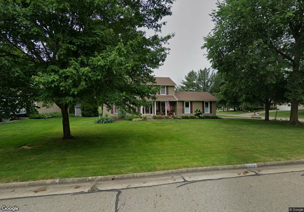
4078 Spring Meadow Cir Uniontown, OH 44685
Estimated Value: $331,328 - $358,000
4
Beds
3
Baths
1,760
Sq Ft
$198/Sq Ft
Est. Value
About This Home
This home is located at 4078 Spring Meadow Cir, Uniontown, OH 44685 and is currently estimated at $348,082, approximately $197 per square foot. 4078 Spring Meadow Cir is a home located in Summit County with nearby schools including Greenwood Elementary School, Green Intermediate Elementary School, and Green Primary School.
Ownership History
Date
Name
Owned For
Owner Type
Purchase Details
Closed on
Jun 20, 2002
Sold by
Mcneil Ronald V
Bought by
Pudoka Dean D and Pudoka Lori M
Current Estimated Value
Home Financials for this Owner
Home Financials are based on the most recent Mortgage that was taken out on this home.
Original Mortgage
$130,000
Outstanding Balance
$55,433
Interest Rate
6.93%
Estimated Equity
$292,649
Purchase Details
Closed on
Mar 30, 2001
Sold by
Mcneil Katharine M
Bought by
Mcneil Ronald
Purchase Details
Closed on
Apr 6, 1999
Sold by
Rogers Daniel A and Rogers Diane S
Bought by
Mcneil Ronald and Mcneil Katharine M
Home Financials for this Owner
Home Financials are based on the most recent Mortgage that was taken out on this home.
Original Mortgage
$148,000
Interest Rate
6.94%
Mortgage Type
Balloon
Create a Home Valuation Report for This Property
The Home Valuation Report is an in-depth analysis detailing your home's value as well as a comparison with similar homes in the area
Home Values in the Area
Average Home Value in this Area
Purchase History
| Date | Buyer | Sale Price | Title Company |
|---|---|---|---|
| Pudoka Dean D | $187,000 | -- | |
| Mcneil Ronald | -- | -- | |
| Mcneil Ronald | $168,000 | Resource Title Agency Inc |
Source: Public Records
Mortgage History
| Date | Status | Borrower | Loan Amount |
|---|---|---|---|
| Open | Pudoka Dean D | $130,000 | |
| Previous Owner | Mcneil Ronald | $148,000 |
Source: Public Records
Tax History Compared to Growth
Tax History
| Year | Tax Paid | Tax Assessment Tax Assessment Total Assessment is a certain percentage of the fair market value that is determined by local assessors to be the total taxable value of land and additions on the property. | Land | Improvement |
|---|---|---|---|---|
| 2025 | $4,525 | $95,152 | $19,877 | $75,275 |
| 2024 | $4,525 | $95,152 | $19,877 | $75,275 |
| 2023 | $4,525 | $95,152 | $19,877 | $75,275 |
| 2022 | $3,723 | $70,105 | $14,616 | $55,489 |
| 2021 | $3,493 | $70,105 | $14,616 | $55,489 |
| 2020 | $3,427 | $70,110 | $14,620 | $55,490 |
| 2019 | $3,372 | $64,640 | $14,620 | $50,020 |
| 2018 | $3,446 | $64,640 | $14,620 | $50,020 |
| 2017 | $3,161 | $64,640 | $14,620 | $50,020 |
| 2016 | $3,146 | $55,560 | $14,620 | $40,940 |
| 2015 | $3,161 | $55,560 | $14,620 | $40,940 |
| 2014 | $3,141 | $55,560 | $14,620 | $40,940 |
| 2013 | $3,151 | $55,390 | $14,620 | $40,770 |
Source: Public Records
Map
Nearby Homes
- 1501 Spring Wood Ln
- 4237 Springdale Rd
- 4350 Sunnyview Dr
- Mystique Plan at Brier Creek
- Countryview Plan at Brier Creek
- Prosperity Plan at Brier Creek
- 3943 Crest View Dr
- 3982 Crest View Dr
- 3831 Golden Wood Way
- 3930 Crest View Dr
- 4440 Shriver Rd
- Westchester Plan at Jacobs Ridge - Estates
- Newberry Plan at Jacobs Ridge - Crossings
- Mercer Plan at Jacobs Ridge - Crossings
- Amberwood Plan at Jacobs Ridge - Estates
- Ascend Plan at Jacobs Ridge - Crossings
- Boardwalk Plan at Jacobs Ridge - Crossings
- Hilltop Plan at Jacobs Ridge - Estates
- Continental Plan at Jacobs Ridge - Crossings
- Woodside Plan at Jacobs Ridge - Estates
- 4102 Spring Meadow Cir
- 4085 Meadow Wood Ln
- 4097 Meadow Wood Ln
- 4057 Spring Meadow Cir
- 4083 Spring Meadow Cir
- 4049 Spring Meadow Cir
- 4095 Spring Meadow Cir
- 4112 Spring Meadow Cir
- 4105 Meadow Wood Ln
- 4039 Spring Meadow Cir
- 4065 Spring Meadow Cir
- 4107 Spring Meadow Cir
- 4073 Spring Meadow Cir
- 4113 Meadow Wood Ln
- 4115 Spring Meadow Cir
- 4088 Meadow Wood Ln
- 4076 Meadow Wood Ln
- 4126 Spring Meadow Cir
- 4066 Meadow Wood Ln
- 1536 Spring Wood Ln