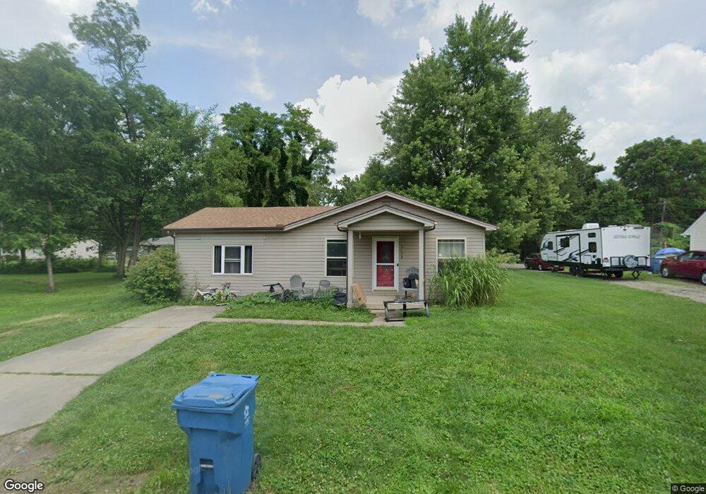
4079 Navajo Ave Dayton, OH 45424
Estimated Value: $121,000 - $196,000
3
Beds
1
Bath
1,320
Sq Ft
$111/Sq Ft
Est. Value
About This Home
This home is located at 4079 Navajo Ave, Dayton, OH 45424 and is currently estimated at $146,023, approximately $110 per square foot. 4079 Navajo Ave is a home located in Montgomery County with nearby schools including Wayne High School.
Ownership History
Date
Name
Owned For
Owner Type
Purchase Details
Closed on
Jan 27, 2020
Sold by
Meiniuger Stephen L and Estate Of Jeanna S Reedy
Bought by
Martin Christina M
Current Estimated Value
Home Financials for this Owner
Home Financials are based on the most recent Mortgage that was taken out on this home.
Original Mortgage
$56,163
Outstanding Balance
$49,728
Interest Rate
3.6%
Mortgage Type
New Conventional
Estimated Equity
$96,295
Purchase Details
Closed on
Nov 29, 2000
Sold by
Denlinger Noel Q
Bought by
Reedy Jeanna S
Home Financials for this Owner
Home Financials are based on the most recent Mortgage that was taken out on this home.
Original Mortgage
$73,415
Interest Rate
7.8%
Mortgage Type
FHA
Purchase Details
Closed on
Jun 16, 1995
Sold by
Whitley James and Whitley Ethel
Bought by
Denlinger Noel Q
Create a Home Valuation Report for This Property
The Home Valuation Report is an in-depth analysis detailing your home's value as well as a comparison with similar homes in the area
Home Values in the Area
Average Home Value in this Area
Purchase History
| Date | Buyer | Sale Price | Title Company |
|---|---|---|---|
| Martin Christina M | $57,900 | Singlesource Property Sln | |
| Reedy Jeanna S | $73,500 | -- | |
| Denlinger Noel Q | -- | -- |
Source: Public Records
Mortgage History
| Date | Status | Borrower | Loan Amount |
|---|---|---|---|
| Open | Martin Christina M | $56,163 | |
| Previous Owner | Reedy Jeanna S | $73,415 |
Source: Public Records
Tax History Compared to Growth
Tax History
| Year | Tax Paid | Tax Assessment Tax Assessment Total Assessment is a certain percentage of the fair market value that is determined by local assessors to be the total taxable value of land and additions on the property. | Land | Improvement |
|---|---|---|---|---|
| 2024 | $1,101 | $17,900 | $2,880 | $15,020 |
| 2023 | $1,101 | $17,900 | $2,880 | $15,020 |
| 2022 | $1,354 | $17,900 | $2,880 | $15,020 |
| 2021 | $1,497 | $17,900 | $2,880 | $15,020 |
| 2020 | $1,590 | $17,900 | $2,880 | $15,020 |
| 2019 | $2,009 | $23,300 | $2,600 | $20,700 |
| 2018 | $1,914 | $23,300 | $2,600 | $20,700 |
| 2017 | $1,902 | $23,300 | $2,600 | $20,700 |
| 2016 | $1,967 | $23,580 | $2,880 | $20,700 |
| 2015 | $1,922 | $23,580 | $2,880 | $20,700 |
| 2014 | $1,922 | $23,580 | $2,880 | $20,700 |
| 2012 | -- | $27,550 | $3,860 | $23,690 |
Source: Public Records
Map
Nearby Homes
- 6494 Shore Dr
- 6512 Shore Dr
- Milford Plan at Canal Heights
- Cortland Plan at Canal Heights
- Chatham Plan at Canal Heights
- Fairfax Plan at Canal Heights
- Johnstown Plan at Canal Heights
- Newcastle Plan at Canal Heights
- Holcombe Plan at Canal Heights
- Bellamy Plan at Canal Heights
- 2251 Kiel St
- 4572 Keeneland Ct
- 679 Deerhurst Dr
- 827 Foxfire Trail
- 715 Deerhurst Dr
- 710 Deerhurst Dr
- Fairfax Plan at Foxfire - Maple Street Collection
- Yosemite Plan at Foxfire - Maple Street Collection
- Cumberland Plan at Foxfire - Maple Street Collection
- Jensen Plan at Foxfire - Maple Street Collection
- 4087 Navajo Ave
- 4086 Navajo Ave
- 4077 Cheyenne Ave
- 4095 Navajo Ave
- 4069 Cheyenne Ave
- 4076 Navajo Ave
- 0 Apache St Unit 468762
- 0 Apache St Unit 468758
- 0 Apache St Unit 468755
- 0 Apache St Unit 468745
- 0 Apache St Unit 485831
- 0 Apache St Unit 485832
- 0 Apache St Unit 485829
- 0 Apache St Unit 485830
- 0 Apache St Unit 1023295
- 0 Apache St Unit 880097
- 0 Apache St Unit 505340
- 4063 Cheyenne Ave
- 6326 Apache St
- 4084 Mohegan Ave