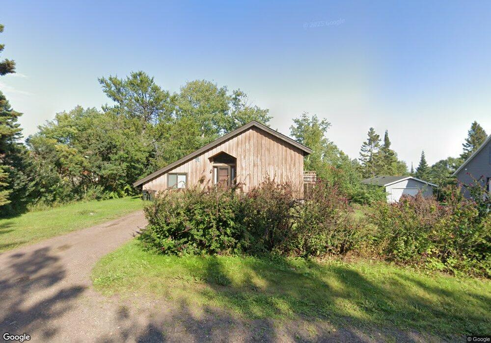
408 1st Ave E Grand Marais, MN 55604
Estimated Value: $355,000 - $473,000
2
Beds
2
Baths
1,035
Sq Ft
$377/Sq Ft
Est. Value
About This Home
This home is located at 408 1st Ave E, Grand Marais, MN 55604 and is currently estimated at $390,295, approximately $377 per square foot. 408 1st Ave E is a home with nearby schools including Sawtooth Mountain Elementary School, Cook County Middle School, and Cook County Senior High School.
Ownership History
Date
Name
Owned For
Owner Type
Purchase Details
Closed on
Nov 17, 2016
Sold by
Paine Donna Donna
Bought by
Smith Lacey
Current Estimated Value
Home Financials for this Owner
Home Financials are based on the most recent Mortgage that was taken out on this home.
Original Mortgage
$150,000
Outstanding Balance
$120,424
Interest Rate
3.42%
Estimated Equity
$269,871
Create a Home Valuation Report for This Property
The Home Valuation Report is an in-depth analysis detailing your home's value as well as a comparison with similar homes in the area
Purchase History
| Date | Buyer | Sale Price | Title Company |
|---|---|---|---|
| Smith Lacey | $160,000 | -- |
Source: Public Records
Mortgage History
| Date | Status | Borrower | Loan Amount |
|---|---|---|---|
| Open | Smith Lacey | $150,000 |
Source: Public Records
Tax History
| Year | Tax Paid | Tax Assessment Tax Assessment Total Assessment is a certain percentage of the fair market value that is determined by local assessors to be the total taxable value of land and additions on the property. | Land | Improvement |
|---|---|---|---|---|
| 2024 | $1,984 | $269,005 | $81,584 | $187,421 |
| 2023 | $19 | $231,554 | $75,870 | $155,684 |
| 2022 | $1,688 | $204,195 | $67,481 | $136,714 |
| 2021 | $1,632 | $151,766 | $54,527 | $97,239 |
| 2020 | $1,648 | $150,349 | $54,426 | $95,923 |
| 2019 | $1,976 | $151,766 | $54,527 | $97,239 |
| 2018 | $2,514 | $185,800 | $66,400 | $119,400 |
| 2017 | $1,608 | $196,300 | $69,900 | $126,400 |
| 2016 | $1,194 | $150,100 | $43,400 | $106,700 |
| 2015 | $1,120 | $133,100 | $37,400 | $95,700 |
| 2014 | $1,146 | $134,400 | $37,500 | $96,900 |
| 2012 | -- | $138,600 | $38,300 | $100,300 |
Source: Public Records
Map
Nearby Homes
- 420 5th Ave W
- 136 W 9th St
- 526 W 5th St
- 550 Humphrey Cir
- 1XX W 13th Ave
- 1627 W 5th St
- 1470 E Highway 61
- 3X Skye Ridge
- 7XX County Road 6
- 1480 Devil Track Rd
- 328 Ball Club Rd
- ABC Bally Creek Rd
- 7xx Caspers Hill
- 728 Caspers Hill
- 192 W Deeryard Lake Rd
- xx W Deeryard Lake Rd
- 3xx Boulder Point Rd
- X30 Isak Ridge
- 532 Caribou Trail
- xxx S Caribou Dr
- 406 1st Ave W
- 412 1st Ave E
- 411 411 E 2nd Ave
- 411 2nd Ave E
- 103 E 4th St
- 401 2nd Ave E
- 403 1st Ave E
- 415 2nd Ave E
- 320 1st Ave E
- 1312 5th St Unit Parcel 1
- 92x 5th St
- 319 E 2nd St Unit s 1, 2 and 3
- 319 2nd Ave E
- 319 2nd Ave E Unit s 1, 2 and 3
- 406 2nd Ave E
- 406 N Broadway Ave
- 1 E 4th St
- 404 2nd Ave E
- 404 2nd Ave W
- 410 2nd Ave E
Your Personal Tour Guide
Ask me questions while you tour the home.