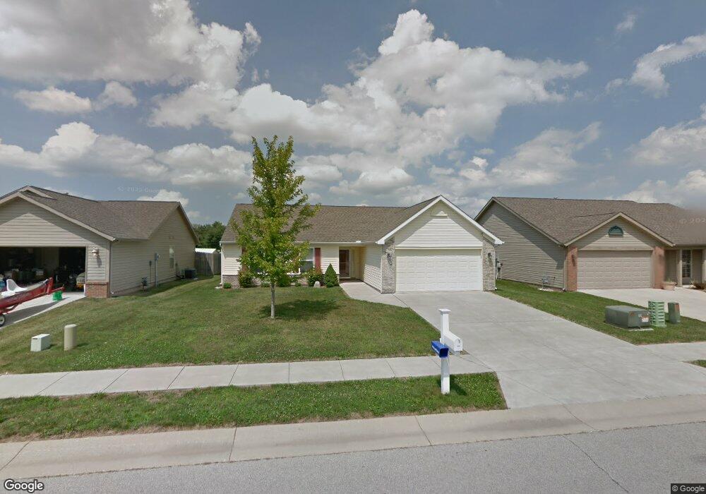
408 Atlas Dr Lafayette, IN 47909
Estimated Value: $275,577 - $304,000
3
Beds
2
Baths
1,424
Sq Ft
$203/Sq Ft
Est. Value
About This Home
This home is located at 408 Atlas Dr, Lafayette, IN 47909 and is currently estimated at $289,394, approximately $203 per square foot. 408 Atlas Dr is a home located in Tippecanoe County with nearby schools including Wea Ridge Elementary School, Wea Ridge Middle School, and McCutcheon High School.
Ownership History
Date
Name
Owned For
Owner Type
Purchase Details
Closed on
Mar 6, 2010
Sold by
Kapper Nicholas J
Bought by
Murphy Michael D and Murphy Amy K
Current Estimated Value
Purchase Details
Closed on
Apr 22, 2009
Sold by
Vessels Robert A and Vessels Sheryl Joan
Bought by
Kapper Nicholas J
Home Financials for this Owner
Home Financials are based on the most recent Mortgage that was taken out on this home.
Original Mortgage
$108,000
Interest Rate
5.05%
Mortgage Type
New Conventional
Purchase Details
Closed on
Jul 28, 2006
Sold by
Tempest Homes Llc
Bought by
Vessels Robert A and Vessels Sheryl Joan
Home Financials for this Owner
Home Financials are based on the most recent Mortgage that was taken out on this home.
Original Mortgage
$116,600
Interest Rate
6.82%
Mortgage Type
Unknown
Purchase Details
Closed on
Apr 27, 2006
Sold by
Double Down Development Llc
Bought by
Tempest Homes Llc
Create a Home Valuation Report for This Property
The Home Valuation Report is an in-depth analysis detailing your home's value as well as a comparison with similar homes in the area
Home Values in the Area
Average Home Value in this Area
Purchase History
| Date | Buyer | Sale Price | Title Company |
|---|---|---|---|
| Murphy Michael D | -- | None Available | |
| Kapper Nicholas J | -- | None Available | |
| Vessels Robert A | -- | None Available | |
| Tempest Homes Llc | -- | None Available |
Source: Public Records
Mortgage History
| Date | Status | Borrower | Loan Amount |
|---|---|---|---|
| Previous Owner | Kapper Nicholas J | $108,000 | |
| Previous Owner | Vessels Robert A | $116,600 |
Source: Public Records
Tax History Compared to Growth
Tax History
| Year | Tax Paid | Tax Assessment Tax Assessment Total Assessment is a certain percentage of the fair market value that is determined by local assessors to be the total taxable value of land and additions on the property. | Land | Improvement |
|---|---|---|---|---|
| 2024 | $2,046 | $204,600 | $48,000 | $156,600 |
| 2023 | $1,964 | $194,800 | $48,000 | $146,800 |
| 2022 | $1,669 | $165,200 | $30,000 | $135,200 |
| 2021 | $1,586 | $156,800 | $30,000 | $126,800 |
| 2020 | $1,465 | $144,700 | $30,000 | $114,700 |
| 2019 | $1,369 | $137,500 | $30,000 | $107,500 |
| 2018 | $1,260 | $132,200 | $30,000 | $102,200 |
| 2017 | $1,153 | $124,400 | $25,000 | $99,400 |
| 2016 | $1,108 | $123,600 | $25,000 | $98,600 |
| 2014 | $1,061 | $122,700 | $25,000 | $97,700 |
| 2013 | $1,031 | $119,000 | $23,300 | $95,700 |
Source: Public Records
Map
Nearby Homes
- 2820 Limestone Ln
- 513 Dorsett Dr
- 2514 Eckman Dr
- 143 Kinkaid Dr
- 116 Wise Dr
- 3227 Townsend Dr
- 2561 S 231 Hwy
- 901 Southlea Dr
- 304 Jersey Ln
- 2713 & 2715 Plaza Ln
- 3352 Coventry Ln
- 318 Thames Ave
- 2508 Lafayette Dr
- 1029 Alder Dr
- 3429 Trafalgar Ct
- 3425 Sibley Ln
- 1005 Sarasota Dr
- 1017 Sarasota Dr
- 2513 Cambridge Rd
- 1006 Southport Dr
- 412 Atlas Dr
- 404 Atlas Dr
- 455 Limestone Ct E
- 457 Limestone Ct E
- 451 Limestone Ct E
- 451 Limestone Ct E
- 0 Limestone Ln
- 459 Limestone Ct E
- 2801 Limestone Ln
- 359 Limestone Ct E
- 365 Limestone Ct E
- 351 Limestone Ct E
- 407 Atlas Dr
- 332 Flagstone Way
- 463 Limestone Ct E
- 463 Limestone Ct E
- 420 Atlas Dr
- 2805 Limestone Ln
- 463 Limestone Ct
- 365 Limestone Ct W