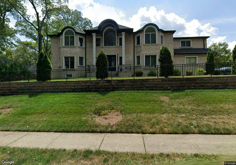
408 Brock Ct Paramus, NJ 07652
Estimated Value: $1,845,000 - $2,404,000
6
Beds
7
Baths
5,036
Sq Ft
$413/Sq Ft
Est. Value
About This Home
This home is located at 408 Brock Ct, Paramus, NJ 07652 and is currently estimated at $2,081,246, approximately $413 per square foot. 408 Brock Ct is a home located in Bergen County with nearby schools including Paramus High School and David Gregory School.
Ownership History
Date
Name
Owned For
Owner Type
Purchase Details
Closed on
Feb 10, 2021
Sold by
Hussain Maqsood and Bajwa Zahid
Bought by
408 Brock Llc
Current Estimated Value
Home Financials for this Owner
Home Financials are based on the most recent Mortgage that was taken out on this home.
Original Mortgage
$900,000
Interest Rate
3.1%
Mortgage Type
Commercial
Purchase Details
Closed on
Sep 13, 2017
Sold by
Midland Builders Llc
Bought by
Hussain Maqsood and Bajwa Zahid
Create a Home Valuation Report for This Property
The Home Valuation Report is an in-depth analysis detailing your home's value as well as a comparison with similar homes in the area
Home Values in the Area
Average Home Value in this Area
Purchase History
| Date | Buyer | Sale Price | Title Company |
|---|---|---|---|
| 408 Brock Llc | $1,300,000 | Fidelity National Ttl Ins Co | |
| Hussain Maqsood | $420,000 | None Available |
Source: Public Records
Mortgage History
| Date | Status | Borrower | Loan Amount |
|---|---|---|---|
| Open | 408 Brock Llc | $930,000 | |
| Previous Owner | 408 Brock Llc | $900,000 |
Source: Public Records
Tax History Compared to Growth
Tax History
| Year | Tax Paid | Tax Assessment Tax Assessment Total Assessment is a certain percentage of the fair market value that is determined by local assessors to be the total taxable value of land and additions on the property. | Land | Improvement |
|---|---|---|---|---|
| 2025 | $23,929 | $1,679,100 | $392,000 | $1,287,100 |
| 2024 | $23,349 | $1,580,500 | $354,900 | $1,225,600 |
| 2023 | $22,225 | $1,522,100 | $340,000 | $1,182,100 |
| 2022 | $22,225 | $1,432,000 | $318,900 | $1,113,100 |
| 2021 | $21,691 | $1,311,400 | $286,900 | $1,024,500 |
| 2020 | $20,619 | $1,292,700 | $282,000 | $1,010,700 |
| 2019 | $9,453 | $509,300 | $359,300 | $150,000 |
| 2018 | $6,586 | $359,300 | $359,300 | $0 |
| 2017 | $6,471 | $359,300 | $359,300 | $0 |
| 2016 | $6,295 | $359,300 | $359,300 | $0 |
| 2015 | $15,769 | $909,400 | $359,300 | $550,100 |
| 2014 | $6,176 | $359,300 | $359,300 | $0 |
Source: Public Records
Map
Nearby Homes
- 216 E Midland Ave
- 391 Harrison St
- 382 Harrison St
- 404 Willard Rd
- 415 Bailey Rd
- 272 E Midland Ave
- 195 Concord Dr
- 278 Idaho St
- 323 Haywood Dr
- 331 Harrison St
- 281 Homestead Rd
- 296 Montana St
- 239 Homestead Rd
- 452 Oregon St
- 541 Forest Ave
- 160 Jerome Ave
- 286 N Farview Ave
- 322 E Midland Ave
- 505 Salem St
- 322 Bullard Ave
- 406 Brock Ct
- 200 E Midland Ave
- 402 Brock Ct
- 407 Brock Ct
- 405 Brock Ct
- 204 E Midland Ave
- 400 Brock Ct
- 401 Brock Ct
- 184 E Midland Ave
- 212 E Midland Ave
- 208 E Midland Ave
- 180 E Midland Ave
- 195 Harwood Place
- 400 N Farview Ave
- 203 Harwood Place
- 404 N Farview Ave
- 193 Harwood Place
- 395 Harrison St
- 205 Harwood Place
- 410 N Farview Ave