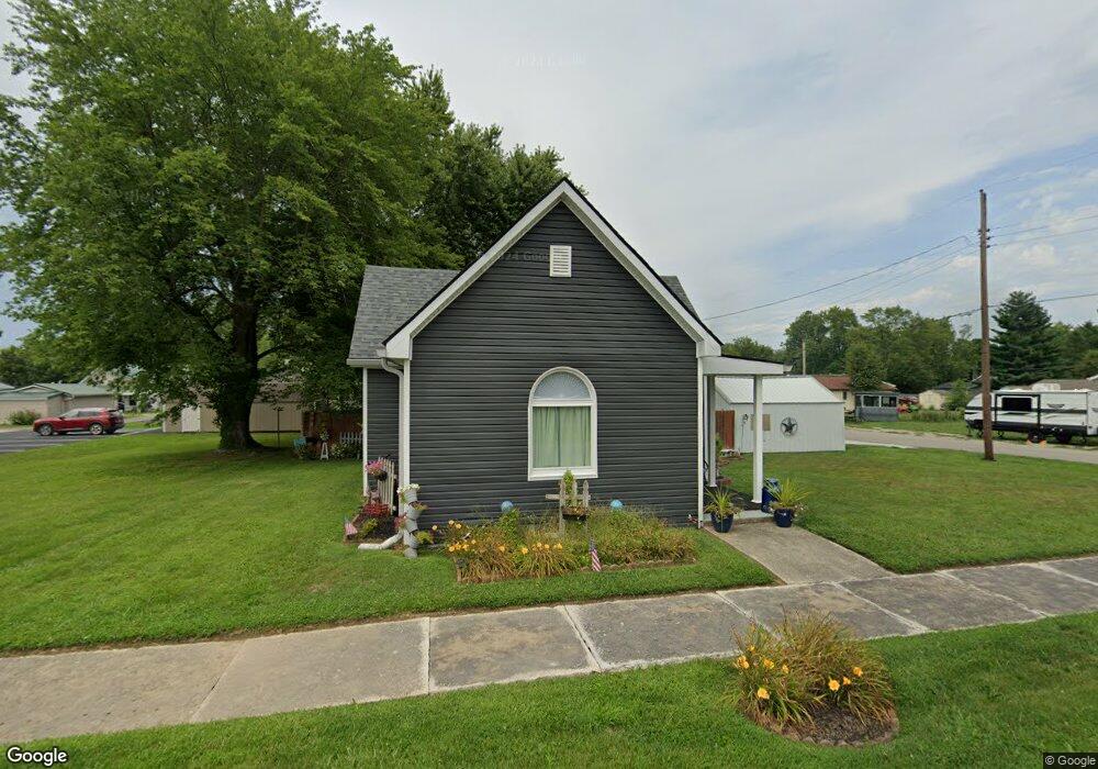
408 E Bennett St Westport, IN 47283
Estimated Value: $111,000 - $177,000
2
Beds
1
Bath
1,144
Sq Ft
$135/Sq Ft
Est. Value
About This Home
This home is located at 408 E Bennett St, Westport, IN 47283 and is currently estimated at $154,298, approximately $134 per square foot. 408 E Bennett St is a home located in Decatur County with nearby schools including South Decatur Elementary School and South Decatur Junior/Senior High School.
Ownership History
Date
Name
Owned For
Owner Type
Purchase Details
Closed on
Jan 15, 2026
Sold by
Murphy Brian E and Murphy Jodi L
Bought by
Frost Autumn
Current Estimated Value
Home Financials for this Owner
Home Financials are based on the most recent Mortgage that was taken out on this home.
Original Mortgage
$165,656
Outstanding Balance
$165,497
Interest Rate
6.19%
Mortgage Type
New Conventional
Estimated Equity
-$11,199
Purchase Details
Closed on
Mar 5, 2020
Sold by
Stephens Dorothy
Bought by
Murphy Brian E and Murphy Jodi L
Home Financials for this Owner
Home Financials are based on the most recent Mortgage that was taken out on this home.
Original Mortgage
$71,000
Interest Rate
3.4%
Mortgage Type
New Conventional
Purchase Details
Closed on
May 17, 2010
Sold by
Manlief Charles R
Bought by
Stephens Dorothy
Create a Home Valuation Report for This Property
The Home Valuation Report is an in-depth analysis detailing your home's value as well as a comparison with similar homes in the area
Purchase History
| Date | Buyer | Sale Price | Title Company |
|---|---|---|---|
| Frost Autumn | -- | Meridian Title Corporation | |
| Murphy Brian E | -- | None Available | |
| Stephens Dorothy | -- | -- |
Source: Public Records
Mortgage History
| Date | Status | Borrower | Loan Amount |
|---|---|---|---|
| Open | Frost Autumn | $165,656 | |
| Previous Owner | Murphy Brian E | $71,000 |
Source: Public Records
Tax History
| Year | Tax Paid | Tax Assessment Tax Assessment Total Assessment is a certain percentage of the fair market value that is determined by local assessors to be the total taxable value of land and additions on the property. | Land | Improvement |
|---|---|---|---|---|
| 2025 | $656 | $118,100 | $19,600 | $98,500 |
| 2024 | $656 | $115,100 | $14,200 | $100,900 |
| 2023 | $635 | $107,400 | $14,200 | $93,200 |
| 2022 | $571 | $99,000 | $14,200 | $84,800 |
| 2021 | $523 | $86,200 | $14,200 | $72,000 |
| 2020 | $371 | $72,000 | $10,200 | $61,800 |
| 2019 | $343 | $64,900 | $10,200 | $54,700 |
| 2018 | $294 | $60,500 | $10,200 | $50,300 |
| 2017 | $265 | $58,000 | $10,200 | $47,800 |
| 2016 | $254 | $54,700 | $9,100 | $45,600 |
| 2014 | $240 | $52,300 | $9,100 | $43,200 |
| 2013 | -- | $50,900 | $9,100 | $41,800 |
Source: Public Records
Map
Nearby Homes
- 603 E North St
- 508 Deer Run
- 204 E Mulberry St
- 217 E Sycamore St
- 107 W Main St
- 212 S Lincoln St
- 1003 N State Road 3
- 3852 W Co Road 1100 S
- 0 W Co Rd 1100 S
- 11182 S County Road 280 W
- 11182 S Co Road 280 W
- 3404 W County Road 800 S
- 9513 S County Road 100 W
- 6255 E County Road 850 N
- 0 Private Road 695 N
- 6570 N Private Road 525 E
- 0 S Co Road 20 W
- 2392 E County Road 820 S
- 2995 W County Road 675 N
- 01 W County Road 675 N
- 406 E Bennett St
- 302 N Cann St
- 304 N Cann St
- 409 E Schott St
- 501 E Bennett St
- 504 E Bennett St
- 306 N Cann St
- 405 E Schott St
- 401 N Cann St
- 505 E Schott St
- 506 E Bennett St
- 403 E Schott St
- 502 E Schott St
- 305 N Owens St
- 408 E Schott St
- 406 E Schott St
- 301 N Owens St
- 509 E Schott St
- 404 E Schott St
- 402 E Schott St
Your Personal Tour Guide
Ask me questions while you tour the home.