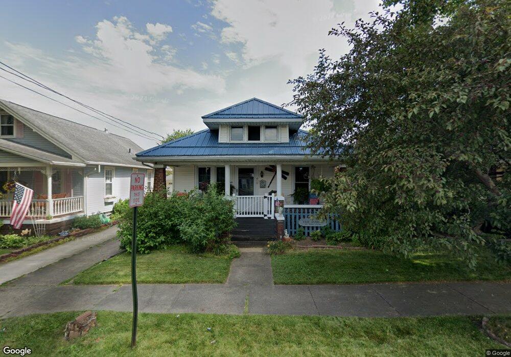
408 E Line St Minerva, OH 44657
Estimated Value: $94,924 - $132,000
2
Beds
2
Baths
1,048
Sq Ft
$106/Sq Ft
Est. Value
About This Home
This home is located at 408 E Line St, Minerva, OH 44657 and is currently estimated at $111,481, approximately $106 per square foot. 408 E Line St is a home located in Stark County with nearby schools including Minerva Elementary School, Minerva Middle School, and Minerva High School.
Ownership History
Date
Name
Owned For
Owner Type
Purchase Details
Closed on
Apr 16, 2018
Sold by
Grubbs Roger D
Bought by
Lizzoli Lisa P
Current Estimated Value
Purchase Details
Closed on
Jan 25, 2005
Sold by
Mcgowan Charles J and Mcgowan Mary J
Bought by
Grubbs Roger D and Grubbs Susan E
Purchase Details
Closed on
Feb 19, 1999
Sold by
Hole Winifred I
Bought by
Mcgowan Charles J and Mcgowan Mary J
Purchase Details
Closed on
Apr 12, 1994
Purchase Details
Closed on
Aug 14, 1990
Create a Home Valuation Report for This Property
The Home Valuation Report is an in-depth analysis detailing your home's value as well as a comparison with similar homes in the area
Home Values in the Area
Average Home Value in this Area
Purchase History
| Date | Buyer | Sale Price | Title Company |
|---|---|---|---|
| Lizzoli Lisa P | $58,500 | None Available | |
| Grubbs Roger D | $72,000 | -- | |
| Mcgowan Charles J | $58,000 | -- | |
| -- | -- | -- | |
| -- | $38,000 | -- |
Source: Public Records
Tax History
| Year | Tax Paid | Tax Assessment Tax Assessment Total Assessment is a certain percentage of the fair market value that is determined by local assessors to be the total taxable value of land and additions on the property. | Land | Improvement |
|---|---|---|---|---|
| 2025 | -- | $26,920 | $7,350 | $19,570 |
| 2024 | -- | $26,920 | $7,350 | $19,570 |
| 2023 | $1,069 | $24,650 | $4,940 | $19,710 |
| 2022 | $1,078 | $24,650 | $4,940 | $19,710 |
| 2021 | $1,105 | $24,650 | $4,940 | $19,710 |
| 2020 | $1,072 | $22,370 | $4,450 | $17,920 |
| 2019 | $922 | $22,370 | $4,450 | $17,920 |
Source: Public Records
Map
Nearby Homes
- 404 Union Ave Unit 25
- 701 E Lincolnway
- 513 Queen St Unit 1A
- 0 Lynnwood Dr
- 113 W 1st St
- 806 S Grant Blvd
- 606 Murray Ave Unit 16
- 605 Stadium St
- 208 Ridgewood Blvd
- 701 W Line St Unit 34
- 144 W 1st St
- 0 Surrey Dr SE
- 22141 Mcdaniel St
- 1179 Alliance Rd NW Unit 11E
- 22657 Mayfair Ave
- 9996 Stump Rd
- 8087 Magnet Rd NE Unit 13E
- 10240 Manor Rd NE Unit 5
- 14000 Lincoln St SE Unit LOT A
- 14000 Lincoln St SE Unit 3
- 410 E Line St
- 406 E Line St
- 404 E Line St
- 107 Bonnieview Ave
- 402 E Line St
- 500 E Line St
- 106 Bonnieview Ave
- 109 Bonnieview Ave
- 407 E Line St Unit 25
- 409 E Line St Unit 25
- 405 E Line St Unit 25
- 502 E Line St
- 106 Park Ave
- 100 Park Ave
- 108 Bonnieview Ave
- 111 Bonnieview Ave
- 411 E Line St Unit 25
- 504 E Line St
- 329 E Line St Unit 25
- 112 Bonnieview Ave
Your Personal Tour Guide
Ask me questions while you tour the home.