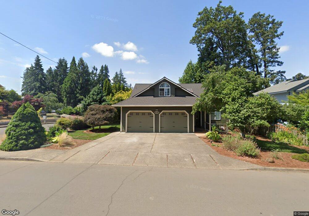
408 Edgewood Dr Silverton, OR 97381
Estimated Value: $539,492 - $620,000
2
Beds
2
Baths
2,175
Sq Ft
$271/Sq Ft
Est. Value
About This Home
This home is located at 408 Edgewood Dr, Silverton, OR 97381 and is currently estimated at $589,873, approximately $271 per square foot. 408 Edgewood Dr is a home located in Marion County with nearby schools including Robert Frost Elementary School, Silverton Middle School, and Silverton High School.
Ownership History
Date
Name
Owned For
Owner Type
Purchase Details
Closed on
Jun 26, 2004
Sold by
Kannenberg Bruce
Bought by
Mickelson Marc and Mickelson Marla G
Current Estimated Value
Home Financials for this Owner
Home Financials are based on the most recent Mortgage that was taken out on this home.
Original Mortgage
$188,800
Outstanding Balance
$86,961
Interest Rate
5.25%
Mortgage Type
Purchase Money Mortgage
Estimated Equity
$502,912
Purchase Details
Closed on
Mar 3, 2003
Sold by
Kannenberg Karl F
Bought by
Kannenberg Karl F and Kannenberg Bruce
Create a Home Valuation Report for This Property
The Home Valuation Report is an in-depth analysis detailing your home's value as well as a comparison with similar homes in the area
Home Values in the Area
Average Home Value in this Area
Purchase History
| Date | Buyer | Sale Price | Title Company |
|---|---|---|---|
| Mickelson Marc | $236,000 | Ticor Title | |
| Kannenberg Karl F | -- | -- |
Source: Public Records
Mortgage History
| Date | Status | Borrower | Loan Amount |
|---|---|---|---|
| Open | Mickelson Marc | $188,800 | |
| Closed | Mickelson Marc | $35,400 |
Source: Public Records
Tax History
| Year | Tax Paid | Tax Assessment Tax Assessment Total Assessment is a certain percentage of the fair market value that is determined by local assessors to be the total taxable value of land and additions on the property. | Land | Improvement |
|---|---|---|---|---|
| 2025 | $4,742 | $294,750 | -- | -- |
| 2024 | $4,742 | $286,170 | -- | -- |
| 2023 | $4,621 | $277,840 | $0 | $0 |
| 2022 | $4,375 | $269,750 | $0 | $0 |
| 2021 | $4,257 | $261,900 | $0 | $0 |
| 2020 | $4,151 | $254,280 | $0 | $0 |
| 2019 | $4,030 | $246,880 | $0 | $0 |
| 2018 | $4,046 | $0 | $0 | $0 |
| 2017 | $3,954 | $0 | $0 | $0 |
| 2016 | $3,883 | $0 | $0 | $0 |
| 2015 | $3,845 | $0 | $0 | $0 |
| 2014 | $3,728 | $0 | $0 | $0 |
Source: Public Records
Map
Nearby Homes
- 301 Edgewood Dr
- TA 102768 Anderson Dr
- 245 Edgewood Dr
- 160 S Center St
- 412 W Main St
- 0 Cowing St
- 251 Fairview St
- 601 S Water St
- 66 S Water St Unit 66
- 407 S 1st St
- 315 S 1st St (& 301 Drake St) St
- 301 S 1st St
- 302 Jersey St
- 318 Koons St
- 424 S 3rd St
- 407 Jersey St
- 623 McClaine St
- 1110 Madison St
- 845 Oakleaf Way
- 308 A St
Your Personal Tour Guide
Ask me questions while you tour the home.