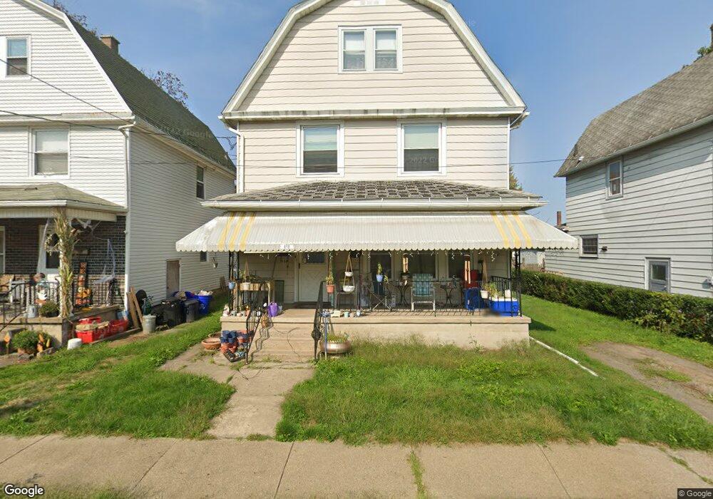
408 Foster St Scranton, PA 18508
The Plot NeighborhoodEstimated Value: $117,755 - $170,000
--
Bed
--
Bath
--
Sq Ft
3,267
Sq Ft Lot
About This Home
This home is located at 408 Foster St, Scranton, PA 18508 and is currently estimated at $154,939. 408 Foster St is a home located in Lackawanna County with nearby schools including Pinchbeck Elementary School, Isaac Tripp Elementary School, and Columbia Heights Elementary School.
Ownership History
Date
Name
Owned For
Owner Type
Purchase Details
Closed on
Dec 5, 2016
Sold by
Ort Martin D and Ort Elaine
Bought by
Ort Christopher D
Current Estimated Value
Purchase Details
Closed on
Oct 21, 2015
Sold by
Ort David M
Bought by
Ort Martin D
Purchase Details
Closed on
Apr 11, 2006
Sold by
Ort David
Bought by
Ort Richard M
Create a Home Valuation Report for This Property
The Home Valuation Report is an in-depth analysis detailing your home's value as well as a comparison with similar homes in the area
Home Values in the Area
Average Home Value in this Area
Purchase History
| Date | Buyer | Sale Price | Title Company |
|---|---|---|---|
| Ort Christopher D | $52,500 | None Available | |
| Ort Martin D | -- | None Available | |
| Ort David M | -- | None Available | |
| Ort Richard M | -- | None Available |
Source: Public Records
Tax History Compared to Growth
Tax History
| Year | Tax Paid | Tax Assessment Tax Assessment Total Assessment is a certain percentage of the fair market value that is determined by local assessors to be the total taxable value of land and additions on the property. | Land | Improvement |
|---|---|---|---|---|
| 2025 | $2,434 | $7,500 | $1,300 | $6,200 |
| 2024 | $2,226 | $7,500 | $1,300 | $6,200 |
| 2023 | $2,226 | $7,500 | $1,300 | $6,200 |
| 2022 | $2,177 | $7,500 | $1,300 | $6,200 |
| 2021 | $2,177 | $7,500 | $1,300 | $6,200 |
| 2020 | $2,136 | $7,500 | $1,300 | $6,200 |
| 2019 | $2,010 | $7,500 | $1,300 | $6,200 |
| 2018 | $2,010 | $7,500 | $1,300 | $6,200 |
| 2017 | $1,975 | $7,500 | $1,300 | $6,200 |
| 2016 | $616 | $7,500 | $1,300 | $6,200 |
| 2015 | $1,486 | $7,500 | $1,300 | $6,200 |
| 2014 | -- | $7,500 | $1,300 | $6,200 |
Source: Public Records
Map
Nearby Homes
- 375 Grove St
- 942 Providence Rd
- 938 Providence Rd
- 1206 Blair Ave Unit Rear
- 1008 Mount Vernon Ave
- 656 Philo St
- 1227 Providence Rd
- 4 Plum Place
- 1311 Short Ave
- 7 Plum Place
- 1513 Meylert Ave
- 1519 1521 von Storch Ave
- 846 Capouse Ave
- 848 Capouse Ave
- 331 Phelps St
- 853 Lords Ct
- 1430 N Main Ave
- 833 Powderly Ct
- 1235 N Sumner Ave
- 1126 W Gibson St
- 404 Foster St
- 412 Foster St
- 1044 Cottage Ave
- 1048 Cottage Ave
- 333 Foster St
- 331 Foster St
- 1035 Cottage Ave
- 1039 Cottage Ave
- 337 Foster St Unit 339
- 1052 Cottage Ave
- 337-339 Foster St
- 337 Foster St
- 1043 Cottage Ave
- 1015 Barring Ave
- 341 Foster St Unit 343
- 1047 Cottage Ave
- 1056 Cottage Ave
- 1051 Cottage Ave
- 1011 Barring Ave Unit 1013
- 1060 Cottage Ave