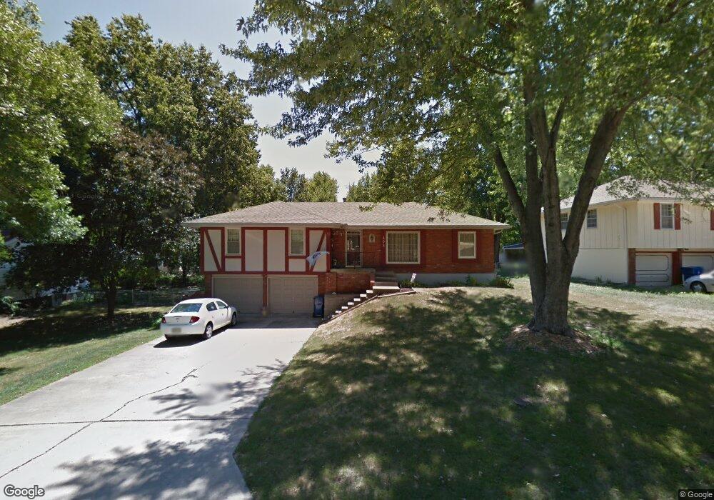
408 Gordon Dr Liberty, MO 64068
Estimated Value: $258,000 - $331,000
3
Beds
2
Baths
1,376
Sq Ft
$211/Sq Ft
Est. Value
About This Home
This home is located at 408 Gordon Dr, Liberty, MO 64068 and is currently estimated at $289,679, approximately $210 per square foot. 408 Gordon Dr is a home located in Clay County with nearby schools including Alexander Doniphan Elementary School, Discovery Middle School, and Liberty High School.
Ownership History
Date
Name
Owned For
Owner Type
Purchase Details
Closed on
Jul 29, 2020
Sold by
Choate Caleb Thomas and Choate Audrey Blair
Bought by
Blum Elizabeth S
Current Estimated Value
Home Financials for this Owner
Home Financials are based on the most recent Mortgage that was taken out on this home.
Original Mortgage
$205,000
Outstanding Balance
$182,185
Interest Rate
3.1%
Mortgage Type
New Conventional
Estimated Equity
$107,494
Purchase Details
Closed on
Jul 19, 2001
Sold by
Cull Patricia A
Bought by
Tallant Susan Renee and Amelunke Karri Michelle
Create a Home Valuation Report for This Property
The Home Valuation Report is an in-depth analysis detailing your home's value as well as a comparison with similar homes in the area
Home Values in the Area
Average Home Value in this Area
Purchase History
| Date | Buyer | Sale Price | Title Company |
|---|---|---|---|
| Blum Elizabeth S | -- | Thomson Affinity Title Llc | |
| Tallant Susan Renee | -- | -- |
Source: Public Records
Mortgage History
| Date | Status | Borrower | Loan Amount |
|---|---|---|---|
| Open | Blum Elizabeth S | $205,000 |
Source: Public Records
Tax History
| Year | Tax Paid | Tax Assessment Tax Assessment Total Assessment is a certain percentage of the fair market value that is determined by local assessors to be the total taxable value of land and additions on the property. | Land | Improvement |
|---|---|---|---|---|
| 2025 | $2,569 | $38,380 | -- | -- |
| 2024 | $2,569 | $33,400 | -- | -- |
| 2023 | $2,612 | $33,400 | $0 | $0 |
| 2022 | $2,354 | $29,720 | $0 | $0 |
| 2021 | $2,336 | $29,716 | $6,650 | $23,066 |
| 2020 | $2,352 | $28,100 | $0 | $0 |
| 2019 | $2,352 | $28,100 | $0 | $0 |
Source: Public Records
Map
Nearby Homes
- 509 Belmont St
- 406 Melrose St
- 407 Glendale Rd
- 319 Glendale Rd
- Lot 2 Bent Oaks Dr
- 2116 Winding Woods Dr
- 1601 Dunwich Dr
- 405 Wherritt Ln
- Lot 2A Oak Crest Dr
- 1327 Easton Ct
- 7503 N Lewis Ave
- 7511 N Lewis Ave
- 7218 N Lewis Ave
- 7514 N Lewis Ave
- 9008 NE 80th St
- 253 S Stewart Rd
- 1836 Green Meadow Dr
- 7629 N Booth Ave
- 1856 Arbor Trail
- 8915 NE 80th Terrace
Your Personal Tour Guide
Ask me questions while you tour the home.