Estimated Value: $148,000 - $190,000
2
Beds
1
Bath
864
Sq Ft
$193/Sq Ft
Est. Value
About This Home
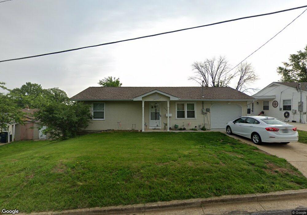
This home is located at 408 Koelling Ave, Union, MO 63084 and is currently estimated at $166,435, approximately $192 per square foot. 408 Koelling Ave is a home located in Franklin County with nearby schools including Union High School and Immaculate Conception School.
Ownership History
Date
Name
Owned For
Owner Type
Purchase Details
Closed on
Apr 10, 2019
Sold by
Arens Trust
Bought by
Bratton Earl
Current Estimated Value
Home Financials for this Owner
Home Financials are based on the most recent Mortgage that was taken out on this home.
Original Mortgage
$115,777
Outstanding Balance
$101,371
Interest Rate
4.3%
Mortgage Type
New Conventional
Estimated Equity
$65,064
Purchase Details
Closed on
Dec 7, 2017
Sold by
Eads Trust
Bought by
Arens Trust
Purchase Details
Closed on
Sep 27, 2010
Sold by
Eads Carol F
Bought by
Eads Carol F and Carol F Eads Revocable Living Trust
Create a Home Valuation Report for This Property
The Home Valuation Report is an in-depth analysis detailing your home's value as well as a comparison with similar homes in the area
Home Values in the Area
Average Home Value in this Area
Purchase History
| Date | Buyer | Sale Price | Title Company |
|---|---|---|---|
| Bratton Earl | -- | None Available | |
| Arens Trust | $40,000 | -- | |
| Eads Carol F | -- | None Available | |
| Eads Carol F | -- | None Available |
Source: Public Records
Mortgage History
| Date | Status | Borrower | Loan Amount |
|---|---|---|---|
| Open | Bratton Earl | $115,777 |
Source: Public Records
Tax History
| Year | Tax Paid | Tax Assessment Tax Assessment Total Assessment is a certain percentage of the fair market value that is determined by local assessors to be the total taxable value of land and additions on the property. | Land | Improvement |
|---|---|---|---|---|
| 2025 | $984 | $16,502 | $0 | $0 |
| 2024 | $984 | $15,803 | $0 | $0 |
| 2023 | $952 | $15,803 | $0 | $0 |
| 2022 | $837 | $13,863 | $0 | $0 |
| 2021 | $839 | $13,863 | $0 | $0 |
| 2020 | $767 | $12,480 | $0 | $0 |
| 2019 | $705 | $11,493 | $0 | $0 |
| 2018 | $380 | $6,510 | $0 | $0 |
| 2017 | $664 | $11,334 | $0 | $0 |
| 2016 | $684 | $11,408 | $0 | $0 |
| 2015 | $673 | $11,408 | $0 | $0 |
| 2014 | $681 | $11,535 | $0 | $0 |
Source: Public Records
Map
Nearby Homes
- 413 Rosedale Ave
- 0 Lot 4 Clearview Dr Unit 19010507
- 0 Lot 6 Clearview Dr Unit 19010511
- 0 Clearview Unit 19010495
- 408 Hall Ave
- 0 Lot 5 Clearview Dr Unit 19010510
- 0 Lot 3 Clearview Dr Unit MIS26011988
- 154 Joel Ave
- 702 Clearview Dr Unit 1
- 725 W Main St
- 4 Lindner Ln
- 914 W State St
- 613 W State St
- 413 W State St
- 605 S Jefferson Ave
- 26 & 30 Ridge Point Meadows
- 613 S Jefferson Ave
- 626 Lindsey Dr
- 207 E Park Ave
- 614 E State St
- 410 Koelling Ave
- 808 W Springfield Ave
- 806 W Springfield Ave
- 412 Koelling Ave
- 409 Jane Ave
- 411 Jane Ave
- 403 Jane Ave
- 415 Jane Ave
- 407 Koelling Ave
- 414 Koelling Ave
- 401 Jane Ave
- 409 Koelling Ave
- 417 Jane Ave
- 416 Koelling Ave
- 413 Koelling Ave
- 902 W Springfield Ave
- 801 W Springfield Ave
- 901 W Springfield Ave
- 803 W Springfield Ave
- 708 W Springfield Ave
Your Personal Tour Guide
Ask me questions while you tour the home.