Estimated Value: $233,541 - $281,000
3
Beds
2
Baths
1,276
Sq Ft
$207/Sq Ft
Est. Value
About This Home
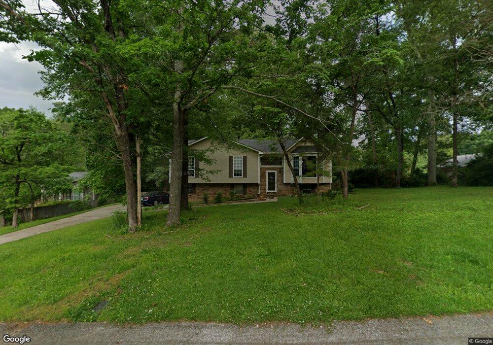
This home is located at 408 Michael Rd, Leeds, AL 35094 and is currently estimated at $263,885, approximately $206 per square foot. 408 Michael Rd is a home located in Jefferson County with nearby schools including Leeds Elementary School, Leeds Middle School, and Leeds High School.
Ownership History
Date
Name
Owned For
Owner Type
Purchase Details
Closed on
Feb 17, 2011
Sold by
Weeks Vicki E
Bought by
Williams Cary R and Miller Matthew B
Current Estimated Value
Home Financials for this Owner
Home Financials are based on the most recent Mortgage that was taken out on this home.
Original Mortgage
$100,000
Interest Rate
4.66%
Mortgage Type
New Conventional
Purchase Details
Closed on
Jun 24, 1998
Sold by
Dee Weeks Lemuel Dee and Dee Lemule
Bought by
Weeks Vicki E
Purchase Details
Closed on
Oct 15, 1997
Sold by
Dee Weeks Lemuel Dee and Dee Lemule
Bought by
Weeks Vicki E
Create a Home Valuation Report for This Property
The Home Valuation Report is an in-depth analysis detailing your home's value as well as a comparison with similar homes in the area
Home Values in the Area
Average Home Value in this Area
Purchase History
| Date | Buyer | Sale Price | Title Company |
|---|---|---|---|
| Williams Cary R | $125,000 | None Available | |
| Weeks Vicki E | -- | Lawyers Title Insurance Corp | |
| Weeks Vicki E | -- | -- |
Source: Public Records
Mortgage History
| Date | Status | Borrower | Loan Amount |
|---|---|---|---|
| Closed | Williams Cary R | $100,000 |
Source: Public Records
Tax History Compared to Growth
Tax History
| Year | Tax Paid | Tax Assessment Tax Assessment Total Assessment is a certain percentage of the fair market value that is determined by local assessors to be the total taxable value of land and additions on the property. | Land | Improvement |
|---|---|---|---|---|
| 2024 | $2,575 | $43,420 | -- | -- |
| 2022 | $2,105 | $17,750 | $5,110 | $12,640 |
| 2021 | $1,714 | $14,450 | $5,110 | $9,340 |
| 2020 | $1,714 | $14,450 | $5,110 | $9,340 |
| 2019 | $1,714 | $28,900 | $0 | $0 |
| 2018 | $1,461 | $24,640 | $0 | $0 |
| 2017 | $1,550 | $26,140 | $0 | $0 |
| 2016 | $1,528 | $25,760 | $0 | $0 |
| 2015 | $1,461 | $24,640 | $0 | $0 |
| 2014 | $1,451 | $24,300 | $0 | $0 |
| 2013 | $1,451 | $24,300 | $0 | $0 |
Source: Public Records
Map
Nearby Homes
- Callum Plan at Grand River - Unali at Grand River
- Caspen Plan at Grand River - Unali at Grand River
- Lilly Plan at Grand River - Unali at Grand River
- Victoria B Plan at Grand River - Unali at Grand River
- Victoria A Plan at Grand River - Unali at Grand River
- Piedmont Plan at Grand River - Unali at Grand River
- Newport B Plan at Grand River - Unali at Grand River
- Newport A Plan at Grand River - Unali at Grand River
- Manchester Plan at Grand River - Unali at Grand River
- Claremont Plan at Grand River - Unali at Grand River
- Adamson Plan at Grand River - Unali at Grand River
- Nottingham Plan at Grand River - Unali at Grand River
- Surrey Plan at Grand River - Unali at Grand River
- Cambridge Plan at Grand River - Unali at Grand River
- 217 Country Club Dr
- 1065 Unali Ln
- 1012 E Unali Townes Loop
- 1003 Grand River Blvd
- 1092 Unali Ln
- 6998 Southern Trace Loop
- 412 Michael Rd
- 6250 Stewart Rd
- 6256 Stewart Rd
- 413 Michael Rd
- 405 Michael Rd
- 6262 Stewart Rd
- 416 Michael Rd
- 417 Michael Rd
- 6242 Stewart Rd
- 6249 Stewart Rd
- 6261 Stewart Rd
- 6255 Stewart Rd
- 6266 Stewart Rd
- 6245 Stewart Rd
- 421 Michael Rd
- 6238 Stewart Rd
- 309 Castleman Ln
- 305 Castleman Ln
- 6241 Stewart Rd
- 6270 Stewart Rd