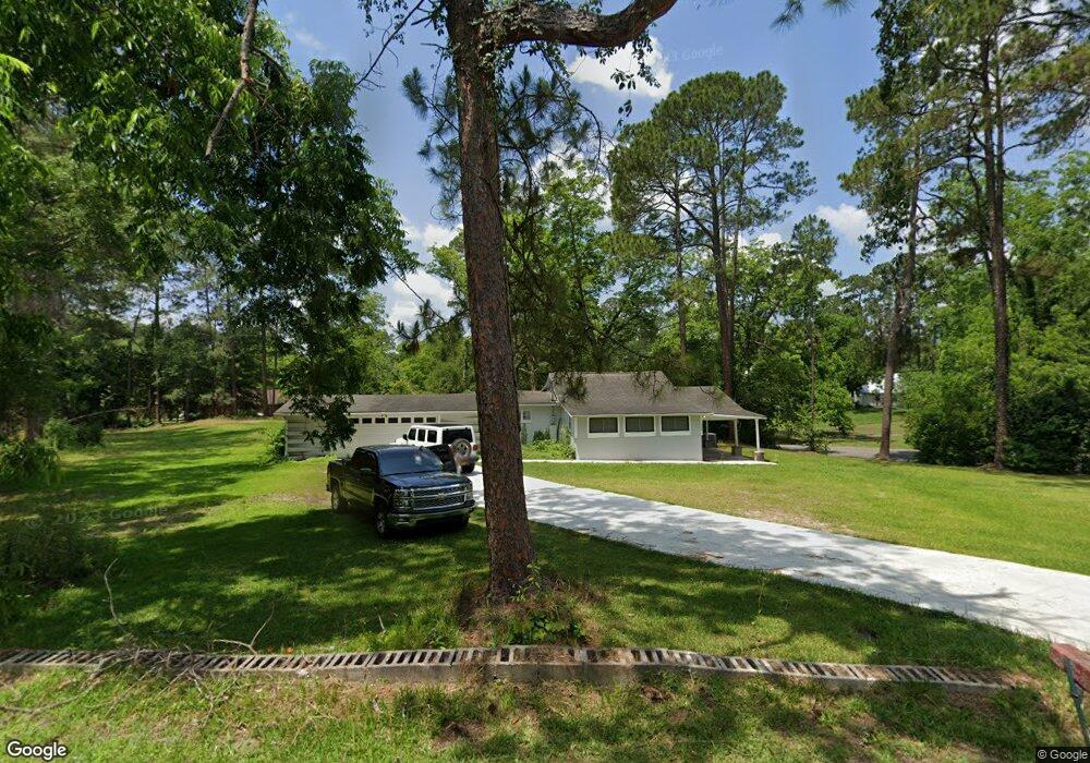
408 S Main St Unit BN Boston, GA 31626
Estimated Value: $99,000 - $257,000
--
Bed
2
Baths
1,532
Sq Ft
$97/Sq Ft
Est. Value
About This Home
This home is located at 408 S Main St Unit BN, Boston, GA 31626 and is currently estimated at $148,622, approximately $97 per square foot. 408 S Main St Unit BN is a home located in Thomas County with nearby schools including Hand in Hand Primary School, Garrison-Pilcher Elementary School, and Cross Creek Elementary School.
Ownership History
Date
Name
Owned For
Owner Type
Purchase Details
Closed on
Jan 11, 2023
Sold by
Smith Thomas Leverne
Bought by
J Murphy Realty Llc
Current Estimated Value
Purchase Details
Closed on
Feb 22, 2022
Sold by
Hutchison Richard
Bought by
Smith Thomas Leverne and Smith Kathryn J
Purchase Details
Closed on
Aug 27, 2004
Sold by
Burns Edna F Estate
Bought by
Hutchinson Richard
Purchase Details
Closed on
Jul 29, 2004
Sold by
Burns A D
Bought by
Hutchinson Richard
Purchase Details
Closed on
Jul 27, 2004
Sold by
Burns Arthur David
Bought by
Hutchinson Richard
Purchase Details
Closed on
Dec 31, 1952
Bought by
Burns A D
Create a Home Valuation Report for This Property
The Home Valuation Report is an in-depth analysis detailing your home's value as well as a comparison with similar homes in the area
Home Values in the Area
Average Home Value in this Area
Purchase History
| Date | Buyer | Sale Price | Title Company |
|---|---|---|---|
| J Murphy Realty Llc | $80,000 | -- | |
| Smith Thomas Leverne | $35,000 | -- | |
| Hutchinson Richard | $55,000 | -- | |
| Hutchinson Richard | -- | -- | |
| Hutchinson Richard | -- | -- | |
| Burns A D | -- | -- |
Source: Public Records
Tax History Compared to Growth
Tax History
| Year | Tax Paid | Tax Assessment Tax Assessment Total Assessment is a certain percentage of the fair market value that is determined by local assessors to be the total taxable value of land and additions on the property. | Land | Improvement |
|---|---|---|---|---|
| 2024 | $960 | $29,746 | $6,670 | $23,076 |
| 2023 | $445 | $22,269 | $6,670 | $15,599 |
| 2022 | $450 | $18,754 | $5,002 | $13,752 |
| 2021 | $442 | $16,744 | $5,002 | $11,742 |
| 2020 | $458 | $16,960 | $5,002 | $11,958 |
| 2019 | $461 | $16,960 | $5,002 | $11,958 |
| 2018 | $472 | $17,252 | $5,002 | $12,250 |
| 2017 | $470 | $16,918 | $4,452 | $12,466 |
| 2016 | $475 | $17,053 | $4,452 | $12,601 |
| 2015 | $549 | $19,540 | $4,152 | $15,388 |
| 2014 | $543 | $19,176 | $4,152 | $15,024 |
| 2013 | -- | $19,175 | $4,152 | $15,023 |
Source: Public Records
Map
Nearby Homes
- 130 E Adams St
- 682 Salem Rd
- 146 Old Highway 84 W
- 185 Community Ln
- 2815 Parker Rd
- 9900 Ozell Rd
- 4311 Ozell Rd
- 431 Dry Lake Rd
- 00 Summer Hill Rd Unit 1
- 2156 County Road 78
- 842 Crabapple Dr
- 2818 Dry Lake Rd
- 00 Cone Road & Beulah Church Rd
- 454 Fox Meadow Ln
- 7402 Coffee Rd
- 233 Fox Meadow Ln
- 138
- 7500 U S 19
- 0 Spencer Rd
- 4126 Grooverville Rd
- 408 S Main St
- 633 S Main St
- 137,139 S Main St
- 439 S Main St
- 503 S Norton St
- 421 S Main St
- 401 S Main St Unit BN
- 337 S Norton St
- 334 S Main St Unit BN
- 520 S Norton St
- 107 W College St
- 414 S Norton St
- 107 E Washington St
- 507 S Norton St
- 322 S Main St Unit BN
- 422 S Norton St
- 205 W Washington St
- 514 S Main St Unit BN
- 404 S Norton St
- 321 S Norton St