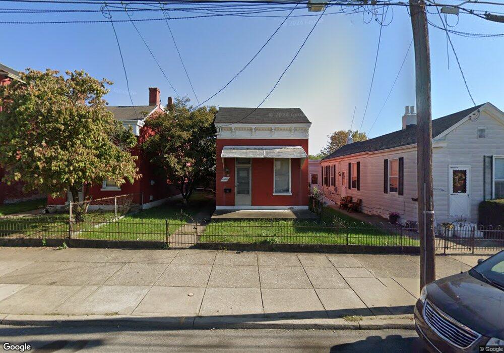
408 W 11th St Newport, KY 41071
Estimated Value: $130,000 - $164,000
2
Beds
2
Baths
1,049
Sq Ft
$143/Sq Ft
Est. Value
About This Home
This home is located at 408 W 11th St, Newport, KY 41071 and is currently estimated at $150,399, approximately $143 per square foot. 408 W 11th St is a home located in Campbell County with nearby schools including Newport Primary School, Newport Intermediate School, and Newport High School.
Ownership History
Date
Name
Owned For
Owner Type
Purchase Details
Closed on
Jun 14, 2007
Sold by
Smith John W and Smith Mary F
Bought by
Smith Charles E and Smith Martha
Current Estimated Value
Home Financials for this Owner
Home Financials are based on the most recent Mortgage that was taken out on this home.
Original Mortgage
$65,000
Outstanding Balance
$39,622
Interest Rate
6.12%
Mortgage Type
New Conventional
Estimated Equity
$110,777
Purchase Details
Closed on
Jul 29, 1998
Sold by
Watson Stella M
Bought by
Smith John W Mary F
Purchase Details
Closed on
Jun 21, 1994
Sold by
Walton Martha
Bought by
Watson Stella M
Create a Home Valuation Report for This Property
The Home Valuation Report is an in-depth analysis detailing your home's value as well as a comparison with similar homes in the area
Home Values in the Area
Average Home Value in this Area
Purchase History
| Date | Buyer | Sale Price | Title Company |
|---|---|---|---|
| Smith Charles E | $65,000 | None Available | |
| Smith John W Mary F | $49,900 | -- | |
| Watson Stella M | $42,000 | -- |
Source: Public Records
Mortgage History
| Date | Status | Borrower | Loan Amount |
|---|---|---|---|
| Open | Smith Charles E | $65,000 |
Source: Public Records
Tax History Compared to Growth
Tax History
| Year | Tax Paid | Tax Assessment Tax Assessment Total Assessment is a certain percentage of the fair market value that is determined by local assessors to be the total taxable value of land and additions on the property. | Land | Improvement |
|---|---|---|---|---|
| 2024 | $245 | $110,000 | $15,000 | $95,000 |
| 2023 | $97 | $70,900 | $6,400 | $64,500 |
| 2022 | $191 | $70,900 | $6,400 | $64,500 |
| 2021 | $194 | $70,900 | $6,400 | $64,500 |
| 2020 | $202 | $70,900 | $6,400 | $64,500 |
| 2019 | $178 | $65,000 | $5,300 | $59,700 |
| 2018 | $184 | $65,000 | $5,300 | $59,700 |
| 2017 | $184 | $65,000 | $5,300 | $59,700 |
| 2016 | $161 | $65,000 | $0 | $0 |
| 2015 | $163 | $65,000 | $0 | $0 |
| 2014 | $164 | $65,000 | $0 | $0 |
Source: Public Records
Map
Nearby Homes
- 327 W 11th St
- 414 Hodge St
- 339 W 12th St
- 427 W 11th St
- 423 Hodge St
- 318 W 12th St
- 406 W 10th St
- 1145 Isabella St
- 320 W 10th St
- 308-310 W 10th St
- 305 W 10th St
- 226 W 10th St
- 1140 Central Ave
- 1006 Central Ave
- 437-439 Lindsey St
- The Breckenridge Plan at Martin's Gate
- 517 W 10th St
- 303 Lindsey St
- 503 W 13th St
- 416 W 13th St
- 406 W 11th St
- 410 W 11th St
- 414 W 11th St
- 416 W 11th St
- 1112 Patterson St
- 409 Thornton St
- 405 Thornton St
- 420 W 11th St
- 411 Thornton St
- 415 Thornton St
- 422 W 11th St
- 1118 Patterson St
- 419 Thornton St
- 1105 Patterson St
- 409 W 11th St
- 405 W 11th St
- 411 W 11th St
- 421 Thornton St
- 426 W 11th St
- 336 W 11th St